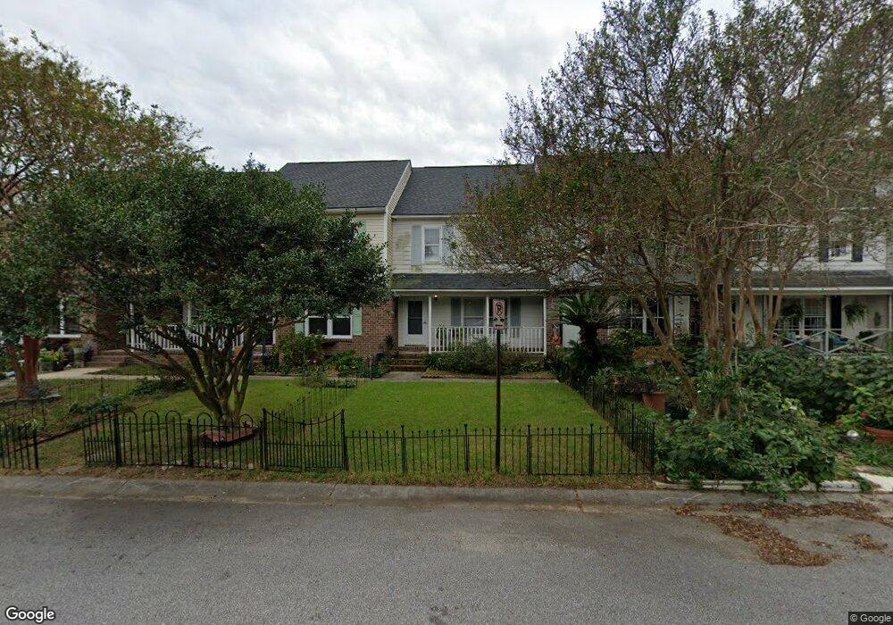
1431 Brockman Cir Charleston, SC 29412
James Island NeighborhoodEstimated Value: $312,000 - $334,380
3
Beds
2
Baths
1,231
Sq Ft
$266/Sq Ft
Est. Value
About This Home
This home is located at 1431 Brockman Cir, Charleston, SC 29412 and is currently estimated at $327,095, approximately $265 per square foot. 1431 Brockman Cir is a home located in Charleston County with nearby schools including Harbor View Elementary School, Camp Road Middle, and James Island Charter High School.
Ownership History
Date
Name
Owned For
Owner Type
Purchase Details
Closed on
Aug 12, 2021
Sold by
Sarnoff David P
Bought by
Hernandez-Rubio Lauren A and Hernandez-Rabio Sequin A
Current Estimated Value
Home Financials for this Owner
Home Financials are based on the most recent Mortgage that was taken out on this home.
Original Mortgage
$190,000
Outstanding Balance
$172,769
Interest Rate
2.9%
Mortgage Type
New Conventional
Estimated Equity
$154,326
Purchase Details
Closed on
May 29, 2001
Sold by
Randy Showalter
Bought by
Sarnoff David P and Sarnoff Pepper L
Create a Home Valuation Report for This Property
The Home Valuation Report is an in-depth analysis detailing your home's value as well as a comparison with similar homes in the area
Home Values in the Area
Average Home Value in this Area
Purchase History
| Date | Buyer | Sale Price | Title Company |
|---|---|---|---|
| Hernandez-Rubio Lauren A | $200,000 | None Listed On Document | |
| Sarnoff David P | $98,500 | -- |
Source: Public Records
Mortgage History
| Date | Status | Borrower | Loan Amount |
|---|---|---|---|
| Open | Hernandez-Rubio Lauren A | $190,000 |
Source: Public Records
Tax History Compared to Growth
Tax History
| Year | Tax Paid | Tax Assessment Tax Assessment Total Assessment is a certain percentage of the fair market value that is determined by local assessors to be the total taxable value of land and additions on the property. | Land | Improvement |
|---|---|---|---|---|
| 2024 | $1,137 | $8,000 | $0 | $0 |
| 2023 | $1,137 | $8,000 | $0 | $0 |
| 2022 | $1,036 | $8,000 | $0 | $0 |
| 2021 | $2,420 | $5,940 | $0 | $0 |
| 2020 | $2,403 | $8,900 | $0 | $0 |
| 2019 | $2,201 | $7,740 | $0 | $0 |
| 2017 | $2,106 | $7,740 | $0 | $0 |
| 2016 | $2,039 | $7,740 | $0 | $0 |
| 2015 | $1,950 | $7,740 | $0 | $0 |
| 2014 | $1,961 | $0 | $0 | $0 |
| 2011 | -- | $0 | $0 | $0 |
Source: Public Records
Map
Nearby Homes
- 1 Maplecrest Dr
- 9 Maplecrest Dr
- 14 Maplecrest Dr
- 17 S Anderson Ave Unit A,B,C, D
- 1 S Anderson Ave
- 50 Held Cir Unit C
- 1453 Camp Rd
- 35 Rivers Point Row Unit A
- 27 Brockman Dr Unit 27B
- 27 Brockman Dr Unit 27C
- 1418 Kentwood Cir
- 1402 Camp Rd Unit 5E
- 1402 Camp Rd Unit 6E
- 1402 Camp Rd Unit 1H
- 1402 Camp Rd Unit 8B
- 1402 Camp Rd Unit 9C
- 1402 Camp Rd Unit 12F
- 21 Rivers Point Row Unit 11 C
- 21 Rivers Point Row Unit 3C
- 1014 Arborwood Dr
- 17 Brockman Dr
- 1433 Brockman Cir
- 1429 Brockman Cir
- 1435 Brockman Cir
- 1427 Brockman Cir
- 1425 Brockman Cir
- 1437 Brockman Cir
- 1423 Brockman Cir
- 1421 Brockman Cir
- 1419 Brockman Cir
- 1417 Brockman Cir
- 1424 Brockman Cir
- 1422 Maplecrest Dr
- 1422 Brockman Cir
- 1422 Brockman Cir Unit 1
- 1422 Brockman Cir
- 1415 Brockman Cir
- 1413 Brockman Cir
- 3 Maplecrest Dr
- 1414 Brockman Cir