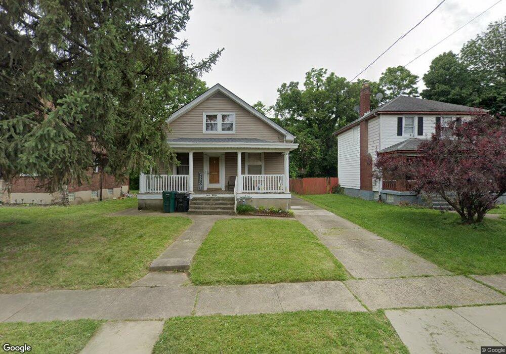
1431 Carolina Ave Cincinnati, OH 45237
Bond Hill NeighborhoodEstimated Value: $111,000 - $185,000
3
Beds
2
Baths
1,450
Sq Ft
$112/Sq Ft
Est. Value
About This Home
This home is located at 1431 Carolina Ave, Cincinnati, OH 45237 and is currently estimated at $162,136, approximately $111 per square foot. 1431 Carolina Ave is a home located in Hamilton County with nearby schools including Bond Hill Academy Elementary School, Shroder High School, and Clark Montessori High School.
Ownership History
Date
Name
Owned For
Owner Type
Purchase Details
Closed on
Sep 29, 2004
Sold by
Key Bank Usa Na
Bought by
Bean Christine N
Current Estimated Value
Purchase Details
Closed on
Jun 4, 2004
Sold by
Baugh Beverly A
Bought by
Key Bank Usa Na
Home Financials for this Owner
Home Financials are based on the most recent Mortgage that was taken out on this home.
Original Mortgage
$59,500
Interest Rate
5.93%
Mortgage Type
Fannie Mae Freddie Mac
Create a Home Valuation Report for This Property
The Home Valuation Report is an in-depth analysis detailing your home's value as well as a comparison with similar homes in the area
Home Values in the Area
Average Home Value in this Area
Purchase History
| Date | Buyer | Sale Price | Title Company |
|---|---|---|---|
| Bean Christine N | $59,500 | Prodigy Title Agency Llc | |
| Key Bank Usa Na | $56,000 | Prodigy Title Agency Llc |
Source: Public Records
Mortgage History
| Date | Status | Borrower | Loan Amount |
|---|---|---|---|
| Previous Owner | Key Bank Usa Na | $59,500 |
Source: Public Records
Tax History Compared to Growth
Tax History
| Year | Tax Paid | Tax Assessment Tax Assessment Total Assessment is a certain percentage of the fair market value that is determined by local assessors to be the total taxable value of land and additions on the property. | Land | Improvement |
|---|---|---|---|---|
| 2024 | $2,014 | $33,537 | $5,880 | $27,657 |
| 2023 | $2,059 | $33,537 | $5,880 | $27,657 |
| 2022 | $1,324 | $19,261 | $5,033 | $14,228 |
| 2021 | $1,270 | $19,261 | $5,033 | $14,228 |
| 2020 | $1,308 | $19,261 | $5,033 | $14,228 |
| 2019 | $1,336 | $18,001 | $4,704 | $13,297 |
| 2018 | $1,338 | $18,001 | $4,704 | $13,297 |
| 2017 | $1,270 | $18,001 | $4,704 | $13,297 |
| 2016 | $1,643 | $22,957 | $4,939 | $18,018 |
| 2015 | $1,482 | $22,957 | $4,939 | $18,018 |
| 2014 | $1,492 | $22,957 | $4,939 | $18,018 |
| 2013 | $1,549 | $23,426 | $5,040 | $18,386 |
Source: Public Records
Map
Nearby Homes
- 1409 Yarmouth Ave
- 1427 Regent Ave
- 1318 Franklin Ave
- 1407 Regent Ave
- 1640 Anita Place
- 4822 Yarmouth Place
- 1751 Andina Ave
- 1801 Northcut Ave
- 1730 Dale Rd
- 1810 Berkley Ave
- 1843 Northcutt Ave
- 1108 Ryland Ave
- 1855 Dalewood Place
- 1832 Catalina Ave
- 4522 Perth Ln
- 1870 Dalewood Place
- 1906 Andina Ave
- 4519 Bristol Ln
- 1224 Westminster Dr
- 5120 Lillian Dr
- 1433 Carolina Ave
- 1425 Carolina Ave
- 1421 Carolina Ave
- 1436 Franklin Ave
- 1438 Franklin Ave
- 1434 Franklin Ave
- 1501 Carolina Ave
- 1419 Carolina Ave
- 1432 Franklin Ave
- 1430 Carolina Ave
- 1424 Carolina Ave
- 1434 Carolina Ave
- 1422 Carolina Ave
- 1502 Franklin Ave
- 1412 Franklin Ave
- 1420 Carolina Ave
- 1507 Carolina Ave
- 1415 Carolina Ave
- 1414 Carolina Ave
- 1502 Carolina Ave