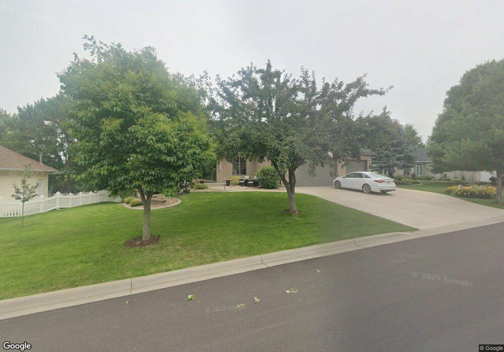
1431 Oconnell Dr Hastings, MN 55033
Hastings-Marshan Township NeighborhoodEstimated Value: $531,526 - $653,000
4
Beds
3
Baths
1,759
Sq Ft
$332/Sq Ft
Est. Value
About This Home
This home is located at 1431 Oconnell Dr, Hastings, MN 55033 and is currently estimated at $584,382, approximately $332 per square foot. 1431 Oconnell Dr is a home located in Dakota County with nearby schools including Christa Mcauliffe Elementary School, Hastings Middle School, and Hastings High School.
Ownership History
Date
Name
Owned For
Owner Type
Purchase Details
Closed on
Dec 12, 2008
Sold by
Hunt Robert Thackston
Bought by
Thuet Chad N and Thuet Teresa J
Current Estimated Value
Purchase Details
Closed on
Oct 18, 2005
Sold by
Lawrence Builders Inc
Bought by
Hunt Robert T and Hunt Sharon K
Purchase Details
Closed on
Mar 1, 2005
Sold by
Lawrence Delores L and Lawrence Paul W
Bought by
Lawrence Builders Inc
Create a Home Valuation Report for This Property
The Home Valuation Report is an in-depth analysis detailing your home's value as well as a comparison with similar homes in the area
Home Values in the Area
Average Home Value in this Area
Purchase History
| Date | Buyer | Sale Price | Title Company |
|---|---|---|---|
| Thuet Chad N | $343,000 | -- | |
| Hunt Robert T | $437,400 | -- | |
| Lawrence Builders Inc | $250,000 | -- |
Source: Public Records
Tax History Compared to Growth
Tax History
| Year | Tax Paid | Tax Assessment Tax Assessment Total Assessment is a certain percentage of the fair market value that is determined by local assessors to be the total taxable value of land and additions on the property. | Land | Improvement |
|---|---|---|---|---|
| 2024 | $5,872 | $509,900 | $92,500 | $417,400 |
| 2023 | $5,872 | $507,000 | $92,600 | $414,400 |
| 2022 | $4,872 | $491,800 | $92,400 | $399,400 |
| 2021 | $4,648 | $396,800 | $80,300 | $316,500 |
| 2020 | $4,848 | $377,400 | $74,600 | $302,800 |
| 2019 | $4,869 | $380,200 | $71,000 | $309,200 |
| 2018 | $4,778 | $363,700 | $67,700 | $296,000 |
| 2017 | $4,473 | $346,200 | $64,400 | $281,800 |
| 2016 | $4,551 | $324,400 | $60,200 | $264,200 |
| 2015 | $4,428 | $313,631 | $56,900 | $256,731 |
| 2014 | -- | $306,764 | $54,724 | $252,040 |
| 2013 | -- | $274,827 | $48,860 | $225,967 |
Source: Public Records
Map
Nearby Homes
- 1960 Rose Way
- 1967 Sierra Dr Unit 303
- 1924 Rose Way Unit 609
- 1478 Pringle Ct
- 1726 14th Ct W
- 2725 General Sieben Dr
- 1767 Carleton Place
- 2109 Westpointe Dr
- 2117 Westpointe Dr
- 1832 Ridgepointe N
- 2120 Ridge Pointe Dr
- 2157 Westpointe Dr
- 1817 Ridgepointe Ct
- 2173 Westpointe Dr
- 2160 Ridge Pointe Dr
- 2189 Westpointe Dr
- 1500 Brittany Rd
- 1824 Fallbrooke Dr
- 1821 Fallbrooke Dr
- Alley Plan at Heritage Ridge
- 1443 Oconnell Dr
- 1429 Oconnell Dr
- 1881 Tierney Dr
- 1877 Tierney Dr
- 1893 Tierney Dr
- 1417 Oconnell Dr
- 1455 Oconnell Dr
- 1432 Oconnell Dr
- 1420 Oconnell Dr
- 1895 Tierney Dr
- 1418 Oconnell Dr
- 1875 Tierney Dr
- 1444 Oconnell Dr
- 1406 Oconnell Dr
- 1880 Steeple Ln
- 1880 1880 Steeple Ln
- 1870 Steeple Ln
- 1862 Tierney Dr
- 1874 Tierney Dr
- 1456 Oconnell Dr