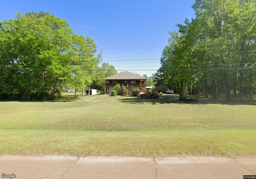
1431 Pate Rd West Point, MS 39773
Estimated Value: $325,000 - $378,000
3
Beds
--
Bath
3,338
Sq Ft
$102/Sq Ft
Est. Value
About This Home
This home is located at 1431 Pate Rd, West Point, MS 39773 and is currently estimated at $340,510, approximately $102 per square foot. 1431 Pate Rd is a home located in Clay County with nearby schools including East Side Elementary School, West Clay Elementary School, and Church Hill Elementary School.
Ownership History
Date
Name
Owned For
Owner Type
Purchase Details
Closed on
Dec 19, 2024
Sold by
Smith Ernest
Bought by
Lemmons Robert and Lemmons Susan
Current Estimated Value
Purchase Details
Closed on
Sep 7, 2012
Sold by
Malone Loran E and The Malone Family Trust
Bought by
Malone Loran E
Create a Home Valuation Report for This Property
The Home Valuation Report is an in-depth analysis detailing your home's value as well as a comparison with similar homes in the area
Purchase History
| Date | Buyer | Sale Price | Title Company |
|---|---|---|---|
| Lemmons Robert | -- | None Listed On Document | |
| Lemmons Robert | -- | None Listed On Document | |
| Malone Loran E | -- | -- |
Source: Public Records
Tax History
| Year | Tax Paid | Tax Assessment Tax Assessment Total Assessment is a certain percentage of the fair market value that is determined by local assessors to be the total taxable value of land and additions on the property. | Land | Improvement |
|---|---|---|---|---|
| 2025 | $1,333 | $26,370 | $6,000 | $20,370 |
| 2024 | $1,333 | $26,370 | $6,000 | $20,370 |
| 2023 | $2,415 | $23,923 | $6,000 | $17,923 |
| 2022 | $1,984 | $35,884 | $9,000 | $26,884 |
| 2021 | $1,735 | $31,384 | $4,500 | $26,884 |
| 2020 | $1,734 | $31,384 | $4,500 | $26,884 |
| 2019 | $1,628 | $30,967 | $4,500 | $26,467 |
| 2018 | $1,561 | $30,967 | $4,500 | $26,467 |
| 2017 | $1,561 | $30,967 | $4,500 | $26,467 |
| 2016 | $640 | $20,645 | $3,000 | $17,645 |
| 2015 | $588 | $19,176 | $3,000 | $16,176 |
| 2014 | $543 | $19,176 | $3,000 | $16,176 |
| 2013 | $543 | $19,176 | $3,000 | $16,176 |
Source: Public Records
Map
Nearby Homes
- 712 Pate Rd
- 120 Nelda Dr
- 0 Riverchase Dr
- Lot 1 Old Waverly Rd
- Lot 12 Old Waverly Rd
- Lot 16 Old Waverly Rd
- Lot 17 Old Waverly Rd
- Lot 20 Old Waverly Rd
- Lot 19 Old Waverly Rd
- Lot 21 Old Waverly Rd
- Lot 18 Old Waverly Rd
- Lot 22 Old Waverly Rd
- Lot 14 Old Waverly Rd
- Lot 13 Old Waverly Rd
- Lot 15 Old Waverly Rd
- 1873 Sandy Land Rd
- 0 Officers Lake Rd
- 774 River Oaks Dr
- 0 Waverly Rd Unit 26355692
- 0 Water Oak Ln Unit 26-442
- 1189 Pate Rd
- 1341 Pate Rd
- 1020 Pate Rd
- 00 Old Highway 50
- 3735 Charlie Purnell Rd
- 569 Waverley Mansion Rd
- 510 Riverview Rd
- 0 Old Highway 50
- 35190 Mississippi 50
- 1852 Waverly Mansion Rd
- 947 Waverley Mansion Rd
- 1011 Old Highway 50
- 420 Riverview Rd
- 0 Pate Rd
- 1015 Waverley Mansion Rd
- 519 Pate Rd
- 9479 Waverly Rd
- 110 Ivy Dr
- 7932 Waverly Rd
- 1825 Humphries Cove
Your Personal Tour Guide
Ask me questions while you tour the home.