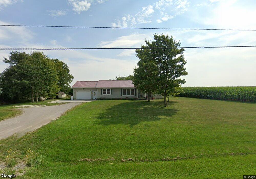
14310 Us Highway 127 West Unity, OH 43570
Estimated Value: $152,000 - $187,000
3
Beds
2
Baths
1,452
Sq Ft
$114/Sq Ft
Est. Value
About This Home
This home is located at 14310 Us Highway 127, West Unity, OH 43570 and is currently estimated at $166,168, approximately $114 per square foot. 14310 Us Highway 127 is a home located in Williams County with nearby schools including Hilltop Elementary School and Hilltop High School.
Ownership History
Date
Name
Owned For
Owner Type
Purchase Details
Closed on
May 21, 2020
Sold by
Estate Of John W Oxender
Bought by
Oxender Patricia I and Oxender Patricia
Current Estimated Value
Purchase Details
Closed on
Aug 6, 2019
Sold by
Meyers Daniel and Meyers Daren
Bought by
Oxender John W
Purchase Details
Closed on
Dec 21, 2018
Sold by
Estate Of Leland Meyers
Bought by
Meyers Daniel E and Schroeder Pamela
Purchase Details
Closed on
Dec 3, 2010
Sold by
King Agnes E
Bought by
Meyers Leland J
Purchase Details
Closed on
Oct 5, 2001
Sold by
King Frank and King Agnes
Bought by
King Agnes E
Purchase Details
Closed on
Jan 1, 1990
Bought by
King Frank and King Agnes
Create a Home Valuation Report for This Property
The Home Valuation Report is an in-depth analysis detailing your home's value as well as a comparison with similar homes in the area
Home Values in the Area
Average Home Value in this Area
Purchase History
| Date | Buyer | Sale Price | Title Company |
|---|---|---|---|
| Oxender Patricia I | -- | None Available | |
| Oxender John W | $86,000 | None Available | |
| Meyers Daniel E | -- | None Available | |
| Meyers Leland J | $70,000 | None Available | |
| King Agnes E | -- | -- | |
| King Frank | -- | -- |
Source: Public Records
Tax History Compared to Growth
Tax History
| Year | Tax Paid | Tax Assessment Tax Assessment Total Assessment is a certain percentage of the fair market value that is determined by local assessors to be the total taxable value of land and additions on the property. | Land | Improvement |
|---|---|---|---|---|
| 2024 | $1,469 | $39,480 | $8,120 | $31,360 |
| 2023 | $1,469 | $30,670 | $7,250 | $23,420 |
| 2022 | $1,366 | $30,670 | $7,250 | $23,420 |
| 2021 | $1,366 | $30,670 | $7,250 | $23,420 |
| 2020 | $1,329 | $29,130 | $6,830 | $22,300 |
| 2019 | $1,322 | $29,130 | $6,830 | $22,300 |
| 2018 | $1,338 | $29,130 | $6,830 | $22,300 |
| 2017 | $1,095 | $24,360 | $6,580 | $17,780 |
| 2016 | $1,042 | $24,360 | $6,580 | $17,780 |
| 2015 | $1,122 | $24,360 | $6,580 | $17,780 |
| 2014 | $1,122 | $23,870 | $6,440 | $17,430 |
| 2013 | $1,079 | $23,870 | $6,440 | $17,430 |
Source: Public Records
Map
Nearby Homes
- 311 W Rings St
- 000 W Jackson
- 22227 Us Highway 20a
- 205 Taylor Dr
- 0 U S 20
- 340 S Main St
- 14701 Us Highway 127
- 16806 US Highway 20a
- 16228 County Road N-30
- 612 Cynthia Dr
- 23161 County Road Jk
- 400 W Main St
- 505 N Gorham St
- 7170 County Road 23
- 15664 County Road K
- 10800 South Rd
- 400 S Main St
- 14191 Lickley Rd
- 302 E Center St
- 18 Cobblestone Rd
- 14322 Us Highway 127
- 14340 U S 127
- 14376 Us Highway 127
- 14124 Us Highway 127
- 20972 County Road 20n
- 20972 County Road 20n
- 14603 Us Highway 127
- 21432 County Road 20n
- 14650 Us Highway 127
- 20988 County Road M90
- 14698 Us Rt 127
- 21571 County Road 20n
- 20742 County Road 20n
- 21670 County Road 20n
- 20630 County Road M90
- 14983 Us Highway 127
- 21750 County Road 20n
- 21763 County Road 20n
- 21843 County Road 20n