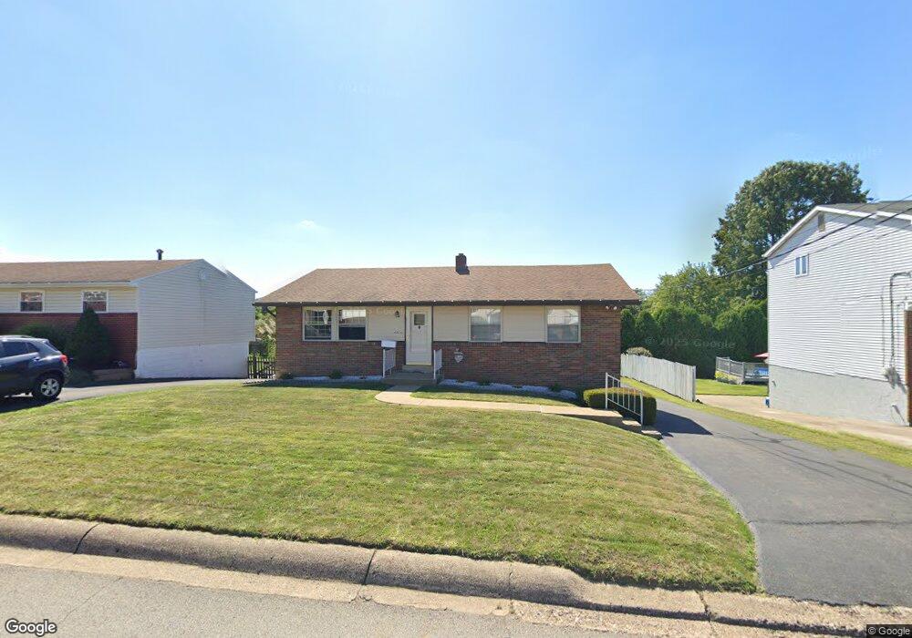
1432 Porter St Conway, PA 15027
Estimated Value: $209,000 - $259,000
3
Beds
3
Baths
1,680
Sq Ft
$138/Sq Ft
Est. Value
About This Home
This home is located at 1432 Porter St, Conway, PA 15027 and is currently estimated at $231,376, approximately $137 per square foot. 1432 Porter St is a home located in Beaver County with nearby schools including Freedom Area Elementary School, Freedom Area Middle School, and Freedom Area Senior High School.
Ownership History
Date
Name
Owned For
Owner Type
Purchase Details
Closed on
Jun 13, 2023
Sold by
Wood Sandra
Bought by
Wood Terry L and Wory Lynda K
Current Estimated Value
Purchase Details
Closed on
Sep 24, 2020
Sold by
Norman Lee M
Bought by
Wood Sandra J
Purchase Details
Closed on
Jul 13, 2020
Sold by
Norman Lee M and Estate Of Nancy J Norman
Bought by
Norman Lee M
Purchase Details
Closed on
Feb 2, 2012
Sold by
Norman Nancy J
Bought by
Norman Nancy J
Purchase Details
Closed on
May 28, 2008
Sold by
Waldron John J
Bought by
Waldron John J and Norman Nancy J
Create a Home Valuation Report for This Property
The Home Valuation Report is an in-depth analysis detailing your home's value as well as a comparison with similar homes in the area
Home Values in the Area
Average Home Value in this Area
Purchase History
| Date | Buyer | Sale Price | Title Company |
|---|---|---|---|
| Wood Terry L | -- | None Listed On Document | |
| Wood Sandra J | $140,000 | Signature Setmnt Svcs Agcy L | |
| Norman Lee M | -- | None Available | |
| Norman Nancy J | -- | None Available | |
| Waldron John J | -- | None Available |
Source: Public Records
Tax History Compared to Growth
Tax History
| Year | Tax Paid | Tax Assessment Tax Assessment Total Assessment is a certain percentage of the fair market value that is determined by local assessors to be the total taxable value of land and additions on the property. | Land | Improvement |
|---|---|---|---|---|
| 2025 | $580 | $79,050 | $17,850 | $61,200 |
| 2024 | $2,708 | $79,050 | $17,850 | $61,200 |
| 2023 | $3,042 | $24,750 | $3,800 | $20,950 |
| 2022 | $2,955 | $24,750 | $3,800 | $20,950 |
| 2021 | $2,955 | $24,750 | $3,800 | $20,950 |
| 2020 | $2,755 | $24,750 | $3,800 | $20,950 |
| 2019 | $2,755 | $24,750 | $3,800 | $20,950 |
| 2018 | $2,648 | $24,750 | $3,800 | $20,950 |
| 2017 | $2,648 | $24,750 | $3,800 | $20,950 |
| 2016 | $2,416 | $24,750 | $3,800 | $20,950 |
| 2015 | $549 | $24,750 | $3,800 | $20,950 |
| 2014 | $549 | $24,750 | $3,800 | $20,950 |
Source: Public Records
Map
Nearby Homes
- 1517 Foote St
- 744 N Gross St
- 1416 Sampson St
- 1113 Foote St
- 1408 4th Ave
- 1401 3rd Ave
- 1421 Miller St
- 1001 7th Ave
- 1341 2nd Ave
- 354 11th St
- 1040 Catherine Dr
- 1025 Catherine Dr
- 1079 Catherine Dr
- 110 13th St
- 1001 2nd Ave
- 500 Conway Wallrose Rd
- 899 19th St
- 155 Sproat Ave
- 149 Shady River Blvd Unit 40 B
- 328 River Ridge Ct Unit 47B
- 1428 Porter St
- 1500 Porter St
- Lot #19 Porter St
- Lot #26 Porter St
- Lot 23 Porter St
- Lot 24 Porter St
- Lot 26 Porter St
- Lot 25 Porter St
- Lot 33 Porter St
- 1424 Porter St
- 1504 Porter St
- 1433 Porter St
- 1429 Porter St
- 1501 Porter St
- 1433 Dupont St
- 1508 Porter St
- 1429 Dupont St
- 1425 Porter St
- 1501 Dupont St
- 1420 Porter St