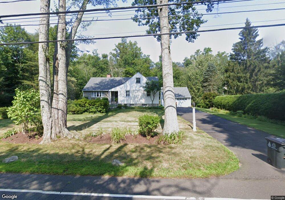
1432 Riverbank Rd Stamford, CT 06903
North Stamford NeighborhoodEstimated Value: $811,000 - $1,009,000
3
Beds
3
Baths
2,126
Sq Ft
$422/Sq Ft
Est. Value
About This Home
This home is located at 1432 Riverbank Rd, Stamford, CT 06903 and is currently estimated at $896,973, approximately $421 per square foot. 1432 Riverbank Rd is a home located in Fairfield County with nearby schools including Roxbury School, Cloonan School, and Westhill High School.
Ownership History
Date
Name
Owned For
Owner Type
Purchase Details
Closed on
Jan 18, 2018
Sold by
Est Fargnili Ardmeis and Fargoni David H
Bought by
Agoora Nasser and Agoora Akhad
Current Estimated Value
Home Financials for this Owner
Home Financials are based on the most recent Mortgage that was taken out on this home.
Original Mortgage
$131,625
Outstanding Balance
$111,076
Interest Rate
3.94%
Mortgage Type
Purchase Money Mortgage
Estimated Equity
$785,897
Purchase Details
Closed on
Apr 11, 2006
Sold by
Sienkiewicz Helen W
Bought by
Agoora Nasser H and Agoora Michele W
Create a Home Valuation Report for This Property
The Home Valuation Report is an in-depth analysis detailing your home's value as well as a comparison with similar homes in the area
Home Values in the Area
Average Home Value in this Area
Purchase History
| Date | Buyer | Sale Price | Title Company |
|---|---|---|---|
| Agoora Nasser | $175,500 | -- | |
| Agoora Nasser H | $695,000 | -- |
Source: Public Records
Mortgage History
| Date | Status | Borrower | Loan Amount |
|---|---|---|---|
| Open | Agoora Nasser | $131,625 | |
| Previous Owner | Agoora Nasser H | $300,000 | |
| Previous Owner | Agoora Nasser H | $236,000 | |
| Previous Owner | Agoora Nasser H | $150,000 | |
| Previous Owner | Agoora Nasser H | $200,000 |
Source: Public Records
Tax History Compared to Growth
Tax History
| Year | Tax Paid | Tax Assessment Tax Assessment Total Assessment is a certain percentage of the fair market value that is determined by local assessors to be the total taxable value of land and additions on the property. | Land | Improvement |
|---|---|---|---|---|
| 2025 | $10,423 | $447,930 | $236,870 | $211,060 |
| 2024 | $10,195 | $447,930 | $236,870 | $211,060 |
| 2023 | $10,956 | $447,930 | $236,870 | $211,060 |
| 2022 | $9,228 | $350,480 | $180,060 | $170,420 |
| 2021 | $9,102 | $350,480 | $180,060 | $170,420 |
| 2020 | $8,878 | $350,480 | $180,060 | $170,420 |
| 2019 | $8,878 | $350,490 | $180,060 | $170,430 |
| 2018 | $8,569 | $350,490 | $180,060 | $170,430 |
| 2017 | $9,170 | $358,340 | $201,940 | $156,400 |
| 2016 | $8,894 | $358,340 | $201,940 | $156,400 |
| 2015 | $8,650 | $358,340 | $201,940 | $156,400 |
| 2014 | $8,353 | $358,340 | $201,940 | $156,400 |
Source: Public Records
Map
Nearby Homes
- 401 Wildwood Rd
- 40 Wildwood Rd
- 11 Fox Glen Dr
- 43 Mill Rd
- 555 Haviland Rd
- 21 S Brook Dr
- 110 Erskine Rd
- 271 Hunting Ridge Rd
- Lot #21 S Brook Dr
- Lot #5 S Brook Dr
- 0 S Brook Dr Unit 170552650
- 21 Easthill Rd
- 391 Sawmill Rd
- 11 Dundee Rd
- 21 Timber Mill Rd
- 81 Fox Ridge Rd
- 30 Partridge Rd
- 494 Sawmill Rd
- 162 Wellington Dr
- 44 Deep Valley Rd
- 1452 Riverbank Rd
- 1418 Riverbank Rd
- 1431 Riverbank Rd
- 52 Round Hill Dr
- 1451 Riverbank Rd
- 1402 Riverbank Rd
- 1419 Riverbank Rd
- 18 Round Hill Dr
- 60 Round Hill Dr
- 1392 Riverbank Rd
- 37 Round Hill Dr
- 63 Hedge Brook Ln
- 49 Hedge Brook Ln
- 57 Hedge Brook Ln
- 152 Harpsichord Turnpike
- 9 Round Hill Dr
- 41 Hedge Brook Ln
- 68 Round Hill Dr
- 27 Hedge Brook Ln
- 64 Round Hill Dr