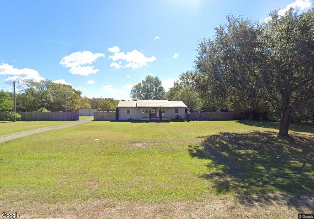
14324 Highway 613 Moss Point, MS 39562
Estimated Value: $208,687 - $229,000
Studio
2
Baths
1,672
Sq Ft
$132/Sq Ft
Est. Value
About This Home
This home is located at 14324 Highway 613, Moss Point, MS 39562 and is currently estimated at $219,922, approximately $131 per square foot. 14324 Highway 613 is a home located in Jackson County with nearby schools including East Central Lower Elementary School, East Central Upper Elementary School, and East Central Middle School.
Ownership History
Date
Name
Owned For
Owner Type
Purchase Details
Closed on
Mar 18, 2025
Sold by
Pierce Robert A and Hinton Leah N
Bought by
Logan Christian and Logan Mark
Current Estimated Value
Home Financials for this Owner
Home Financials are based on the most recent Mortgage that was taken out on this home.
Original Mortgage
$191,500
Outstanding Balance
$189,873
Interest Rate
6.95%
Mortgage Type
New Conventional
Estimated Equity
$30,049
Purchase Details
Closed on
Oct 18, 2024
Sold by
Goff Kimberly D
Bought by
Pierce Robert A and Hinton Leah N
Home Financials for this Owner
Home Financials are based on the most recent Mortgage that was taken out on this home.
Original Mortgage
$133,210
Interest Rate
6.2%
Mortgage Type
Construction
Create a Home Valuation Report for This Property
The Home Valuation Report is an in-depth analysis detailing your home's value as well as a comparison with similar homes in the area
Purchase History
| Date | Buyer | Sale Price | Title Company |
|---|---|---|---|
| Logan Christian | -- | Island Winds Title | |
| Logan Christian | -- | Island Winds Title | |
| Logan Christian | -- | Island Winds Title | |
| Logan Christian | -- | Island Winds Title | |
| Pierce Robert A | -- | Island Winds Title | |
| Pierce Robert A | -- | Island Winds Title | |
| Pierce Robert A | -- | Island Winds Title | |
| Pierce Robert A | -- | Island Winds Title |
Source: Public Records
Mortgage History
| Date | Status | Borrower | Loan Amount |
|---|---|---|---|
| Open | Logan Christian | $191,500 | |
| Closed | Logan Christian | $191,500 | |
| Previous Owner | Pierce Robert A | $133,210 |
Source: Public Records
Tax History
| Year | Tax Paid | Tax Assessment Tax Assessment Total Assessment is a certain percentage of the fair market value that is determined by local assessors to be the total taxable value of land and additions on the property. | Land | Improvement |
|---|---|---|---|---|
| 2025 | $2,055 | $17,297 | $957 | $16,340 |
| 2024 | $2,055 | $10,090 | $932 | $9,158 |
| 2023 | $1,211 | $10,090 | $932 | $9,158 |
| 2022 | $1,177 | $10,090 | $932 | $9,158 |
| 2021 | $514 | $6,778 | $621 | $6,157 |
| 2020 | $503 | $6,302 | $565 | $5,737 |
| 2019 | $495 | $6,302 | $565 | $5,737 |
| 2018 | $520 | $6,384 | $565 | $5,819 |
| 2017 | $533 | $6,384 | $565 | $5,819 |
| 2016 | $501 | $6,384 | $565 | $5,819 |
| 2015 | $471 | $59,450 | $5,650 | $53,800 |
| 2014 | $472 | $6,111 | $565 | $5,546 |
| 2013 | $448 | $6,111 | $565 | $5,546 |
Source: Public Records
Map
Nearby Homes
- 0 Ms-613 Hwy Unit 4116583
- 0 Ms-613 Hwy Unit 4107607
- 0 Ms-613 Hwy Unit 4107612
- 0 Ms-613 Hwy Unit 4116582
- 0 Perry St
- 13600 Reservoir Rd E
- 13111 Maida Hurd Rd
- 14004 Ann Rd
- 14015 Lily Orchard Rd
- 14208 Lily Orchard Rd
- 0 Lily Orchard Rd
- 14004 Timber Ridge Dr
- 0 Grafe Homestead Rd Unit 4137349
- 0 R B Dickerson Rd
- 13875 Wolf Ridge Rd Unit LotWP001
- 13875 Wolf Ridge Rd
- 4432 Lily Patch Ln
- 26.1 Acres Brinkman Rd E
- 17500 Goff Farm Rd
- -0- Rayford Shumock Rd
- 14316 Highway 613
- 14400 Highway 613
- Nhn Ms-613
- 11413 Highway 613
- 14416 Highway 613
- 14417 Highway 613
- 14617 Highway 613
- 7008 Beechnut Ln
- 7101 Beechnut Ln
- 14505 Highway 613
- 14524 Highway 613
- 14112 Highway 613
- 14109 Highway 613
- 7117 Beechnut Ln
- NHN Nhn Highway 613 Hwy
- NHN Nhn Ellis Hamilton Rd
- 14108 Highway 613
- 0 Carter Unit 3257565
- 14700 Highway 613
- 14704 Highway 613
Your Personal Tour Guide
Ask me questions while you tour the home.