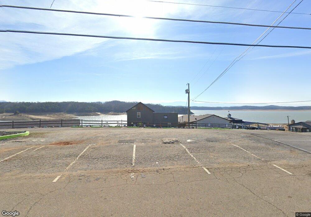
1433 Highway 139 Dandridge, TN 37725
Estimated Value: $373,141 - $571,000
--
Bed
--
Bath
1,982
Sq Ft
$239/Sq Ft
Est. Value
About This Home
This home is located at 1433 Highway 139, Dandridge, TN 37725 and is currently estimated at $472,714, approximately $238 per square foot. 1433 Highway 139 is a home.
Ownership History
Date
Name
Owned For
Owner Type
Purchase Details
Closed on
Oct 6, 2021
Sold by
Laurie Timothy and Laurie Dorothy
Bought by
Lake And Mountain Development Llc
Current Estimated Value
Home Financials for this Owner
Home Financials are based on the most recent Mortgage that was taken out on this home.
Original Mortgage
$2,840,000
Outstanding Balance
$2,589,815
Interest Rate
2.8%
Mortgage Type
Stand Alone Second
Estimated Equity
-$2,117,101
Purchase Details
Closed on
Sep 27, 1989
Bought by
Goins Dorothy Sawyer
Purchase Details
Closed on
Nov 28, 1980
Bought by
Flynn Carl E and Ollie Belle
Purchase Details
Closed on
Mar 3, 1976
Purchase Details
Closed on
Feb 15, 1975
Create a Home Valuation Report for This Property
The Home Valuation Report is an in-depth analysis detailing your home's value as well as a comparison with similar homes in the area
Home Values in the Area
Average Home Value in this Area
Purchase History
| Date | Buyer | Sale Price | Title Company |
|---|---|---|---|
| Lake And Mountain Development Llc | $1,868,500 | Tennessee Land Title | |
| Laurie Timothy | -- | Tennessee Land Title | |
| Goins Dorothy Sawyer | -- | -- | |
| Flynn Carl E | -- | -- | |
| -- | -- | -- | |
| -- | -- | -- |
Source: Public Records
Mortgage History
| Date | Status | Borrower | Loan Amount |
|---|---|---|---|
| Open | Lake And Mountain Development Llc | $2,840,000 |
Source: Public Records
Tax History Compared to Growth
Tax History
| Year | Tax Paid | Tax Assessment Tax Assessment Total Assessment is a certain percentage of the fair market value that is determined by local assessors to be the total taxable value of land and additions on the property. | Land | Improvement |
|---|---|---|---|---|
| 2025 | $952 | $153,080 | $34,080 | $119,000 |
| 2023 | $952 | $41,375 | $0 | $0 |
| 2022 | $906 | $41,375 | $10,400 | $30,975 |
| 2021 | $906 | $41,375 | $10,400 | $30,975 |
| 2020 | $906 | $41,375 | $10,400 | $30,975 |
| 2019 | $906 | $41,375 | $10,400 | $30,975 |
| 2018 | $843 | $35,875 | $12,500 | $23,375 |
| 2017 | $843 | $35,875 | $12,500 | $23,375 |
| 2016 | $843 | $35,875 | $12,500 | $23,375 |
| 2015 | $843 | $35,875 | $12,500 | $23,375 |
| 2014 | $843 | $35,875 | $12,500 | $23,375 |
Source: Public Records
Map
Nearby Homes
- 1331 Highway 139
- 838 Pinnacle Dr
- 1283 Highway 139 Unit 405c
- 1283 Highway 139 Unit 406-C
- 206 Eagle View Dr
- 1273 Tennessee 139 Unit 308
- 2160 Ranch Rd
- 2169 Ranch Rd
- 1269 Tennessee 139
- 1269 Tennessee 139 Unit 201B
- 1269 Highway 139 Unit 304b
- 323 Eagle Claw Ln
- 522 Conley Trail
- 535 Conley Trail
- 1786 Fain Cemetery Rd
- 5 Lots Aaron St
- Par 005.00 Aaron St
- 1887 Lakebrook Cir
- 107 Dream Way
- 1435 Highway 139
- 1435 Tennessee 139 Unit 4
- 1431 Tennessee 139
- 1431 Highway 139
- 1438 Highway 139
- 1429 Tennessee 139
- 1429 Highway 139
- 1421 Tennessee 139
- 1421 Highway 139
- 0 12 50 Ac - Highway 139 Unit 894490
- 1417 Highway 139
- 1413 Highway 139
- 1413 Tennessee 139
- 1387 Tennessee 139
- 1387 Highway 139
- 13871387 Highway 139
- 1420 Highway 139
- 0 Comer Cir
- 712 Comer Cir
- 2021 Glenbrook Ln