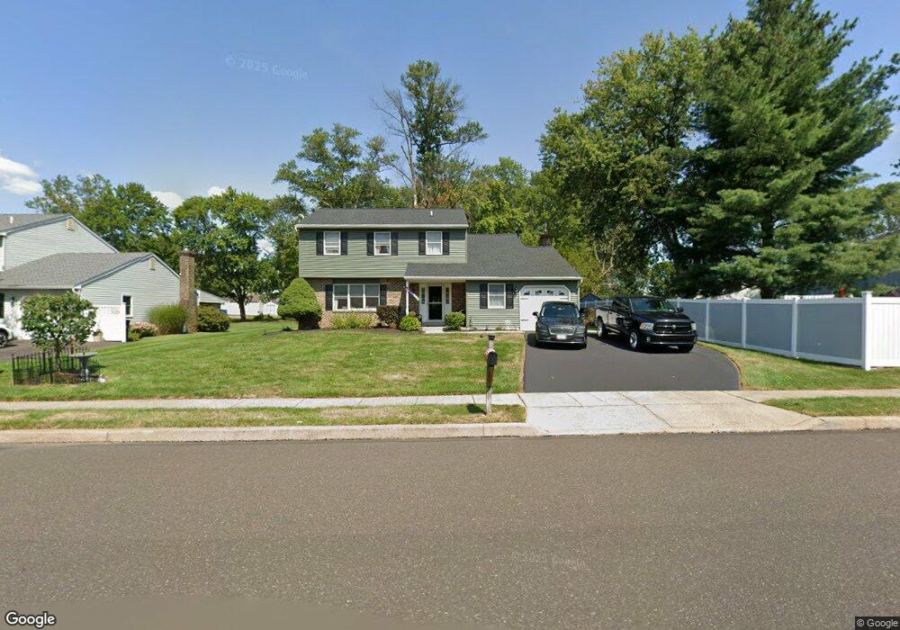
1433 Independence Way Hatfield, PA 19440
Estimated Value: $501,000 - $635,000
4
Beds
3
Baths
2,117
Sq Ft
$266/Sq Ft
Est. Value
About This Home
This home is located at 1433 Independence Way, Hatfield, PA 19440 and is currently estimated at $563,422, approximately $266 per square foot. 1433 Independence Way is a home located in Montgomery County with nearby schools including A. M. Kulp Elementary School, Pennfield Middle School, and North Penn Senior High School.
Ownership History
Date
Name
Owned For
Owner Type
Purchase Details
Closed on
Apr 24, 2007
Sold by
Heffner Nancy and Heffner Robert
Bought by
Heffner Robert E
Current Estimated Value
Home Financials for this Owner
Home Financials are based on the most recent Mortgage that was taken out on this home.
Original Mortgage
$130,000
Interest Rate
6.21%
Create a Home Valuation Report for This Property
The Home Valuation Report is an in-depth analysis detailing your home's value as well as a comparison with similar homes in the area
Home Values in the Area
Average Home Value in this Area
Purchase History
| Date | Buyer | Sale Price | Title Company |
|---|---|---|---|
| Heffner Robert E | -- | None Available |
Source: Public Records
Mortgage History
| Date | Status | Borrower | Loan Amount |
|---|---|---|---|
| Closed | Heffner Robert E | $130,000 |
Source: Public Records
Tax History Compared to Growth
Tax History
| Year | Tax Paid | Tax Assessment Tax Assessment Total Assessment is a certain percentage of the fair market value that is determined by local assessors to be the total taxable value of land and additions on the property. | Land | Improvement |
|---|---|---|---|---|
| 2025 | $6,390 | $159,620 | $43,080 | $116,540 |
| 2024 | $6,390 | $159,620 | $43,080 | $116,540 |
| 2023 | $6,116 | $159,620 | $43,080 | $116,540 |
| 2022 | $5,917 | $159,620 | $43,080 | $116,540 |
| 2021 | $5,749 | $159,620 | $43,080 | $116,540 |
| 2020 | $5,613 | $159,620 | $43,080 | $116,540 |
| 2019 | $5,520 | $159,620 | $43,080 | $116,540 |
| 2018 | $5,519 | $159,620 | $43,080 | $116,540 |
| 2017 | $5,309 | $159,620 | $43,080 | $116,540 |
| 2016 | $5,246 | $159,620 | $43,080 | $116,540 |
| 2015 | $5,036 | $159,620 | $43,080 | $116,540 |
| 2014 | $5,036 | $159,620 | $43,080 | $116,540 |
Source: Public Records
Map
Nearby Homes
- 0 Fairmount St
- 6 Township Line Rd
- 2317 E Orvilla Rd
- 2674 Anthony Dr
- 165 Township Line Rd
- 36 N Maple Ave
- 732 Cowpath Rd
- 1744 Lydia Dr
- 2943 E Walnut St Unit 59
- 3 Diamond St
- 1226 Cabin Rd
- 1306 W Orvilla Rd
- 105 S Main St
- 138 Diamond St Unit 31
- 0002 Sydney Ln
- 83 Bethlehem Pike Unit 1213 FIRESTONE
- 83 Bethlehem Pike Unit 1106- MADISON PLAN
- 142 Orchard Ln
- 303 Wynstone Ct
- 24 S Wayne Ave
- 1457 Independence Way
- 3200 Roxbury Rd
- 3204 Roxbury Rd
- 3208 Roxbury Rd
- 3212 Roxbury Rd
- 3216 Roxbury Rd
- 1424 Independence Way
- 3228 Roxbury Rd
- 3232 Roxbury Rd
- 3223 E Orvilla Rd
- 1478 Independence Way
- 3236 Roxbury Rd
- 1457 Downing Dr
- 1416 Independence Way
- 3240 Roxbury Rd
- 3244 Roxbury Rd
- 1377 Independence Way
- 3231 E Orvilla Rd
- 1441 Downing Dr
- 1466 Downing Dr