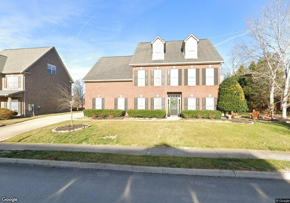
1434 Stone Tower Rd Knoxville, TN 37922
Concord NeighborhoodEstimated Value: $661,000 - $733,000
4
Beds
4
Baths
3,909
Sq Ft
$178/Sq Ft
Est. Value
About This Home
This home is located at 1434 Stone Tower Rd, Knoxville, TN 37922 and is currently estimated at $694,560, approximately $177 per square foot. 1434 Stone Tower Rd is a home located in Knox County with nearby schools including Northshore Elementary School, Farragut Middle School, and Farragut High School.
Ownership History
Date
Name
Owned For
Owner Type
Purchase Details
Closed on
Mar 31, 2004
Sold by
Fred Long Construction Concepts
Bought by
Gillespie James A and Gillespie Anne T
Current Estimated Value
Home Financials for this Owner
Home Financials are based on the most recent Mortgage that was taken out on this home.
Original Mortgage
$231,800
Outstanding Balance
$108,245
Interest Rate
5.55%
Mortgage Type
Purchase Money Mortgage
Estimated Equity
$586,315
Create a Home Valuation Report for This Property
The Home Valuation Report is an in-depth analysis detailing your home's value as well as a comparison with similar homes in the area
Home Values in the Area
Average Home Value in this Area
Purchase History
| Date | Buyer | Sale Price | Title Company |
|---|---|---|---|
| Gillespie James A | $289,750 | Abstract Title Inc |
Source: Public Records
Mortgage History
| Date | Status | Borrower | Loan Amount |
|---|---|---|---|
| Open | Gillespie James A | $231,800 | |
| Closed | Gillespie James A | $57,950 |
Source: Public Records
Tax History Compared to Growth
Tax History
| Year | Tax Paid | Tax Assessment Tax Assessment Total Assessment is a certain percentage of the fair market value that is determined by local assessors to be the total taxable value of land and additions on the property. | Land | Improvement |
|---|---|---|---|---|
| 2024 | $1,481 | $95,300 | $0 | $0 |
| 2023 | $1,481 | $95,300 | $0 | $0 |
| 2022 | $1,481 | $95,300 | $0 | $0 |
| 2021 | $1,968 | $92,825 | $0 | $0 |
| 2020 | $1,968 | $92,825 | $0 | $0 |
| 2019 | $1,968 | $92,825 | $0 | $0 |
| 2018 | $1,968 | $92,825 | $0 | $0 |
| 2017 | $1,968 | $92,825 | $0 | $0 |
| 2016 | $1,937 | $0 | $0 | $0 |
| 2015 | $1,937 | $0 | $0 | $0 |
| 2014 | $1,937 | $0 | $0 | $0 |
Source: Public Records
Map
Nearby Homes
- 1422 Stone Tower Dr
- 12617 Weatherstone Dr
- 12631 Barnstable Ln Unit 2
- 121 Padstow Ln
- 0 Lot 11 Holder Branch Unit 1313576
- 12618 Hunters Creek Ln
- 1529 Linden Leaf Ln
- 1202 Quicksilver Way
- 1535 Linden Leaf Ln
- 12304 S Northshore Dr
- 0 Lot 15 Pipers Run Ln Unit 1317913
- 12873 Magnolia Crest Ln
- 2044 Wooded Mountain Ln
- 1826 Shadyside Ln
- 1824 Glen Shady Blvd
- 1823 Shadyside Ln
- 2071 Wooded Mountain Ln
- 12630 Bayview Dr Unit 1
- 12649 Bayview Dr
- 1635 Yachtsman Way
- 1430 Stone Tower Rd
- Lot 82 Weatherstone Dr
- 12507 Weatherstone Dr
- 1501 Lewisbrooke Ln
- 12636 Weatherstone Dr
- 1422 Stone Tower Rd
- 12503 Weatherstone Dr
- 12505 Oakborough Ln
- 1404 Stone Tower Rd
- 12635 Weatherstone Dr
- 12632 Weatherstone Dr
- 12515 Weatherstone Dr
- 1500 Lewisbrooke Ln
- 1506 Lewisbrooke Ln
- 1421 Stone Tower Rd
- 12509 Oakborough Ln
- 12628 Weatherstone Dr
- 1512 Lewisbrooke Ln
- 12502 Weatherstone Dr
- 1411 Stone Tower Rd