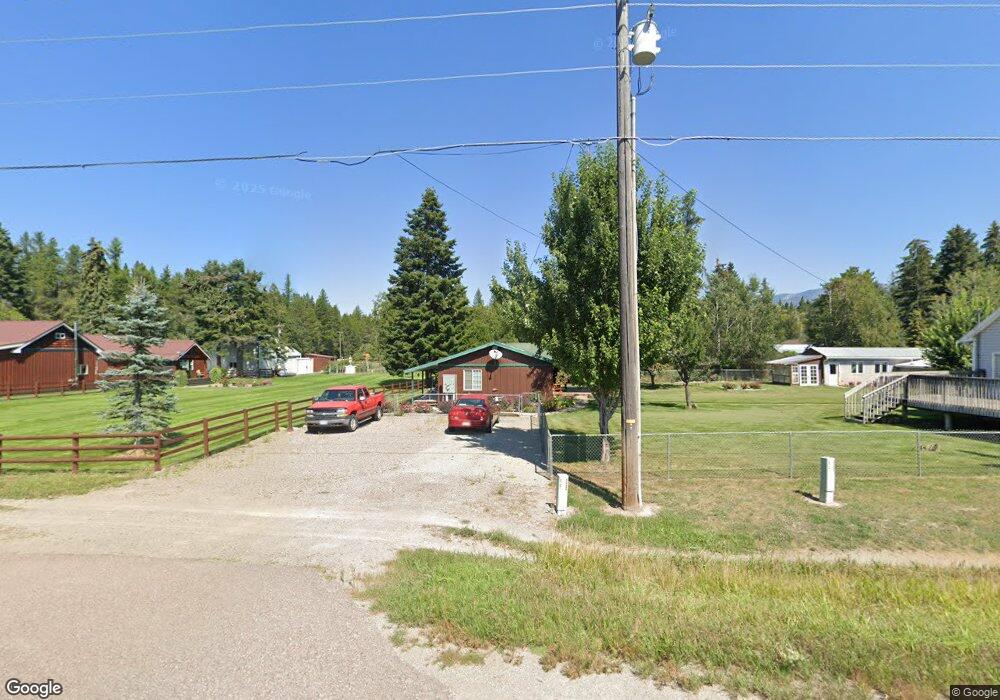
1435 Mt Highway 209 Bigfork, MT 59911
Estimated Value: $449,351 - $1,007,000
1
Bed
1
Bath
788
Sq Ft
$1,084/Sq Ft
Est. Value
About This Home
This home is located at 1435 Mt Highway 209, Bigfork, MT 59911 and is currently estimated at $854,338, approximately $1,084 per square foot. 1435 Mt Highway 209 is a home located in Flathead County with nearby schools including Bigfork Elementary School, Bigfork Middle School, and Bigfork High School.
Ownership History
Date
Name
Owned For
Owner Type
Purchase Details
Closed on
Jul 5, 2017
Sold by
Nationstar Mortgage Llc
Bought by
Curtis James Michael
Current Estimated Value
Home Financials for this Owner
Home Financials are based on the most recent Mortgage that was taken out on this home.
Original Mortgage
$167,000
Interest Rate
3.96%
Mortgage Type
New Conventional
Purchase Details
Closed on
Jun 1, 2010
Sold by
Curtis James Michael
Bought by
Nastionstar Mortgage Llc
Purchase Details
Closed on
Sep 26, 2005
Sold by
Curtis James Michael
Bought by
Flathead County Title Company Inc
Purchase Details
Closed on
Sep 22, 2005
Sold by
Crowl Evertt D and Crowl Linda F
Bought by
Curtis James Michael
Create a Home Valuation Report for This Property
The Home Valuation Report is an in-depth analysis detailing your home's value as well as a comparison with similar homes in the area
Home Values in the Area
Average Home Value in this Area
Purchase History
| Date | Buyer | Sale Price | Title Company |
|---|---|---|---|
| Curtis James Michael | -- | None Available | |
| Nastionstar Mortgage Llc | $231,938 | None Available | |
| Flathead County Title Company Inc | -- | None Available | |
| Curtis James Michael | -- | None Available |
Source: Public Records
Mortgage History
| Date | Status | Borrower | Loan Amount |
|---|---|---|---|
| Previous Owner | Curtis James Michael | $167,000 |
Source: Public Records
Tax History
| Year | Tax Paid | Tax Assessment Tax Assessment Total Assessment is a certain percentage of the fair market value that is determined by local assessors to be the total taxable value of land and additions on the property. | Land | Improvement |
|---|---|---|---|---|
| 2025 | $1,225 | $439,220 | $0 | $0 |
| 2024 | $1,415 | $296,853 | $0 | $0 |
| 2023 | $1,568 | $296,853 | $0 | $0 |
| 2022 | $1,554 | $211,600 | $0 | $0 |
| 2021 | $1,487 | $211,600 | $0 | $0 |
| 2020 | $1,565 | $196,390 | $0 | $0 |
| 2019 | $1,509 | $196,390 | $0 | $0 |
| 2018 | $1,606 | $199,600 | $0 | $0 |
| 2017 | $1,589 | $199,600 | $0 | $0 |
| 2016 | $1,506 | $189,100 | $0 | $0 |
| 2015 | $1,373 | $189,100 | $0 | $0 |
| 2014 | $1,378 | $114,639 | $0 | $0 |
Source: Public Records
Map
Nearby Homes
- 115 Ferndale Dr
- 72 Pilots Trail
- 305 Ferndale Dr Unit 41&42
- 305 Ferndale Dr Unit 42
- 305 Ferndale Dr Unit 41
- 30580 Cayuse Ln
- 518 Eastman Dr
- 280 Shady Ln
- 29545 Drifting Way
- 639 Three Eagle Ln
- 172 Swanlea Rd S
- #30 Bear Creek Village
- 1150 Swan Hill Dr
- 12022 Mount Highway 83
- 12524 Sunburst Dr
- 183 Pinto Trail
- 157 Pinto Trail
- 237 Timberjack Trail
- 664 Saddlehorn Trail
- 1 Red Owl Rd
- #15 N Ferndale Drive Hanger
- 123 Ferndale Dr
- 1445 Mt Highway 209
- 1445 Mt Highway 209
- 31850 S Ferndale Dr
- 137 Ferndale Dr
- 30673 Mt Highway 209
- 1455 Mt Highway 209
- 1455 Hwy 209
- 31844 S Ferndale Dr
- 220 Fernview Ln
- 31844 S Ferndale Dr
- 1455 Mt Highway 209
- 31845 S Ferndale Dr
- 140 Ferndale Dr
- 155 Ferndale Dr
- 1385 Mt Highway 209
- 30618 Fernview Ln
- 149 Ferndale Dr
- 30491 Mt Highway 209
Your Personal Tour Guide
Ask me questions while you tour the home.