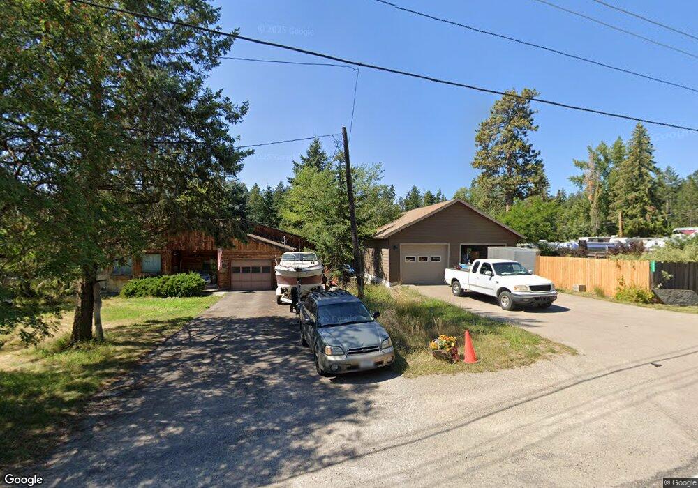
14367 Community Ln Bigfork, MT 59911
Estimated Value: $379,556 - $845,000
1
Bed
1
Bath
720
Sq Ft
$748/Sq Ft
Est. Value
About This Home
This home is located at 14367 Community Ln, Bigfork, MT 59911 and is currently estimated at $538,389, approximately $747 per square foot. 14367 Community Ln is a home located in Lake County with nearby schools including Bigfork Elementary School, Bigfork Middle School, and Bigfork High School.
Ownership History
Date
Name
Owned For
Owner Type
Purchase Details
Closed on
Oct 28, 2016
Sold by
Gifford Mark E and Ward Family Living Trust
Bought by
Ward William P
Current Estimated Value
Home Financials for this Owner
Home Financials are based on the most recent Mortgage that was taken out on this home.
Original Mortgage
$158,000
Outstanding Balance
$127,166
Interest Rate
3.5%
Mortgage Type
Seller Take Back
Estimated Equity
$411,223
Purchase Details
Closed on
Apr 1, 1999
Sold by
Barker William H and Barker Marta F
Bought by
Barker William Henry
Create a Home Valuation Report for This Property
The Home Valuation Report is an in-depth analysis detailing your home's value as well as a comparison with similar homes in the area
Purchase History
| Date | Buyer | Sale Price | Title Company |
|---|---|---|---|
| Ward William P | -- | Insured Title Company | |
| Barker William Henry | -- | None Available |
Source: Public Records
Mortgage History
| Date | Status | Borrower | Loan Amount |
|---|---|---|---|
| Open | Ward William P | $158,000 |
Source: Public Records
Tax History
| Year | Tax Paid | Tax Assessment Tax Assessment Total Assessment is a certain percentage of the fair market value that is determined by local assessors to be the total taxable value of land and additions on the property. | Land | Improvement |
|---|---|---|---|---|
| 2025 | $1,172 | $313,300 | $0 | $0 |
| 2024 | $1,593 | $241,400 | $0 | $0 |
| 2023 | $1,521 | $241,400 | $0 | $0 |
| 2022 | $1,164 | $135,874 | $0 | $0 |
| 2021 | $1,026 | $135,874 | $0 | $0 |
| 2020 | $1,068 | $112,986 | $0 | $0 |
| 2019 | $1,049 | $112,986 | $0 | $0 |
| 2018 | $895 | $89,610 | $0 | $0 |
| 2017 | $648 | $89,610 | $0 | $0 |
| 2016 | $793 | $84,190 | $0 | $0 |
| 2015 | $751 | $84,190 | $0 | $0 |
| 2014 | $745 | $74,483 | $0 | $0 |
Source: Public Records
Map
Nearby Homes
- Nhn Yenne Point Rd
- 14530 Yenne Point Rd
- 52 Hidden Dr
- 52 Hidden Harbor
- 32960 Barberry Rd
- 32970 Ninebark Ln
- 32962 Ninebark Ln
- 32651 Pine Meadow Dr
- 32679 Pine Meadow Dr
- 15286 Woods Bay Point Rd
- 13962 Pine St
- 33676 Hilltop Terrace
- 13390 Mt Highway 35
- 181 Sylvan Dr
- NHN Elkridge Rd
- 604 Ranch Rd
- 616 Ranch Rd
- 551 Ranch Rd
- 17431 Fishing Rock Ln
- 175B Eagle Bend Dr
- 14364 Forest Dr
- 14395 Community Ln
- 14357 Forest Dr
- 14368 Forest Dr
- 14364 Community Ln
- 14903 Mt Highway 35
- 14871 Mt Highway 35
- 32952 Driftwood Ln
- 32924 Driftwood Ln
- 74 Community Ln
- 14847 Montana Hwy 35 Unit 3
- 32880 Driftwood Ln
- 207 Community Ln
- 14871 Mt Hwy 35 Unit CabinFour
- 14871 Mt Hwy 35 Unit RVSlip2
- 14871 Mt Hwy 35 Unit RVSlip1
- 14871 Mt Hwy 35 Unit Cabin Three
- 14871 Mt Hwy 35 Unit Cabin One
- 14871 Mt Hwy 35 Unit Cabin Twelve
- 14871 Mt Hwy 35
Your Personal Tour Guide
Ask me questions while you tour the home.