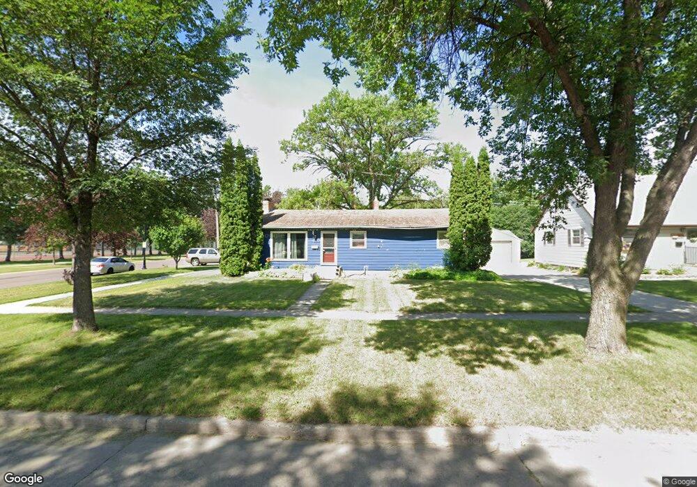
1437 21st St S Fargo, ND 58103
South High NeighborhoodEstimated Value: $246,000 - $290,000
3
Beds
2
Baths
1,920
Sq Ft
$138/Sq Ft
Est. Value
About This Home
This home is located at 1437 21st St S, Fargo, ND 58103 and is currently estimated at $265,741, approximately $138 per square foot. 1437 21st St S is a home located in Cass County with nearby schools including Lewis & Clark Elementary School, Carl Ben Eielson Middle School, and South High School.
Ownership History
Date
Name
Owned For
Owner Type
Purchase Details
Closed on
Jun 21, 2016
Sold by
Gjerde Elizabeth and Brossart Elizaberh A
Bought by
Norman Andrew D and Norman Kristi L
Current Estimated Value
Home Financials for this Owner
Home Financials are based on the most recent Mortgage that was taken out on this home.
Original Mortgage
$170,050
Outstanding Balance
$135,341
Interest Rate
3.57%
Mortgage Type
New Conventional
Estimated Equity
$130,400
Purchase Details
Closed on
Jan 25, 2008
Sold by
Laney Brian J and Laney Christne C
Bought by
Brossart Elizabeth A
Home Financials for this Owner
Home Financials are based on the most recent Mortgage that was taken out on this home.
Original Mortgage
$134,934
Interest Rate
6.1%
Mortgage Type
FHA
Create a Home Valuation Report for This Property
The Home Valuation Report is an in-depth analysis detailing your home's value as well as a comparison with similar homes in the area
Home Values in the Area
Average Home Value in this Area
Purchase History
| Date | Buyer | Sale Price | Title Company |
|---|---|---|---|
| Norman Andrew D | $179,000 | None Available | |
| Brossart Elizabeth A | -- | -- |
Source: Public Records
Mortgage History
| Date | Status | Borrower | Loan Amount |
|---|---|---|---|
| Open | Norman Andrew D | $170,050 | |
| Previous Owner | Brossart Elizabeth A | $134,934 |
Source: Public Records
Tax History Compared to Growth
Tax History
| Year | Tax Paid | Tax Assessment Tax Assessment Total Assessment is a certain percentage of the fair market value that is determined by local assessors to be the total taxable value of land and additions on the property. | Land | Improvement |
|---|---|---|---|---|
| 2024 | $3,288 | $113,000 | $25,350 | $87,650 |
| 2023 | $3,131 | $106,600 | $25,350 | $81,250 |
| 2022 | $3,128 | $106,600 | $25,350 | $81,250 |
| 2021 | $2,925 | $100,950 | $27,000 | $73,950 |
| 2020 | $2,668 | $91,750 | $27,000 | $64,750 |
| 2019 | $2,317 | $86,550 | $15,000 | $71,550 |
| 2018 | $2,285 | $86,550 | $15,000 | $71,550 |
| 2017 | $2,196 | $84,050 | $15,000 | $69,050 |
| 2016 | $1,945 | $81,600 | $15,000 | $66,600 |
| 2015 | $1,968 | $70,350 | $11,250 | $59,100 |
| 2014 | $1,887 | $65,150 | $11,250 | $53,900 |
| 2013 | $1,889 | $65,150 | $11,250 | $53,900 |
Source: Public Records
Map
Nearby Homes
- 2202 15th Ave S
- 2402 N Flickertail Dr S Unit 1
- 2013 13th Ave S
- 2009 13th Ave S
- 1407 17th St S
- 1725 Whitestone Cir S
- 1737 Park Blvd S
- 1709 13th Ave S
- 1129 22nd St S Unit B09
- 1129 22nd St S Unit B12
- 1301 16 1 2 St S
- 1402 E Gateway Cir S Unit M
- 1545 15th St S
- 1410 14 1 2 St S
- 1550 14 1 2 St S
- 1718 15th St S
- 818 19th St S
- 2326 20th Ave S Unit 9
- 2320 20th Ave S Unit 7
- 814 19th St S
- 1433 21st St S
- 1433 21 St S
- 2111 15th Ave S
- 1429 21st St S
- 2117 15th Ave S
- 1425 21st St S
- 2005 15th Ave S
- 1458 21st St S
- 2123 15th Ave S
- 1421 21st St S
- 1454 21st St S
- 1450 21st St S
- 1442 23rd St S
- 1417 21st St S
- 2001 15th Ave S
- 1448 23rd St S
- 2207 15th Ave S
- 1457 20th St S
- 1446 21st St S
- 1453 20th St S