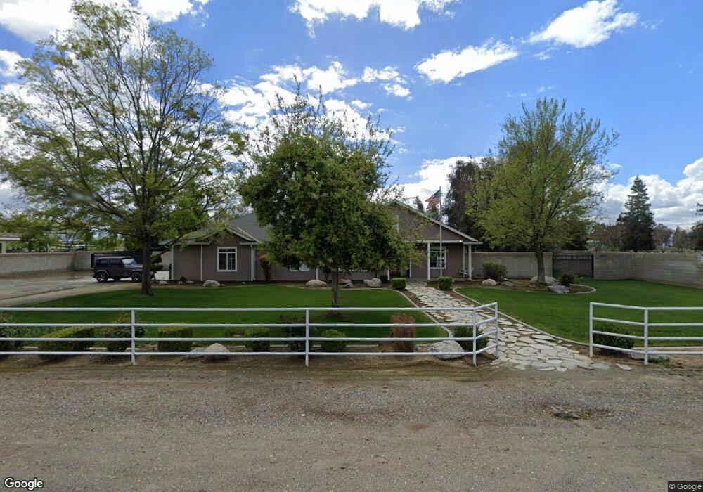
1437 Kuhio St Bakersfield, CA 93313
Estimated Value: $506,000 - $882,000
3
Beds
2
Baths
2,176
Sq Ft
$323/Sq Ft
Est. Value
About This Home
This home is located at 1437 Kuhio St, Bakersfield, CA 93313 and is currently estimated at $702,512, approximately $322 per square foot. 1437 Kuhio St is a home located in Kern County with nearby schools including General Shafter Elementary School, Ridgeview High School, and Gideon Apostolic Academy.
Ownership History
Date
Name
Owned For
Owner Type
Purchase Details
Closed on
Mar 20, 2014
Sold by
Melo Brady and Melo Leane
Bought by
Melo Family Trust
Current Estimated Value
Purchase Details
Closed on
Jun 1, 2004
Sold by
Devin Kenneth D and Devin Katherine G
Bought by
Devin Kenneth D and Devin Katherine G
Purchase Details
Closed on
May 2, 2003
Sold by
Devin Kenneth D and Devin Katherine G
Bought by
Melo Brady and Melo Leane
Purchase Details
Closed on
Feb 4, 2003
Sold by
Jones Michael D and Jones Jennifer M
Bought by
Devin Kenneth D and Devin Katherine G
Create a Home Valuation Report for This Property
The Home Valuation Report is an in-depth analysis detailing your home's value as well as a comparison with similar homes in the area
Home Values in the Area
Average Home Value in this Area
Purchase History
| Date | Buyer | Sale Price | Title Company |
|---|---|---|---|
| Melo Family Trust | -- | None Available | |
| Devin Kenneth D | -- | -- | |
| Melo Brady | $35,000 | Chicago Title | |
| Devin Kenneth D | $40,000 | -- |
Source: Public Records
Tax History Compared to Growth
Tax History
| Year | Tax Paid | Tax Assessment Tax Assessment Total Assessment is a certain percentage of the fair market value that is determined by local assessors to be the total taxable value of land and additions on the property. | Land | Improvement |
|---|---|---|---|---|
| 2025 | $5,106 | $419,862 | $64,621 | $355,241 |
| 2024 | $5,106 | $411,631 | $63,354 | $348,277 |
| 2023 | $4,982 | $403,561 | $62,112 | $341,449 |
| 2022 | $4,889 | $395,650 | $60,895 | $334,755 |
| 2021 | $4,768 | $387,894 | $59,701 | $328,193 |
| 2020 | $4,693 | $383,919 | $59,089 | $324,830 |
| 2019 | $4,623 | $383,919 | $59,089 | $324,830 |
| 2018 | $4,504 | $369,016 | $56,796 | $312,220 |
| 2017 | $4,425 | $361,783 | $55,683 | $306,100 |
| 2016 | $3,808 | $354,692 | $54,592 | $300,100 |
| 2015 | $3,768 | $349,365 | $53,772 | $295,593 |
| 2014 | $3,373 | $313,110 | $52,719 | $260,391 |
Source: Public Records
Map
Nearby Homes
- 1523 Kuhio St
- 1509 Porty Ave
- 10517 McCormac Ave
- 15852 Wible Rd
- 1301 Taft Hwy Unit 93
- 1301 Taft Hwy Unit 50
- 1301 Taft Hwy Unit 12
- 1301 Taft Hwy Unit 166
- 1301 Taft Hwy Unit 91
- 1225 Taft Hwy Unit 23
- 1225 Taft Hwy Unit 3
- 1225 Taft Hwy Unit 24
- 1225 Taft Hwy Unit 5
- 0 S Union Ave Unit 202509110
- 9449 S Union Ave
- 2310 Taft Hwy
- 400 Stirrup Ave
- 0 Bear Mountain Blvd
- 9338 Gladys St
- 1301 Charterten Ave
- 1511 Kuhio St
- 1403 Kuhio St
- 13252 Thoroughbred St
- 1329 Kuhio St
- 13210 Thoroughbred St
- 1518 Kuhio St
- 1555 Kuhio St
- 13153 Thoroughbred St
- 1564 Kuhio St
- 1639 Kuhio St
- 13406 Billie St
- 0 Thoroughbred St
- 1330 de Harvey Ave
- 1500 de Harvey Ave
- 13106 Billie St
- 1345 de Harvey Ave
- 13338 S H St
- 13338 S H St
- 13080 Thoroughbred St
- 1331 de Harvey Ave