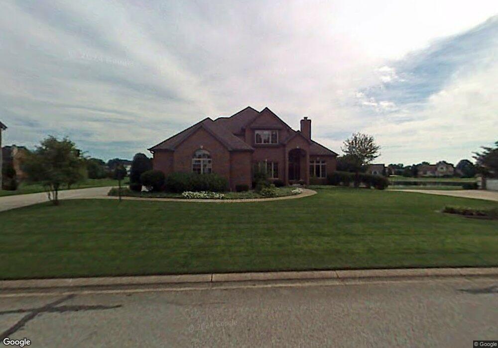
14374 Northampton Dr Granger, IN 46530
Estimated Value: $663,000 - $715,000
4
Beds
6
Baths
2,328
Sq Ft
$297/Sq Ft
Est. Value
About This Home
This home is located at 14374 Northampton Dr, Granger, IN 46530 and is currently estimated at $690,804, approximately $296 per square foot. 14374 Northampton Dr is a home located in St. Joseph County with nearby schools including Northpoint Elementary School, Discovery Middle School, and Penn High School.
Ownership History
Date
Name
Owned For
Owner Type
Purchase Details
Closed on
Aug 14, 2006
Sold by
Harwood Jay R and Harwood Karen Sue
Bought by
Redden Peter J
Current Estimated Value
Home Financials for this Owner
Home Financials are based on the most recent Mortgage that was taken out on this home.
Original Mortgage
$350,000
Outstanding Balance
$211,160
Interest Rate
6.85%
Mortgage Type
New Conventional
Estimated Equity
$479,644
Create a Home Valuation Report for This Property
The Home Valuation Report is an in-depth analysis detailing your home's value as well as a comparison with similar homes in the area
Home Values in the Area
Average Home Value in this Area
Purchase History
| Date | Buyer | Sale Price | Title Company |
|---|---|---|---|
| Redden Peter J | -- | Metropolitan Title In Llc |
Source: Public Records
Mortgage History
| Date | Status | Borrower | Loan Amount |
|---|---|---|---|
| Open | Redden Peter J | $350,000 |
Source: Public Records
Tax History Compared to Growth
Tax History
| Year | Tax Paid | Tax Assessment Tax Assessment Total Assessment is a certain percentage of the fair market value that is determined by local assessors to be the total taxable value of land and additions on the property. | Land | Improvement |
|---|---|---|---|---|
| 2024 | $6,188 | $600,000 | $117,300 | $482,700 |
| 2023 | $6,140 | $669,100 | $166,700 | $502,400 |
| 2022 | $6,466 | $646,600 | $144,200 | $502,400 |
| 2021 | $5,256 | $520,800 | $58,800 | $462,000 |
| 2020 | $5,360 | $531,200 | $59,900 | $471,300 |
| 2019 | $5,278 | $523,000 | $85,600 | $437,400 |
| 2018 | $5,655 | $538,400 | $85,600 | $452,800 |
| 2017 | $5,841 | $533,300 | $85,600 | $447,700 |
| 2016 | $4,891 | $450,600 | $72,300 | $378,300 |
| 2014 | $5,288 | $455,300 | $72,300 | $383,000 |
Source: Public Records
Map
Nearby Homes
- 50642 Brookhaven Dr
- 50558 Hollybrook Dr
- 14124 Northampton Ct
- 30217 Stratford Ct
- 50727 Pickett Ridge Ct
- 50817 Stonebridge Dr
- Lot 1 Stratford Ct
- 50980 Taddington Ct
- 71138 Brush Rd
- 14202 Stonehurst Ct
- 14929 Trail Unit 1
- 50916 Stone Hill Ct
- 51070 Lexingham Dr
- 14970 Woodford Lot 20 Trail Unit 20
- 51216 Leeward Point
- 15065 Woodford Lot 8 Trail Unit 8
- 50595 Bantam Ridge Dr
- 15095 Gossamer Lot 10 Trail Unit 10
- 14197 Avery Point
- 51405 Elm Rd
- 14348 Northampton Dr
- 14396 Northampton Dr
- 14371 Northampton Dr
- 14320 Northampton Dr
- 14351 Northampton Dr
- 14416 Northampton Dr
- 50585 Brookhaven Dr
- 14333 Northampton Dr
- 14415 Northampton Dr
- 14442 Northampton Dr
- 14435 Northampton Dr
- 14313 Northampton Dr
- 50665 Brookhaven Dr
- 50550 Brookhaven Dr
- 50613 Brookhaven Dr
- 50562 Brookhaven Dr
- 14476 Northampton Dr
- 50602 Brookhaven Dr
- 14293 Northampton Dr
- 50643 Brookhaven Dr