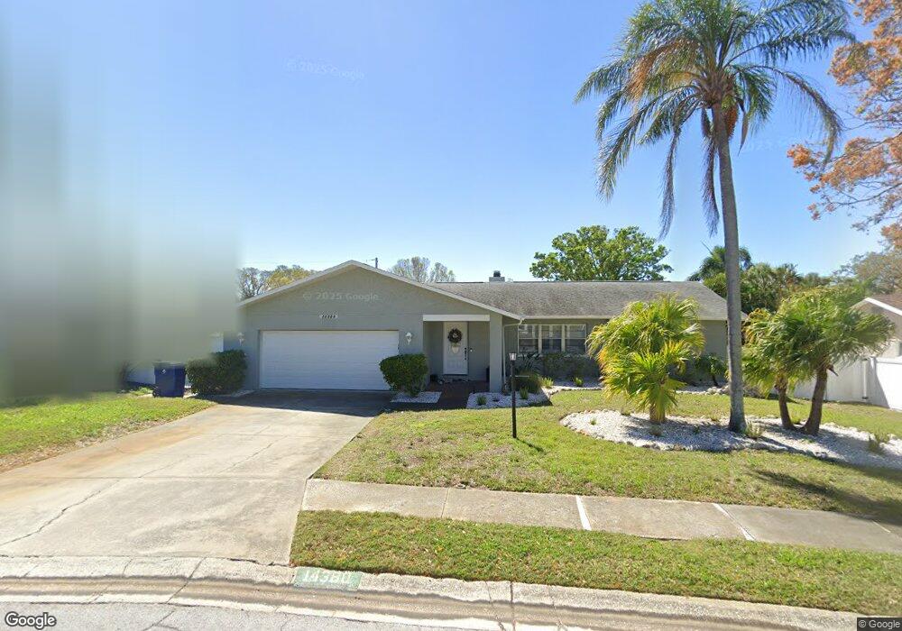
14380 Apache Ave Largo, FL 33774
Collins Estates NeighborhoodEstimated Value: $461,599 - $544,000
Studio
--
Bath
1,590
Sq Ft
$311/Sq Ft
Est. Value
About This Home
This home is located at 14380 Apache Ave, Largo, FL 33774 and is currently estimated at $495,150, approximately $311 per square foot. 14380 Apache Ave is a home located in Pinellas County with nearby schools including Oakhurst Elementary School, Seminole Middle School, and Seminole High School.
Ownership History
Date
Name
Owned For
Owner Type
Purchase Details
Closed on
Jul 10, 2017
Sold by
Parkes Gregory L and Bisho Of The Diocese Of St Pet
Bought by
Faraone Michael C and Faraone Amanda C
Current Estimated Value
Home Financials for this Owner
Home Financials are based on the most recent Mortgage that was taken out on this home.
Original Mortgage
$227,797
Outstanding Balance
$188,234
Interest Rate
3.87%
Mortgage Type
FHA
Estimated Equity
$306,916
Purchase Details
Closed on
Sep 24, 1997
Sold by
Proper Kathleen M
Bought by
Bishop Of The Diocese Of St Petersb
Create a Home Valuation Report for This Property
The Home Valuation Report is an in-depth analysis detailing your home's value as well as a comparison with similar homes in the area
Home Values in the Area
Average Home Value in this Area
Purchase History
| Date | Buyer | Sale Price | Title Company |
|---|---|---|---|
| Faraone Michael C | $232,000 | None Available | |
| Bishop Of The Diocese Of St Petersb | $121,000 | -- |
Source: Public Records
Mortgage History
| Date | Status | Borrower | Loan Amount |
|---|---|---|---|
| Open | Faraone Michael C | $227,797 |
Source: Public Records
Tax History
| Year | Tax Paid | Tax Assessment Tax Assessment Total Assessment is a certain percentage of the fair market value that is determined by local assessors to be the total taxable value of land and additions on the property. | Land | Improvement |
|---|---|---|---|---|
| 2025 | $4,321 | $280,620 | -- | -- |
| 2024 | $4,205 | $272,711 | -- | -- |
| 2023 | $4,205 | $264,768 | $0 | $0 |
| 2022 | $3,959 | $257,056 | $0 | $0 |
| 2021 | $4,019 | $249,569 | $0 | $0 |
| 2020 | $4,015 | $246,123 | $0 | $0 |
| 2019 | $3,956 | $240,589 | $0 | $0 |
| 2018 | $3,551 | $236,103 | $0 | $0 |
| 2017 | $118 | $220,243 | $0 | $0 |
| 2016 | $118 | $222,436 | $0 | $0 |
| 2015 | $118 | $215,774 | $0 | $0 |
| 2014 | $116 | $169,224 | $0 | $0 |
Source: Public Records
Map
Nearby Homes
- 11320 Currie Ln
- 14557 Apache Ave
- 14108 110th Terrace
- 14423 Kandi Ct
- 14512 117th Ave
- 11722 Currie Ln Unit D1
- 11722 Currie Ln Unit F2
- 14095 Chamberlain Ave
- 11696 Currie Ln
- 11534 Lowe Rd
- 14447 Mark Dr
- 14723 Sunset Dr
- 11469 Oakhurst Rd
- 14733 Sunset Dr
- 13879 Kimberly Dr
- 11630 Hamlin Blvd Unit 124
- 11630 Hamlin Blvd Unit 127
- 11630 Hamlin Blvd
- 11630 Hamlin Blvd Unit 204
- 14744 Sunset Dr
- 14360 Apache Ave
- 14390 Apache Ave
- 14381 Iroquois Ave
- 14361 Iroquois Ave
- 14397 Iroquois Ave
- 14341 Iroquois Ave
- 14371 Apache Ave
- 14410 Apache Ave
- 14340 Apache Ave
- 14415 Iroquois Ave
- 14351 Apache Ave
- 14321 Iroquois Ave
- 11240 144th St
- 14430 Apache Ave
- 14331 Apache Ave
- 11283 144th St
- 14320 Apache Ave
- 14390 Iroquois Ave
- 14429 Iroquois Ave
- 14360 Iroquois Ave
Your Personal Tour Guide
Ask me questions while you tour the home.