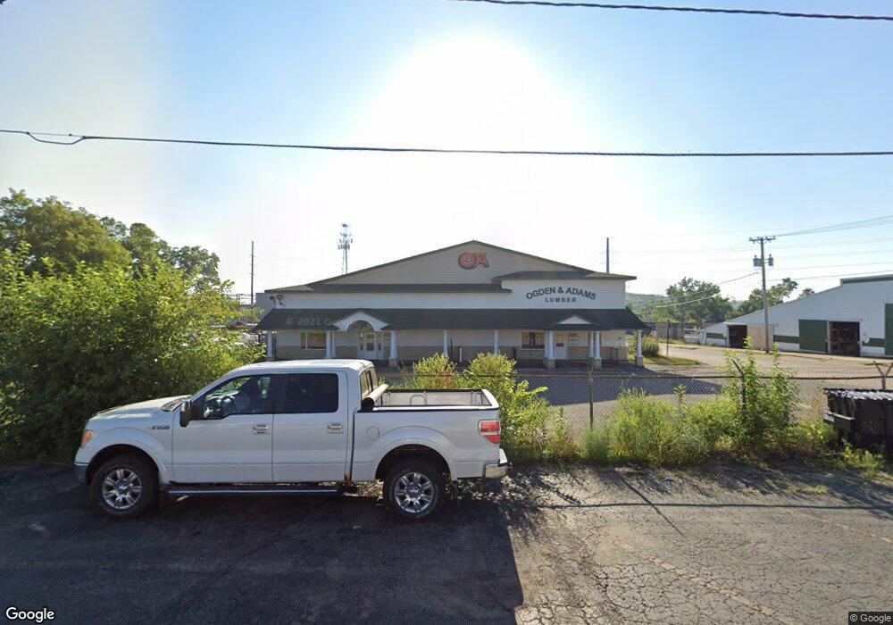
144 32nd Street Dr SE Cedar Rapids, IA 52403
Kenwood Park NeighborhoodEstimated Value: $792,687
--
Bed
--
Bath
8,500
Sq Ft
$93/Sq Ft
Est. Value
About This Home
This home is located at 144 32nd Street Dr SE, Cedar Rapids, IA 52403 and is currently estimated at $792,687, approximately $93 per square foot. 144 32nd Street Dr SE is a home located in Linn County with nearby schools including Kenwood Leadership Academy, Franklin Middle School, and George Washington High School.
Ownership History
Date
Name
Owned For
Owner Type
Purchase Details
Closed on
Jun 12, 2023
Sold by
Home Creations Llc
Bought by
Fuen Devida Iglesia De Dios
Current Estimated Value
Home Financials for this Owner
Home Financials are based on the most recent Mortgage that was taken out on this home.
Original Mortgage
$580,000
Outstanding Balance
$545,302
Interest Rate
6.39%
Mortgage Type
New Conventional
Estimated Equity
$247,385
Purchase Details
Closed on
Mar 20, 2006
Sold by
River Trails Transit Lines Inc
Bought by
Home Creations Llc
Create a Home Valuation Report for This Property
The Home Valuation Report is an in-depth analysis detailing your home's value as well as a comparison with similar homes in the area
Home Values in the Area
Average Home Value in this Area
Purchase History
| Date | Buyer | Sale Price | Title Company |
|---|---|---|---|
| Fuen Devida Iglesia De Dios | $725,000 | None Listed On Document | |
| Devida Iglesia Dc Dios Fuen | $725,000 | None Listed On Document | |
| Devida Iglesia De Dios Fuen | $725,000 | None Listed On Document | |
| Home Creations Llc | $499,500 | None Available |
Source: Public Records
Mortgage History
| Date | Status | Borrower | Loan Amount |
|---|---|---|---|
| Open | Devida Iglesia De Dios Fuen | $580,000 |
Source: Public Records
Tax History Compared to Growth
Tax History
| Year | Tax Paid | Tax Assessment Tax Assessment Total Assessment is a certain percentage of the fair market value that is determined by local assessors to be the total taxable value of land and additions on the property. | Land | Improvement |
|---|---|---|---|---|
| 2025 | $28,774 | $1,624,600 | $211,900 | $1,412,700 |
| 2024 | $25,398 | $1,506,300 | $211,900 | $1,294,400 |
| 2023 | $25,398 | $910,000 | $211,900 | $698,100 |
| 2022 | $22,666 | $790,100 | $211,900 | $578,200 |
| 2021 | $23,544 | $1,269,300 | $211,900 | $1,057,400 |
| 2020 | $23,544 | $1,309,000 | $203,800 | $1,105,200 |
| 2019 | $22,626 | $756,400 | $203,800 | $552,600 |
| 2018 | $22,522 | $756,400 | $203,800 | $552,600 |
| 2017 | $19,364 | $660,400 | $203,800 | $456,600 |
| 2016 | $22,713 | $660,400 | $203,800 | $456,600 |
| 2015 | $23,330 | $678,944 | $203,750 | $475,194 |
| 2014 | $20,924 | $678,944 | $203,750 | $475,194 |
| 2013 | $23,764 | $678,944 | $203,750 | $475,194 |
Source: Public Records
Map
Nearby Homes
- 139 32nd St NE
- 3218 C Ave NE
- 3101 C Ave NE
- 410 32nd St NE
- 3322 C Ave NE
- 419 33rd St NE
- 413 34th St NE
- 309 29th Street Dr SE
- 3107 E Ave NE
- 431 30th Street Dr SE
- 426 29th Street Dr SE Unit 3
- 615 34th St NE
- 521 29th St NE
- 3111 Carroll Dr SE
- 3140 Carroll Dr SE
- 650 Staub Ct NE
- 219 40th Street Dr SE Unit 206
- 215 40th Street Dr SE Unit 304
- 2522 A Ave NE
- 2600 C Ave NE
- 135 33rd Street Dr SE
- 141 33rd Street Dr SE
- 123 32nd Street Dr SE
- 123 32nd St Dr SE
- 200 32nd Street Dr SE Unit 3
- 200 32nd Street Dr SE Unit 1
- 200 32nd Street Dr SE Unit 2
- 201 33rd Street Dr SE Unit E
- 201 33rd Street Dr SE Unit D
- 201 33rd Street Dr SE Unit C
- 201 33rd Street Dr SE Unit A
- 201 33rd Street Dr SE
- 201 33rd Street Dr SE Unit 300
- 201 33rd Street Dr SE Unit 200
- 201 33rd Street Dr SE Unit 100
- 138 33rd Street Dr SE
- 130 33rd Street Dr SE
- 128 33rd Street Dr SE
- 122 33rd Street Dr SE
- 124 33rd Street Dr SE