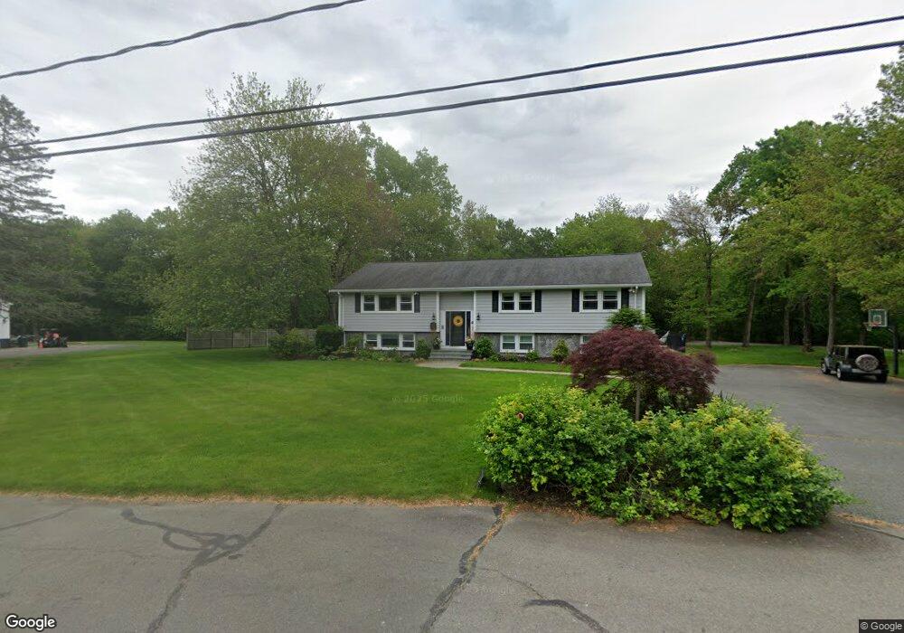
144 Alfred Rd Milton, MA 02186
Brush Hill NeighborhoodEstimated Value: $1,259,000 - $1,541,000
4
Beds
4
Baths
3,215
Sq Ft
$432/Sq Ft
Est. Value
About This Home
This home is located at 144 Alfred Rd, Milton, MA 02186 and is currently estimated at $1,390,257, approximately $432 per square foot. 144 Alfred Rd is a home located in Norfolk County with nearby schools including Milton High School, Delphi Academy, and Thacher Montessori School.
Ownership History
Date
Name
Owned For
Owner Type
Purchase Details
Closed on
Nov 17, 2017
Sold by
Adg Nt
Bought by
Green Annette H and Green Donald E
Current Estimated Value
Home Financials for this Owner
Home Financials are based on the most recent Mortgage that was taken out on this home.
Original Mortgage
$150,000
Outstanding Balance
$125,693
Interest Rate
3.85%
Mortgage Type
Unknown
Estimated Equity
$1,264,564
Purchase Details
Closed on
Oct 7, 2004
Sold by
Green Annette H and Green Donald E
Bought by
Adg Nominee Re T and Green Annette H
Purchase Details
Closed on
Dec 1, 1998
Sold by
Roche John J and Roche Margaret E
Bought by
Green Donald and Green Annette
Home Financials for this Owner
Home Financials are based on the most recent Mortgage that was taken out on this home.
Original Mortgage
$180,000
Interest Rate
6.83%
Mortgage Type
Purchase Money Mortgage
Create a Home Valuation Report for This Property
The Home Valuation Report is an in-depth analysis detailing your home's value as well as a comparison with similar homes in the area
Home Values in the Area
Average Home Value in this Area
Purchase History
| Date | Buyer | Sale Price | Title Company |
|---|---|---|---|
| Green Annette H | -- | -- | |
| Adg Nominee Re T | -- | -- | |
| Green Donald | $377,000 | -- |
Source: Public Records
Mortgage History
| Date | Status | Borrower | Loan Amount |
|---|---|---|---|
| Open | Green Annette H | $150,000 | |
| Previous Owner | Green Donald | $300,000 | |
| Previous Owner | Green Donald | $180,000 | |
| Previous Owner | Green Donald | $25,500 | |
| Previous Owner | Green Donald | $30,000 |
Source: Public Records
Tax History
| Year | Tax Paid | Tax Assessment Tax Assessment Total Assessment is a certain percentage of the fair market value that is determined by local assessors to be the total taxable value of land and additions on the property. | Land | Improvement |
|---|---|---|---|---|
| 2025 | $12,734 | $1,148,200 | $578,000 | $570,200 |
| 2024 | $12,237 | $1,120,600 | $550,400 | $570,200 |
| 2023 | $11,231 | $985,200 | $524,300 | $460,900 |
| 2022 | $11,009 | $882,800 | $524,300 | $358,500 |
| 2021 | $11,163 | $850,200 | $505,400 | $344,800 |
| 2020 | $11,346 | $864,800 | $495,900 | $368,900 |
| 2019 | $11,166 | $847,200 | $481,500 | $365,700 |
| 2018 | $10,795 | $781,700 | $420,800 | $360,900 |
| 2017 | $10,097 | $744,600 | $400,700 | $343,900 |
| 2016 | $9,990 | $740,000 | $400,700 | $339,300 |
| 2015 | $9,989 | $716,600 | $369,100 | $347,500 |
Source: Public Records
Map
Nearby Homes
- 200 Robbins St
- 350 Blue Hill Ave
- 5 Kinsale Ln
- 58 Adanac Rd
- 6 Kinsale Ln
- 7 Preacher Rd
- 4 Farmer Rd
- 49 Summit St
- 17 Quisset Brook Rd
- 485 Blue Hills Pkwy Unit 10
- 485 Blue Hills Pkwy Unit 12
- 485 Blue Hills Pkwy Unit 33
- 485 Blue Hills Pkwy Unit 13
- 485 Blue Hills Pkwy Unit 2
- 485 Blue Hills Pkwy Unit 23
- 485 Blue Hills Pkwy Unit 49
- 485 Blue Hills Pkwy Unit 6
- 1386 Canton Ave
- 7 Parkway Crescent
- 0 Truman Pkwy
- 130 Alfred Rd
- 42 Apple Ln
- 154 Alfred Rd
- 131 Alfred Rd
- 690 Blue Hill Ave
- 34 Apple Ln
- 120 Alfred Rd
- 680 Blue Hill Ave
- 680 Blue Hill Ave
- 35 Apple Ln
- 57 Barbara Ln
- 166 Alfred Rd
- 656 Blue Hill Ave
- 714 Blue Hill Ave
- 20 Apple Ln
- 108 Alfred Rd
- 108 Alfred Rd Unit 1
- 23 Apple Ln
- 68 Barbara Ln
- 726 Blue Hill Ave
Your Personal Tour Guide
Ask me questions while you tour the home.