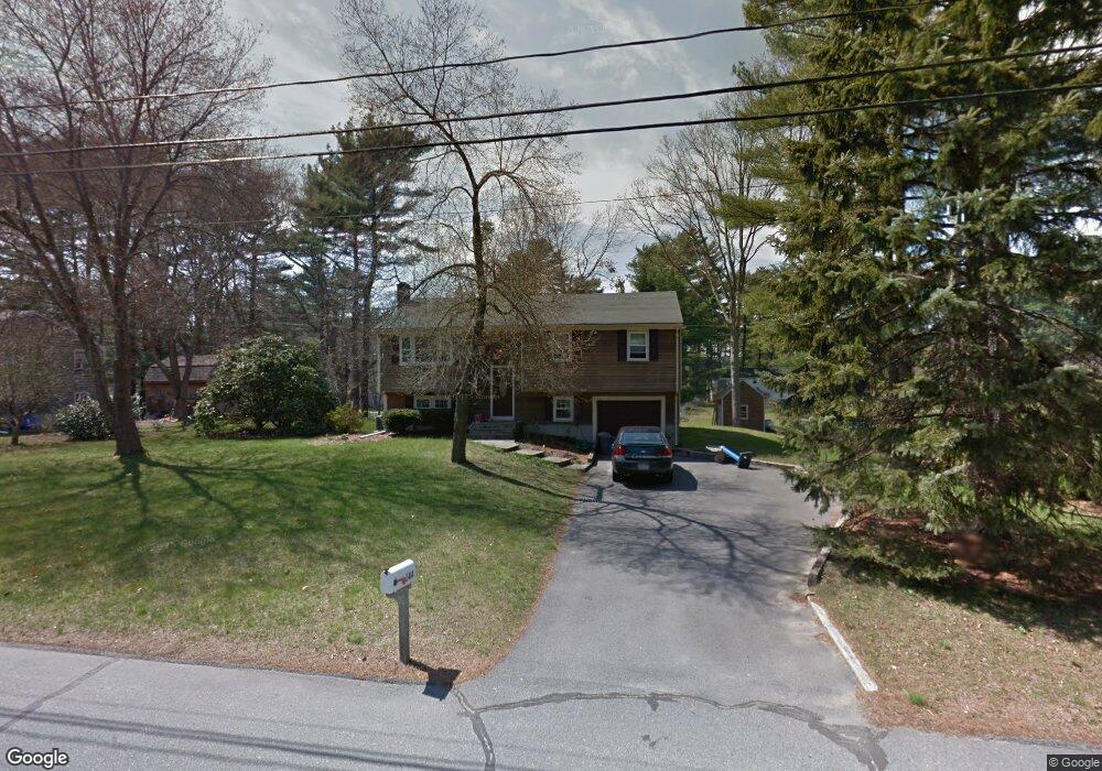
144 Cynthia Dr Raynham, MA 02767
Estimated Value: $562,000 - $582,933
3
Beds
2
Baths
1,735
Sq Ft
$329/Sq Ft
Est. Value
About This Home
This home is located at 144 Cynthia Dr, Raynham, MA 02767 and is currently estimated at $571,233, approximately $329 per square foot. 144 Cynthia Dr is a home located in Bristol County with nearby schools including Merrill Elementary School, LaLiberte Elementary School, and Williams Intermediate School.
Ownership History
Date
Name
Owned For
Owner Type
Purchase Details
Closed on
Oct 19, 2001
Sold by
Pickett David B and Pickett Donna M
Bought by
Lablue David W and Lablue Cheryl A
Current Estimated Value
Home Financials for this Owner
Home Financials are based on the most recent Mortgage that was taken out on this home.
Original Mortgage
$196,000
Interest Rate
6.92%
Mortgage Type
Purchase Money Mortgage
Purchase Details
Closed on
Dec 28, 1987
Sold by
Casey William F
Bought by
Pickett David B
Create a Home Valuation Report for This Property
The Home Valuation Report is an in-depth analysis detailing your home's value as well as a comparison with similar homes in the area
Home Values in the Area
Average Home Value in this Area
Purchase History
| Date | Buyer | Sale Price | Title Company |
|---|---|---|---|
| Lablue David W | $218,000 | -- | |
| Pickett David B | $160,500 | -- |
Source: Public Records
Mortgage History
| Date | Status | Borrower | Loan Amount |
|---|---|---|---|
| Open | Pickett David B | $247,000 | |
| Closed | Pickett David B | $196,000 | |
| Previous Owner | Pickett David B | $121,500 | |
| Previous Owner | Pickett David B | $121,500 |
Source: Public Records
Tax History Compared to Growth
Tax History
| Year | Tax Paid | Tax Assessment Tax Assessment Total Assessment is a certain percentage of the fair market value that is determined by local assessors to be the total taxable value of land and additions on the property. | Land | Improvement |
|---|---|---|---|---|
| 2025 | $5,704 | $471,400 | $189,900 | $281,500 |
| 2024 | $5,764 | $464,100 | $182,600 | $281,500 |
| 2023 | $5,327 | $391,700 | $164,300 | $227,400 |
| 2022 | $5,158 | $347,800 | $146,100 | $201,700 |
| 2021 | $4,893 | $333,100 | $138,800 | $194,300 |
| 2020 | $4,716 | $327,300 | $138,800 | $188,500 |
| 2019 | $3,944 | $327,300 | $138,800 | $188,500 |
| 2018 | $4,419 | $296,600 | $138,800 | $157,800 |
| 2017 | $3,496 | $276,100 | $131,500 | $144,600 |
| 2016 | $4,091 | $273,100 | $128,500 | $144,600 |
| 2015 | $3,763 | $246,900 | $129,700 | $117,200 |
Source: Public Records
Map
Nearby Homes
- 21 Sully Rd
- 73 Sherwood Ln
- 100 Francine Rd
- 848 N Main St
- 970 N Main St
- 643 Center St
- 1037 N Main St
- 520 King St
- 53 Queens Cir
- 100 Pleasant St
- 115 Goldfinch Dr
- 92 N Main St
- 2 Maplewood Ln Unit 21-1
- 0 Maplewood Unit 21.3 73426136
- 0 Maplewood Unit 33-1 73420094
- 930 King St
- 120 King St
- 40 Country Club Dr
- 80 Partridge Ln
- 25 Twin Diamond Dr
- 166 Cynthia Dr
- 111 Elizabeth Dr
- 119 Elizabeth Dr
- 145 Cynthia Dr
- 128 Cynthia Dr
- 103 Elizabeth Dr
- 178 Cynthia Dr
- 133 Cynthia Dr
- 169 Cynthia Dr
- 131 Elizabeth Dr
- 89 Elizabeth Dr
- 123 Cynthia Dr
- 203 Cynthia Dr
- 112 Cynthia Dr
- 141 Elizabeth Dr
- 190 Cynthia Dr
- 79 Elizabeth Dr
- 113 Cynthia Dr
- 64 Alice Rd
- 110 Elizabeth Dr