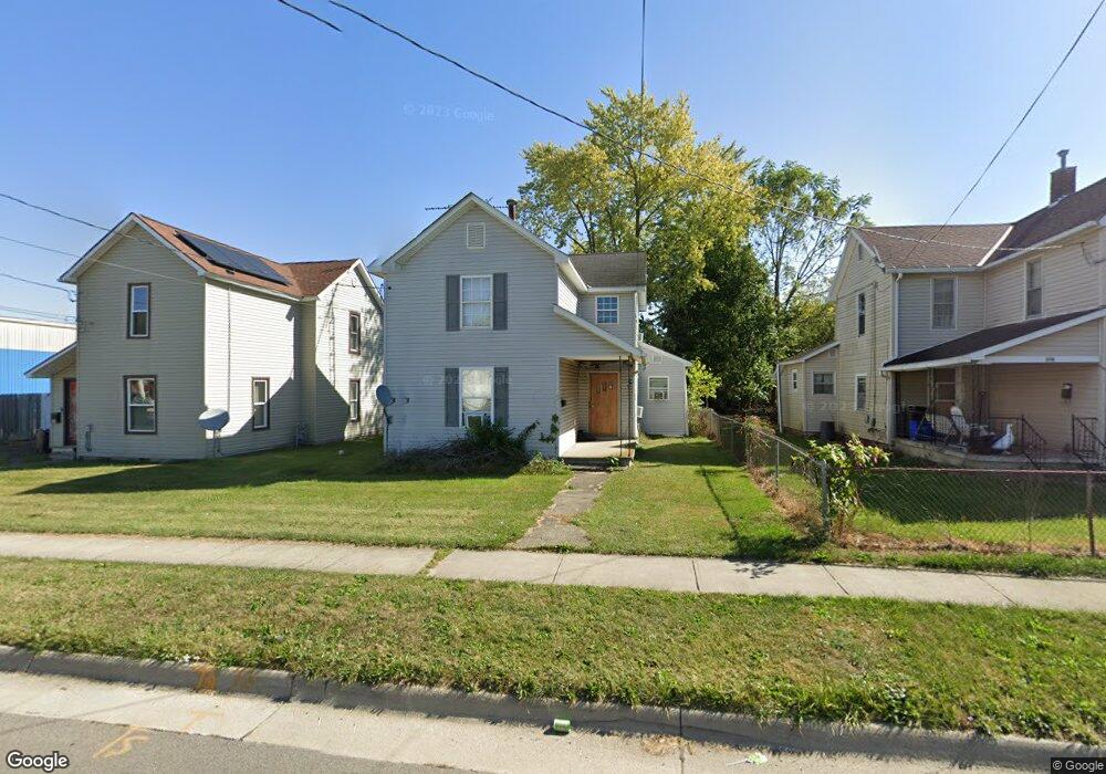
144 Latourette St Marion, OH 43302
Estimated Value: $57,000 - $109,000
2
Beds
1
Bath
1,344
Sq Ft
$64/Sq Ft
Est. Value
About This Home
This home is located at 144 Latourette St, Marion, OH 43302 and is currently estimated at $85,666, approximately $63 per square foot. 144 Latourette St is a home located in Marion County with nearby schools including James A. Garfield Elementary School, Ulysses S. Grant Middle School, and Harding High School.
Ownership History
Date
Name
Owned For
Owner Type
Purchase Details
Closed on
Aug 31, 2007
Sold by
Wells Fargo Bank Na
Bought by
Mcintire James and Mcintire Shirley
Current Estimated Value
Purchase Details
Closed on
Jun 7, 2007
Sold by
French Kimberly
Bought by
Wells Fargo Bank Na and Securitized Asset Backed Receivables Llc
Purchase Details
Closed on
Jun 18, 2001
Bought by
Mcintire James and Mcintire Shirley
Purchase Details
Closed on
Mar 12, 1993
Bought by
Mcintire James and Mcintire Shirley
Purchase Details
Closed on
Oct 9, 1992
Bought by
Mcintire James and Mcintire Shirley
Create a Home Valuation Report for This Property
The Home Valuation Report is an in-depth analysis detailing your home's value as well as a comparison with similar homes in the area
Home Values in the Area
Average Home Value in this Area
Purchase History
| Date | Buyer | Sale Price | Title Company |
|---|---|---|---|
| Mcintire James | $12,700 | Accutitle Agency | |
| Wells Fargo Bank Na | $53,499 | None Available | |
| Mcintire James | -- | -- | |
| Mcintire James | $7,000 | -- | |
| Mcintire James | $3,900 | -- | |
| Mcintire James | $6,000 | -- |
Source: Public Records
Tax History Compared to Growth
Tax History
| Year | Tax Paid | Tax Assessment Tax Assessment Total Assessment is a certain percentage of the fair market value that is determined by local assessors to be the total taxable value of land and additions on the property. | Land | Improvement |
|---|---|---|---|---|
| 2024 | $731 | $19,030 | $1,830 | $17,200 |
| 2023 | $731 | $19,030 | $1,830 | $17,200 |
| 2022 | $679 | $19,030 | $1,830 | $17,200 |
| 2021 | $677 | $17,080 | $1,590 | $15,490 |
| 2020 | $678 | $17,080 | $1,590 | $15,490 |
| 2019 | $737 | $17,080 | $1,590 | $15,490 |
| 2018 | $673 | $16,960 | $1,590 | $15,370 |
| 2017 | $1,053 | $16,960 | $1,590 | $15,370 |
| 2016 | $677 | $16,960 | $1,590 | $15,370 |
| 2015 | $677 | $16,590 | $1,520 | $15,070 |
| 2014 | $679 | $16,590 | $1,520 | $15,070 |
| 2012 | $709 | $17,230 | $1,710 | $15,520 |
Source: Public Records
Map
Nearby Homes
- 213 Sharp St
- 407 Latourette St
- 355 Lee St
- 403 Uncapher Ave
- 383 Brentwood Dr
- 472 Clinton St
- 678 Marshall St
- 434 Scranton Ave
- 512 Henry St
- 690 Meadow St
- 523 Thompson St
- 579 Henry St
- 178 Leader St
- 473 Avondale Ave
- 429 W Columbia St
- 625 Rochelle Dr
- 468 Avondale Ave
- 531 Toledo Ave
- 520 Toledo Ave
- 302 Blaine Ave
- 136 Latourette St
- 146 Latourette St
- 154 Latourette St
- 137 Fies Ave
- 158 Latourette St
- 141 Fies Ave
- 137 Fies Ave
- 147 Fies Ave
- 153 Fies Ave
- 143 Latourette St
- 137 Latourette St
- 149 Latourette St
- 114 Latourette St
- 131 Latourette St
- 165 Latourette St
- 895 York St
- 895 W Center St
- 901 York St
- 125 Latourette St
- 875 W Center St