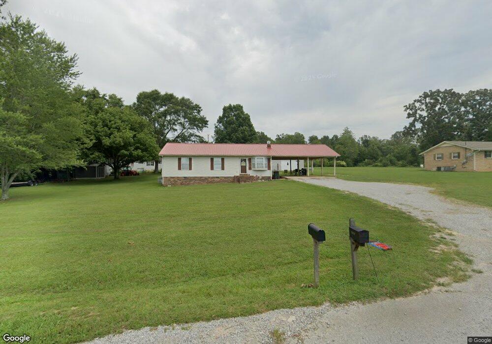
144 Michael Cir Lawrenceburg, TN 38464
Estimated Value: $191,884 - $247,000
--
Bed
2
Baths
1,134
Sq Ft
$204/Sq Ft
Est. Value
About This Home
This home is located at 144 Michael Cir, Lawrenceburg, TN 38464 and is currently estimated at $231,221, approximately $203 per square foot. 144 Michael Cir is a home located in Lawrence County with nearby schools including Ingram Sowell Elementary School, Lawrenceburg Public Elementary School, and David Crockett Elementary School.
Ownership History
Date
Name
Owned For
Owner Type
Purchase Details
Closed on
Nov 29, 1988
Bought by
Martin Jimmy R and Martin Sherrie
Current Estimated Value
Purchase Details
Closed on
Nov 23, 1988
Bought by
Richardson Chuck and Richardson Johnette
Purchase Details
Closed on
Aug 25, 1988
Bought by
Chandler Mack and Gieske Chuck
Purchase Details
Closed on
Mar 20, 1987
Bought by
Wife Wright W and Wife Betty W
Create a Home Valuation Report for This Property
The Home Valuation Report is an in-depth analysis detailing your home's value as well as a comparison with similar homes in the area
Home Values in the Area
Average Home Value in this Area
Purchase History
| Date | Buyer | Sale Price | Title Company |
|---|---|---|---|
| Martin Jimmy R | $49,500 | -- | |
| Richardson Chuck | $43,600 | -- | |
| Chandler Mack | -- | -- | |
| Wife Wright W | -- | -- |
Source: Public Records
Tax History Compared to Growth
Tax History
| Year | Tax Paid | Tax Assessment Tax Assessment Total Assessment is a certain percentage of the fair market value that is determined by local assessors to be the total taxable value of land and additions on the property. | Land | Improvement |
|---|---|---|---|---|
| 2025 | $701 | $34,850 | $0 | $0 |
| 2024 | $701 | $34,850 | $5,000 | $29,850 |
| 2023 | $701 | $34,850 | $5,000 | $29,850 |
| 2022 | $701 | $34,850 | $5,000 | $29,850 |
| 2021 | $588 | $19,875 | $2,500 | $17,375 |
| 2020 | $588 | $19,875 | $2,500 | $17,375 |
| 2019 | $588 | $19,875 | $2,500 | $17,375 |
| 2018 | $588 | $19,875 | $2,500 | $17,375 |
| 2017 | $588 | $19,875 | $2,500 | $17,375 |
| 2016 | $588 | $19,875 | $2,500 | $17,375 |
| 2015 | $544 | $19,875 | $2,500 | $17,375 |
| 2014 | $527 | $19,250 | $2,500 | $16,750 |
Source: Public Records
Map
Nearby Homes
- 206 State Ave
- 2600 Clanton Rd
- 380 Lanning Rd
- 260 Wesley Chapel Rd
- 729 Weakley Creek Rd
- 1194 Harmony Way
- 2073 Choates Creek Rd
- 2342 Pulaski Hwy
- 111 Grandview Dr
- 145 Lantz Rd
- 786 Hillview Dr
- 79 Bishop Rd
- 2290 Grandview Dr
- 0 Lightfoot Ln
- 123 Quail Dr
- 0 Lanning Rd
- 33 Bishop Rd
- 2024 Powdermill Hill Rd
- 2167 Powdermill Hill Rd
- 107 Pond Dr
- 167 Michael Cir
- 142 Michael Cir
- 145 Michael Cir
- 1292 Norton Rd
- 1290 Norton Rd
- 139 Michael Cir
- 140 Michael Cir
- 1260 Norton Rd
- 174 Michael Cir
- 106 Michael Cir
- 138 Michael Cir
- 108 Michael Cir
- 137 1/2 Michael Cir
- 155 Michael Cir
- 137 Michael Cir
- 104 Michael Cir
- 110 Michael Cir
- 1296 Norton Rd
- 100 Michael Cir
- 136 Michael Cir