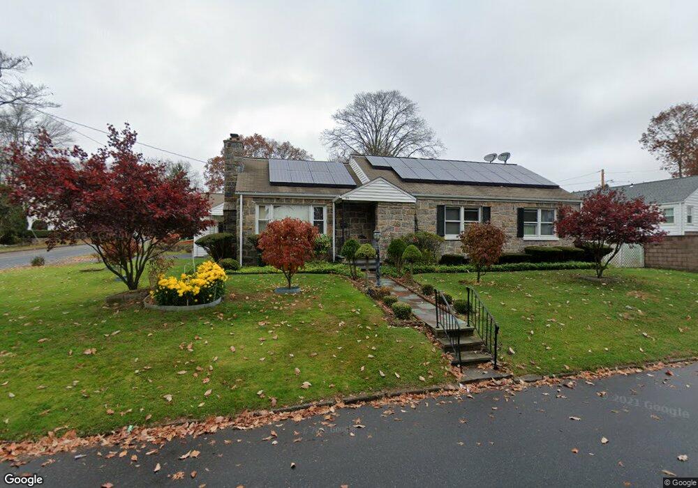
144 Powell Place Bridgeport, CT 06604
Brooklawn-Saint Vincent NeighborhoodEstimated Value: $412,000 - $492,445
3
Beds
2
Baths
1,580
Sq Ft
$297/Sq Ft
Est. Value
About This Home
This home is located at 144 Powell Place, Bridgeport, CT 06604 and is currently estimated at $468,861, approximately $296 per square foot. 144 Powell Place is a home located in Fairfield County with nearby schools including Blackham School, Central High School, and Assumption Catholic School.
Ownership History
Date
Name
Owned For
Owner Type
Purchase Details
Closed on
Mar 30, 2016
Sold by
Nguyen Con and Nguyen Phuoc
Bought by
Nguyen Thien
Current Estimated Value
Purchase Details
Closed on
May 25, 1990
Sold by
Aaron Harry
Bought by
Nguyen Con
Home Financials for this Owner
Home Financials are based on the most recent Mortgage that was taken out on this home.
Original Mortgage
$102,700
Interest Rate
10.13%
Mortgage Type
Purchase Money Mortgage
Create a Home Valuation Report for This Property
The Home Valuation Report is an in-depth analysis detailing your home's value as well as a comparison with similar homes in the area
Home Values in the Area
Average Home Value in this Area
Purchase History
| Date | Buyer | Sale Price | Title Company |
|---|---|---|---|
| Nguyen Thien | $50,000 | -- | |
| Nguyen Thien | $50,000 | -- | |
| Nguyen Con | $137,000 | -- |
Source: Public Records
Mortgage History
| Date | Status | Borrower | Loan Amount |
|---|---|---|---|
| Previous Owner | Nguyen Con | $90,000 | |
| Previous Owner | Nguyen Con | $102,700 |
Source: Public Records
Tax History Compared to Growth
Tax History
| Year | Tax Paid | Tax Assessment Tax Assessment Total Assessment is a certain percentage of the fair market value that is determined by local assessors to be the total taxable value of land and additions on the property. | Land | Improvement |
|---|---|---|---|---|
| 2025 | $7,887 | $181,510 | $82,460 | $99,050 |
| 2024 | $7,887 | $181,510 | $82,460 | $99,050 |
| 2023 | $7,887 | $181,510 | $82,460 | $99,050 |
| 2022 | $7,887 | $181,510 | $82,460 | $99,050 |
| 2021 | $7,887 | $181,510 | $82,460 | $99,050 |
| 2020 | $7,440 | $137,800 | $51,620 | $86,180 |
| 2019 | $7,440 | $137,800 | $51,620 | $86,180 |
| 2018 | $7,492 | $137,800 | $51,620 | $86,180 |
| 2017 | $7,492 | $137,800 | $51,620 | $86,180 |
| 2016 | $7,492 | $137,800 | $51,620 | $86,180 |
| 2015 | $7,378 | $174,840 | $65,470 | $109,370 |
| 2014 | $7,378 | $174,840 | $65,470 | $109,370 |
Source: Public Records
Map
Nearby Homes
- 2675 Park Ave Unit 3
- 2675 Park Ave Unit 22
- 2625 Park Ave Unit 12L
- 2625 Park Ave Unit 5S
- 2625 Park Ave Unit 5N
- 1473 Wood Ave
- 125 Alexander Dr
- 150 Alexander Dr
- 2445 Park Ave Unit 23
- 11 Myron Ave
- 1480 Capitol Ave Unit 811
- 125 Garden Dr
- 241 Sampson St
- 2345 Park Ave
- 1275 Capitol Ave
- 1213 Wood Ave
- 3200 Park Ave Unit 11C2
- 3200 Park Ave Unit 11E2
- 681 Westfield Ave
- 112 Eastwood Rd
- 1240 Brooklawn Ave
- 116 Powell Terrace
- 96 Powell Terrace
- 145 Powell Place
- 1241 Brooklawn Ave
- 1260 Brooklawn Ave
- 1231 Brooklawn Ave
- 41 Powell Place
- 1180 Brooklawn Ave
- 1191 Brooklawn Ave
- 125 Powell Place
- 94 Powell Place
- 1263 Brooklawn Ave
- 101 Powell Place
- 1175 Brooklawn Ave
- 1164 Brooklawn Ave
- 93 Mayflower Dr
- 33 Brooklawn Terrace
- 78 Powell Place
- 70 Powell Terrace