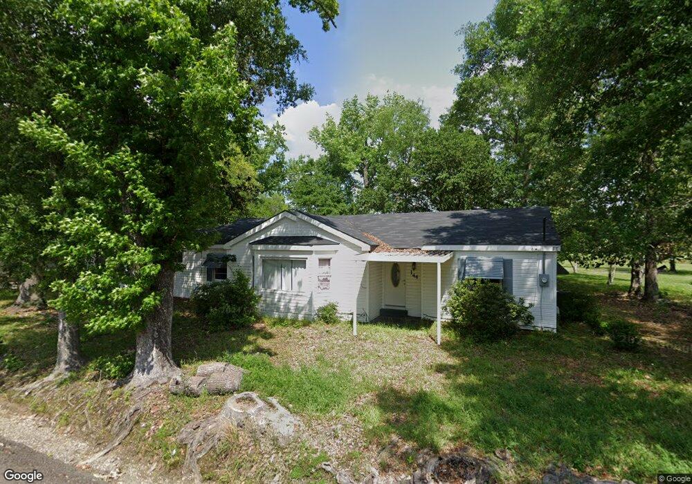
144 Rip Henagen Rd Dequincy, LA 70633
Estimated Value: $139,000 - $143,000
3
Beds
2
Baths
1,500
Sq Ft
$94/Sq Ft
Est. Value
About This Home
This home is located at 144 Rip Henagen Rd, Dequincy, LA 70633 and is currently estimated at $141,000, approximately $94 per square foot. 144 Rip Henagen Rd is a home located in Calcasieu Parish with nearby schools including DeQuincy Primary School, DeQuincy Elementary School, and DeQuincy Middle School.
Ownership History
Date
Name
Owned For
Owner Type
Purchase Details
Closed on
Nov 3, 2021
Sold by
Franks Christopher Allen and Franks Anita
Bought by
Stampley Jeff and Stampley Heather
Current Estimated Value
Purchase Details
Closed on
Apr 4, 2012
Sold by
Robertson Dudley Mark and Robertson Stephen Terry
Bought by
Franks Christopher A and Franks Sandy L
Home Financials for this Owner
Home Financials are based on the most recent Mortgage that was taken out on this home.
Original Mortgage
$90,306
Interest Rate
3.97%
Mortgage Type
New Conventional
Create a Home Valuation Report for This Property
The Home Valuation Report is an in-depth analysis detailing your home's value as well as a comparison with similar homes in the area
Home Values in the Area
Average Home Value in this Area
Purchase History
| Date | Buyer | Sale Price | Title Company |
|---|---|---|---|
| Stampley Jeff | $56,050 | None Listed On Document | |
| Franks Christopher A | $88,500 | None Available |
Source: Public Records
Mortgage History
| Date | Status | Borrower | Loan Amount |
|---|---|---|---|
| Previous Owner | Franks Christopher A | $90,306 |
Source: Public Records
Tax History Compared to Growth
Tax History
| Year | Tax Paid | Tax Assessment Tax Assessment Total Assessment is a certain percentage of the fair market value that is determined by local assessors to be the total taxable value of land and additions on the property. | Land | Improvement |
|---|---|---|---|---|
| 2024 | $392 | $3,470 | $620 | $2,850 |
| 2023 | $392 | $3,470 | $620 | $2,850 |
| 2022 | $390 | $3,470 | $620 | $2,850 |
| 2021 | $409 | $3,470 | $620 | $2,850 |
| 2020 | $366 | $3,170 | $600 | $2,570 |
| 2019 | $397 | $3,420 | $570 | $2,850 |
| 2018 | $396 | $3,420 | $570 | $2,850 |
| 2017 | $367 | $3,420 | $570 | $2,850 |
| 2015 | $396 | $3,400 | $550 | $2,850 |
Source: Public Records
Map
Nearby Homes
- 144 Rip Henagan Rd
- 184 Rip Henagan Rd
- 147 Rip Henagen Rd
- 132 Rip Henagen Rd
- 137 Rip Henagen Rd
- 127 Rip Henagen Rd
- 164 Rip Henagen Rd
- 167 Rip Henagen Rd
- 118 Rip Henagen Rd
- 173 Rip Henagan Rd
- 173 Rip Henagen Rd
- 173 Rip Henagen Rd
- 176 Rip Henagen Rd
- 119 Rip Henagen Rd
- 119 Rip Henagen Rd
- 181 Malone Rd
- 187 Rip Henagen Rd
- 225 Malone Rd
- 195 Rip Henagen Rd
- 124 Malone Rd