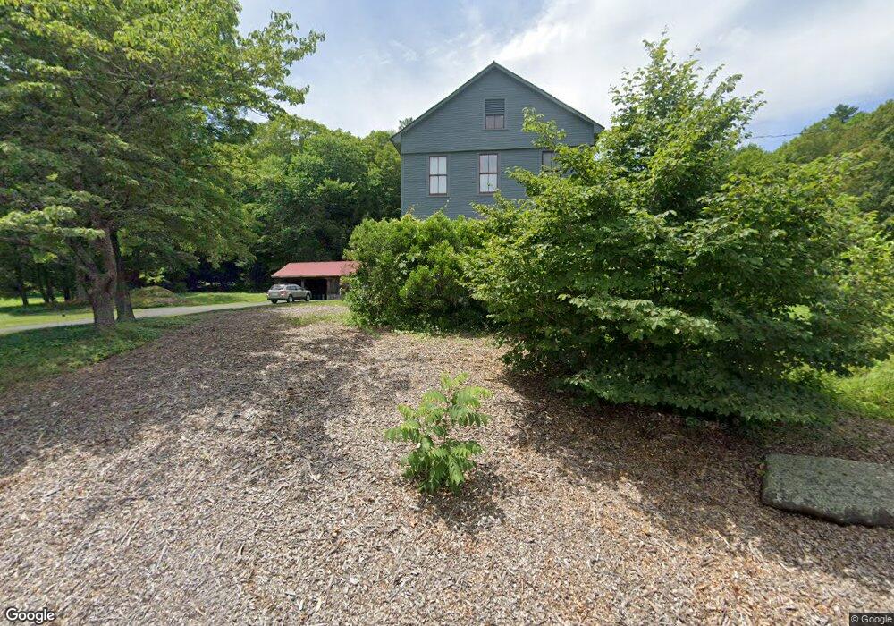
144 River Rd Gill, MA 01354
Gill NeighborhoodEstimated Value: $216,000 - $510,000
4
Beds
2
Baths
2,049
Sq Ft
$176/Sq Ft
Est. Value
About This Home
This home is located at 144 River Rd, Gill, MA 01354 and is currently estimated at $359,935, approximately $175 per square foot. 144 River Rd is a home located in Franklin County with nearby schools including Turners Fall High School.
Ownership History
Date
Name
Owned For
Owner Type
Purchase Details
Closed on
Jun 18, 2013
Sold by
Kaufhold Peter C and Kaufhold John F
Bought by
Bathory Michael J and Gallagher Maryanne
Current Estimated Value
Purchase Details
Closed on
Nov 29, 2004
Sold by
Friedrich K Kaufhold L and Kaufhold John F
Bought by
Gallagher Maryanne and Bathory Michael J
Home Financials for this Owner
Home Financials are based on the most recent Mortgage that was taken out on this home.
Original Mortgage
$100,000
Interest Rate
5.63%
Create a Home Valuation Report for This Property
The Home Valuation Report is an in-depth analysis detailing your home's value as well as a comparison with similar homes in the area
Home Values in the Area
Average Home Value in this Area
Purchase History
| Date | Buyer | Sale Price | Title Company |
|---|---|---|---|
| Bathory Michael J | $80,000 | -- | |
| Gallagher Maryanne | $365,000 | -- |
Source: Public Records
Mortgage History
| Date | Status | Borrower | Loan Amount |
|---|---|---|---|
| Previous Owner | Gallagher Maryanne | $100,000 | |
| Previous Owner | Gallagher Maryanne | $115,000 |
Source: Public Records
Tax History
| Year | Tax Paid | Tax Assessment Tax Assessment Total Assessment is a certain percentage of the fair market value that is determined by local assessors to be the total taxable value of land and additions on the property. | Land | Improvement |
|---|---|---|---|---|
| 2025 | $3,914 | $266,995 | $65,895 | $201,100 |
| 2024 | $3,727 | $240,788 | $60,088 | $180,700 |
| 2023 | $3,597 | $212,737 | $54,837 | $157,900 |
| 2022 | $3,357 | $201,481 | $54,881 | $146,600 |
| 2021 | $3,375 | $195,215 | $54,915 | $140,300 |
| 2020 | $3,367 | $195,215 | $54,915 | $140,300 |
| 2019 | $3,226 | $186,883 | $52,383 | $134,500 |
| 2018 | $3,036 | $176,715 | $52,315 | $124,400 |
| 2017 | $2,929 | $176,641 | $52,241 | $124,400 |
| 2016 | $3,059 | $181,526 | $67,226 | $114,300 |
| 2015 | $2,984 | $177,121 | $67,221 | $109,900 |
Source: Public Records
Map
Nearby Homes
- 0 Four Mile Brook Rd Unit 73462497
- 182 Main Rd
- 0 French King Hwy
- 0 State Rd
- Lots 1-4 Kavanaugh Ln
- 20 Walnut St
- 18 Crescent St
- 8 Craig Ave
- 13 Maple Ave
- 24 State Rd
- 183 Millers Falls Rd
- 45 Millers Falls Rd
- 0 Millers Falls Rd Unit 73034825
- 2 Alice St
- 0 Old Farley Rd
- 001 Adams Rd
- 52 Canada Hill Rd
- 20 Merrifield Rd
- 8 Country Club Ln
- 47 Cross St
- 143 River Rd
- 119 River Rd
- 100 River Rd
- 85 River Rd
- 88 Barney Hale Rd
- 93 Barney Hale Rd
- 92 Barney Hale Rd
- 76 River Rd
- 94 Barney Hale Rd
- 0 Barney Hale Rd
- 73 River Rd
- 11 Saco Ln
- 98 Barney Hale Rd
- 119 Cross Rd
- 496 Pine Meadow Rd
- 42 Grist Mill Rd
- 65 River Rd
- 40 Grist Mill Rd
- 109 Barney Hale Rd
- 58 River Rd
Your Personal Tour Guide
Ask me questions while you tour the home.