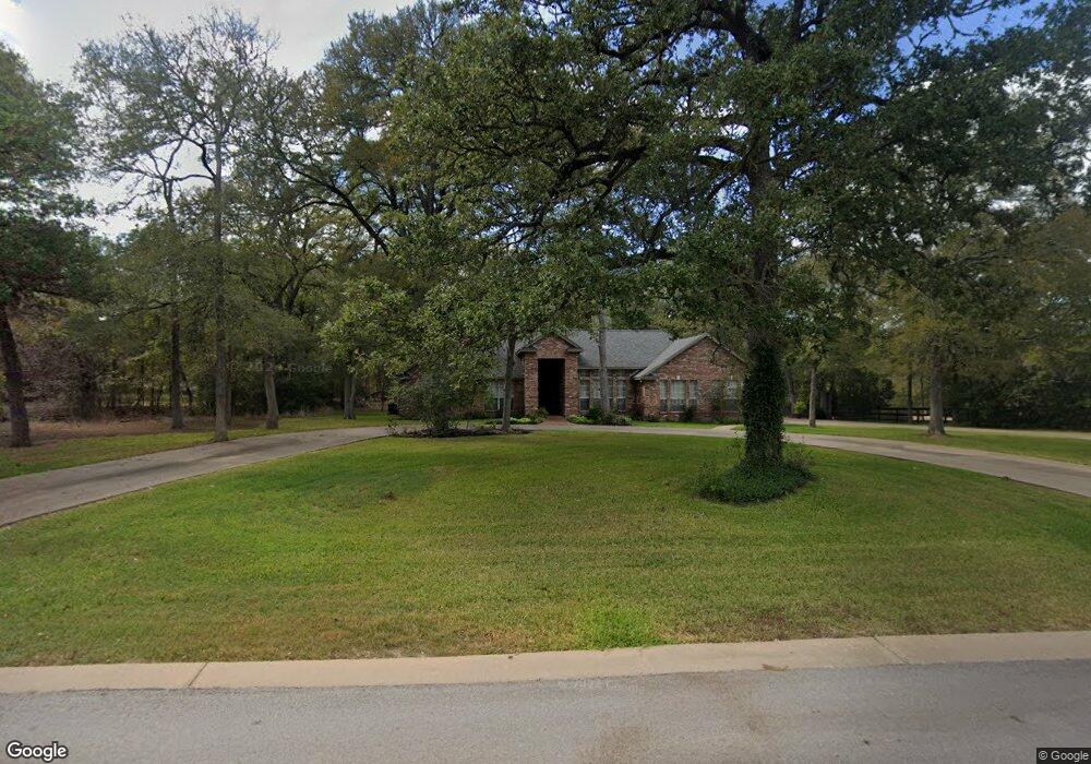
144 Spring Branch Bastrop, TX 78602
Estimated Value: $471,000 - $737,000
Studio
--
Bath
2,514
Sq Ft
$223/Sq Ft
Est. Value
About This Home
This home is located at 144 Spring Branch, Bastrop, TX 78602 and is currently estimated at $560,021, approximately $222 per square foot. 144 Spring Branch is a home located in Bastrop County with nearby schools including Mina Elementary School, Bastrop Intermediate School, and Bastrop Middle School.
Ownership History
Date
Name
Owned For
Owner Type
Purchase Details
Closed on
Apr 1, 2013
Sold by
Ingram Clay and Ingram Laurie
Bought by
Mcclanahan Todd and Mcclanahan Jamie
Current Estimated Value
Home Financials for this Owner
Home Financials are based on the most recent Mortgage that was taken out on this home.
Original Mortgage
$236,800
Outstanding Balance
$168,054
Interest Rate
3.59%
Mortgage Type
Unknown
Estimated Equity
$391,967
Purchase Details
Closed on
Jun 23, 2010
Sold by
Forestar Usa Real Estate Group Inc
Bought by
Ingram Clay
Home Financials for this Owner
Home Financials are based on the most recent Mortgage that was taken out on this home.
Original Mortgage
$2,500
Interest Rate
4.87%
Mortgage Type
Seller Take Back
Create a Home Valuation Report for This Property
The Home Valuation Report is an in-depth analysis detailing your home's value as well as a comparison with similar homes in the area
Home Values in the Area
Average Home Value in this Area
Purchase History
| Date | Buyer | Sale Price | Title Company |
|---|---|---|---|
| Mcclanahan Todd | $236,800 | None Available | |
| Ingram Clay | -- | None Available |
Source: Public Records
Mortgage History
| Date | Status | Borrower | Loan Amount |
|---|---|---|---|
| Open | Mcclanahan Todd | $236,800 | |
| Previous Owner | Ingram Clay | $2,500 |
Source: Public Records
Tax History
| Year | Tax Paid | Tax Assessment Tax Assessment Total Assessment is a certain percentage of the fair market value that is determined by local assessors to be the total taxable value of land and additions on the property. | Land | Improvement |
|---|---|---|---|---|
| 2025 | $5,967 | $492,621 | $150,313 | $342,308 |
| 2023 | $5,967 | $407,282 | $0 | $0 |
| 2022 | $5,957 | $370,256 | $0 | $0 |
| 2021 | $6,663 | $355,688 | $57,849 | $297,839 |
| 2020 | $6,245 | $305,996 | $35,158 | $270,838 |
| 2019 | $6,598 | $311,347 | $35,158 | $276,189 |
| 2018 | $7,099 | $333,396 | $35,158 | $310,434 |
| 2017 | $6,761 | $302,171 | $38,674 | $284,376 |
| 2016 | $6,147 | $274,701 | $35,158 | $276,963 |
| 2015 | $4,707 | $249,728 | $35,158 | $237,700 |
| 2014 | $4,707 | $227,025 | $27,598 | $199,427 |
Source: Public Records
Map
Nearby Homes
- 104 Spring Branch
- 106 Spring Meadow
- 106 Fallow Way
- 117 Fallow Way
- 175 Cassena Ranch Dr
- 130 Axis Trail
- TBD (27 Acres) Shiloh Rd
- 156 Lone Star Cir
- 123 Lone Star Cir
- 203 Remington Run
- 102 Thompson Trail
- 341 Bird Dog Bend
- 100 Javelina Trail
- 127 Eleanor Ln
- 235 El Camino River Rd
- 1133 Largemouth Ln
- 1125 Largemouth Ln
- 307 Sunfish Ln
- 762 Texas 304 Unit A
- 762 Sh 304 A
- 150 Spring Branch
- 132 Spring Branch
- 137 Spring Branch
- 141 Spring Branch
- 118 Spring Branch
- 103 Jacobs Cove
- 147 Spring Branch
- 102 Jacobs Cove
- 154 Spring Branch
- 133 Spring Branch
- 153 Spring Branch
- 110 Spring Branch
- 121 Spring Branch
- 121 Spring Branch
- 101 Jacobs Cove
- 152 Spring Branch
- 155 Spring Branch
- 427 Highway 304
- 156 Spring Branch
- 156 Spring Branch