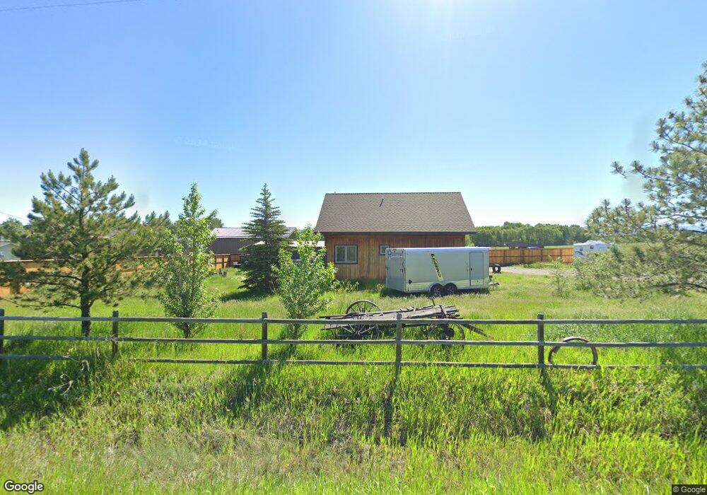
1440 Cobb Hill Rd Bozeman, MT 59718
Four Corners NeighborhoodEstimated Value: $801,000 - $1,697,031
1
Bed
1
Bath
1,075
Sq Ft
$1,291/Sq Ft
Est. Value
About This Home
This home is located at 1440 Cobb Hill Rd, Bozeman, MT 59718 and is currently estimated at $1,388,010, approximately $1,291 per square foot. 1440 Cobb Hill Rd is a home located in Gallatin County with nearby schools including Monforton Primary School, Monforton Elementary School, and Monforton Junior High School.
Ownership History
Date
Name
Owned For
Owner Type
Purchase Details
Closed on
Oct 9, 2023
Sold by
Lang John Michael
Bought by
Lang Family Trust and Walter
Current Estimated Value
Purchase Details
Closed on
Feb 25, 2008
Sold by
Wytcherley Jack Chris
Bought by
Hasterlik Steven N and Limberger Margaret C
Home Financials for this Owner
Home Financials are based on the most recent Mortgage that was taken out on this home.
Original Mortgage
$359,347
Interest Rate
5.64%
Mortgage Type
Unknown
Create a Home Valuation Report for This Property
The Home Valuation Report is an in-depth analysis detailing your home's value as well as a comparison with similar homes in the area
Home Values in the Area
Average Home Value in this Area
Purchase History
| Date | Buyer | Sale Price | Title Company |
|---|---|---|---|
| Lang Family Trust | -- | None Listed On Document | |
| Hasterlik Steven N | -- | Security Title Company |
Source: Public Records
Mortgage History
| Date | Status | Borrower | Loan Amount |
|---|---|---|---|
| Previous Owner | Hasterlik Steven N | $359,347 |
Source: Public Records
Tax History Compared to Growth
Tax History
| Year | Tax Paid | Tax Assessment Tax Assessment Total Assessment is a certain percentage of the fair market value that is determined by local assessors to be the total taxable value of land and additions on the property. | Land | Improvement |
|---|---|---|---|---|
| 2025 | $6,172 | $1,484,691 | $0 | $0 |
| 2024 | $7,724 | $1,449,804 | $0 | $0 |
| 2023 | $7,431 | $1,449,804 | $0 | $0 |
| 2022 | $5,990 | $874,130 | $0 | $0 |
| 2021 | $6,722 | $874,130 | $0 | $0 |
| 2020 | $6,178 | $795,725 | $0 | $0 |
| 2019 | $6,102 | $795,725 | $0 | $0 |
| 2018 | $5,791 | $684,491 | $0 | $0 |
| 2017 | $3,530 | $428,621 | $0 | $0 |
| 2016 | $3,268 | $391,650 | $0 | $0 |
| 2015 | $2,640 | $338,030 | $0 | $0 |
| 2014 | $2,086 | $156,212 | $0 | $0 |
Source: Public Records
Map
Nearby Homes
- 118 Dovetail Ln
- TBD Dovetail Ln
- 49 Lady Bug Ln
- 50 Pattee Trail
- 25 Big Chief Trail
- TBD Elk Ln
- 26 Big Chief Trail
- 171 Brave Heart Loop
- 423 Parklands Trail
- 41 Lion Peak Dr
- 196 Arrow Peak Ct
- 91 W Hyalite Peak Dr
- Lot 1 Bridge District
- 8404 Huffine Ln
- 62 Brave Heart Loop
- 19 Charger Ln
- 604 Talon Way
- 80867 Gallatin Rd
- 33 Leachman Ln
- 56 Koch Peak Ct
- 1425 Cobb Hill Rd
- 1506 Cobb Hill Rd
- 1499 Cobb Hill Rd
- 31 Dovetail Ln
- 1391 Cobb Hill Rd
- 1388 Cobb Hill Rd
- 1542 Cobb Hill Rd
- 1538 Cobb Hill Rd
- 1587 Cobb Hill Rd
- 1310 Cobb Hill Rd
- 1306 Cobb Hill Rd
- 1611 Cobb Hill Rd
- 1281 Cobb Hill Rd
- 1250 Cobb Hill Rd
- 1568 Cobb Hill Rd
- 1240 Cobb Hill Rd
- 1226 Cobb Hill Rd
- 1685 Cobb Hill
- 1617 Cobb Hill Rd
- 1211 Cobb Hill Rd