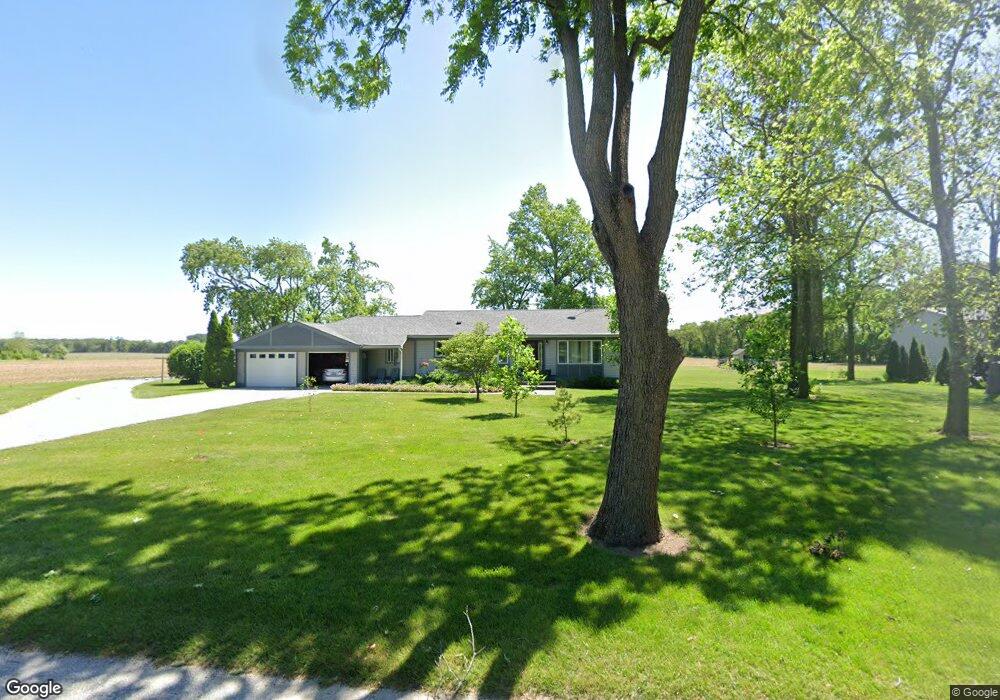
14401 S 700 W Wanatah, IN 46390
Estimated Value: $293,375 - $345,000
3
Beds
2
Baths
1,842
Sq Ft
$172/Sq Ft
Est. Value
About This Home
This home is located at 14401 S 700 W, Wanatah, IN 46390 and is currently estimated at $316,594, approximately $171 per square foot. 14401 S 700 W is a home located in LaPorte County.
Ownership History
Date
Name
Owned For
Owner Type
Purchase Details
Closed on
Mar 31, 2011
Sold by
Rocke Brad A and Rocke Julie K
Bought by
Rocke Brad A and Rocke Julie K
Current Estimated Value
Home Financials for this Owner
Home Financials are based on the most recent Mortgage that was taken out on this home.
Original Mortgage
$60,500
Outstanding Balance
$42,108
Interest Rate
4.99%
Mortgage Type
New Conventional
Estimated Equity
$274,486
Purchase Details
Closed on
Aug 17, 2005
Sold by
Egolf Franklin D and Egolf Shirley A
Bought by
Rocke Brad A and Rocke Julie K
Home Financials for this Owner
Home Financials are based on the most recent Mortgage that was taken out on this home.
Original Mortgage
$62,000
Interest Rate
5.69%
Mortgage Type
Fannie Mae Freddie Mac
Create a Home Valuation Report for This Property
The Home Valuation Report is an in-depth analysis detailing your home's value as well as a comparison with similar homes in the area
Home Values in the Area
Average Home Value in this Area
Purchase History
| Date | Buyer | Sale Price | Title Company |
|---|---|---|---|
| Rocke Brad A | -- | Chicago Title Insurance Co | |
| Rocke Brad A | -- | Chicago Title Insurance Co | |
| Rocke Brad A | -- | Meridian Title Corp |
Source: Public Records
Mortgage History
| Date | Status | Borrower | Loan Amount |
|---|---|---|---|
| Open | Rocke Brad A | $60,500 | |
| Closed | Rocke Brad A | $62,000 |
Source: Public Records
Tax History Compared to Growth
Tax History
| Year | Tax Paid | Tax Assessment Tax Assessment Total Assessment is a certain percentage of the fair market value that is determined by local assessors to be the total taxable value of land and additions on the property. | Land | Improvement |
|---|---|---|---|---|
| 2024 | $1,334 | $222,600 | $42,500 | $180,100 |
| 2023 | $1,255 | $184,600 | $31,900 | $152,700 |
| 2022 | $1,493 | $192,700 | $31,900 | $160,800 |
| 2021 | $1,493 | $182,300 | $31,900 | $150,400 |
| 2020 | $1,401 | $182,300 | $31,900 | $150,400 |
| 2019 | $1,320 | $175,700 | $29,000 | $146,700 |
| 2018 | $1,261 | $176,500 | $29,000 | $147,500 |
| 2017 | $1,156 | $171,000 | $29,000 | $142,000 |
| 2016 | $1,078 | $165,200 | $29,000 | $136,200 |
| 2014 | $928 | $151,300 | $29,000 | $122,300 |
Source: Public Records
Map
Nearby Homes
- 0 W Hwy 30 Unit GNR545374
- 6948 W 1700 S
- 114 E Jersey St
- 307 N Pennsylvania St
- 14501 S 400 W
- 6465 W 1100 S
- 305 N Ohio St
- 627 Fieldcrest Cir
- 106 N Illinois St Unit 266
- 104 W Cross St
- 116 Sprunger Dr
- 207 N Washington St
- 105 Earl St
- 9552 S Bigelow Mill Rd
- 627 E 300 S
- 17622 S State Road 39
- 11333 S State Road 39
- 9052 W Saint Road 8
- 601 E Main St
- 201 E Oneida St