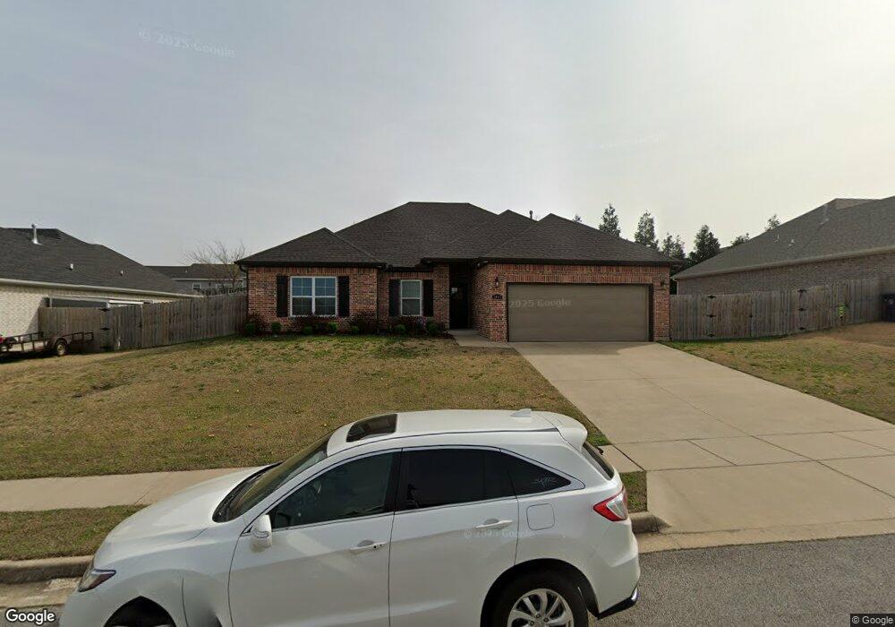
1441 Colonel McNeil Dr Prairie Grove, AR 72753
Estimated Value: $360,115 - $401,000
2
Beds
2
Baths
1,831
Sq Ft
$203/Sq Ft
Est. Value
About This Home
This home is located at 1441 Colonel McNeil Dr, Prairie Grove, AR 72753 and is currently estimated at $371,279, approximately $202 per square foot. 1441 Colonel McNeil Dr is a home located in Washington County with nearby schools including Prairie Grove Elementary School, Prairie Grove Middle School, and Prairie Grove Junior High School.
Ownership History
Date
Name
Owned For
Owner Type
Purchase Details
Closed on
Mar 15, 2022
Sold by
Armstrong Tiffany and Armstrong John Jeremy
Bought by
Brown Gwendolyn A
Current Estimated Value
Home Financials for this Owner
Home Financials are based on the most recent Mortgage that was taken out on this home.
Original Mortgage
$314,204
Outstanding Balance
$293,041
Interest Rate
3.92%
Mortgage Type
FHA
Estimated Equity
$78,238
Purchase Details
Closed on
Jul 16, 2019
Sold by
Alderson & Stroud Llc
Bought by
Armstrong Tiffany and Armstrong John Jeremy
Home Financials for this Owner
Home Financials are based on the most recent Mortgage that was taken out on this home.
Original Mortgage
$215,523
Interest Rate
4.12%
Mortgage Type
FHA
Create a Home Valuation Report for This Property
The Home Valuation Report is an in-depth analysis detailing your home's value as well as a comparison with similar homes in the area
Home Values in the Area
Average Home Value in this Area
Purchase History
| Date | Buyer | Sale Price | Title Company |
|---|---|---|---|
| Brown Gwendolyn A | $320,000 | Advantage Title & Escrow | |
| Armstrong Tiffany | $219,500 | Waco Title Company |
Source: Public Records
Mortgage History
| Date | Status | Borrower | Loan Amount |
|---|---|---|---|
| Open | Brown Gwendolyn A | $314,204 | |
| Previous Owner | Armstrong Tiffany | $215,523 |
Source: Public Records
Tax History Compared to Growth
Tax History
| Year | Tax Paid | Tax Assessment Tax Assessment Total Assessment is a certain percentage of the fair market value that is determined by local assessors to be the total taxable value of land and additions on the property. | Land | Improvement |
|---|---|---|---|---|
| 2025 | $2,871 | $67,800 | $8,000 | $59,800 |
| 2024 | $3,026 | $67,800 | $8,000 | $59,800 |
| 2023 | $3,236 | $67,800 | $8,000 | $59,800 |
| 2022 | $1,998 | $43,940 | $6,000 | $37,940 |
| 2021 | $1,998 | $43,940 | $6,000 | $37,940 |
| 2020 | $1,989 | $43,940 | $6,000 | $37,940 |
| 2019 | $1,946 | $35,770 | $5,000 | $30,770 |
| 2018 | $272 | $5,000 | $5,000 | $0 |
| 2017 | $27 | $5,000 | $5,000 | $0 |
| 2016 | $270 | $5,000 | $5,000 | $0 |
| 2015 | $270 | $5,000 | $5,000 | $0 |
| 2014 | $202 | $3,000 | $3,000 | $0 |
Source: Public Records
Map
Nearby Homes
- 1421 Colonel McNeil Dr
- 1380 Colonel Hawthorne Dr
- 1360 Colonel Bass Ln
- 1681 Cavalry Ln
- 1461 General Parson Dr
- 1280 General Parson Dr
- 611 Sundowner Ranch Ave
- 1321 General Marmaduke Dr
- 650 Marcella St
- 631 Marcella St
- 16543 U S Highway 62
- 511 Captain Stockton St
- 816 Spurgeon Ln
- 661 Kendra St
- 101 S Eagle Mountain St
- 150 N Eagle Mountain St
- 951 E Buchanan St
- 123 S Eagle Mountain St
- 113 S Eagle Mountain St
- 730 Marcella St
- 1441 Colonel McNeil Dr
- 1461 Colonel McNeil Dr
- 1461 Colonel McNeil Dr
- 1440 Colonel Hawthorne Dr
- 1440 Colonel McNeil Dr
- 1381 Colonel McNeil Dr
- 1481 Colonel McNeil Dr
- 1420 Colonel McNeil Dr
- 1460 Colonel McNeil Dr
- Lot 514 Colonel McNeil Dr
- Lot 526 Colonel McNeil Dr
- Lot 530 Colonel McNeil Dr
- Lot 332 Colonel McNeil Dr
- Lot 528 Colonel McNeil Dr
- Lot 532 Colonel McNeil Dr
- Lot 534 Colonel McNeil Dr
- 1480 Colonel Hawthorne Dr
- 1380 Colonel McNeil Dr
- Lot 527 Colonel McNeil Dr
- Lot 525 Colonel McNeil Dr