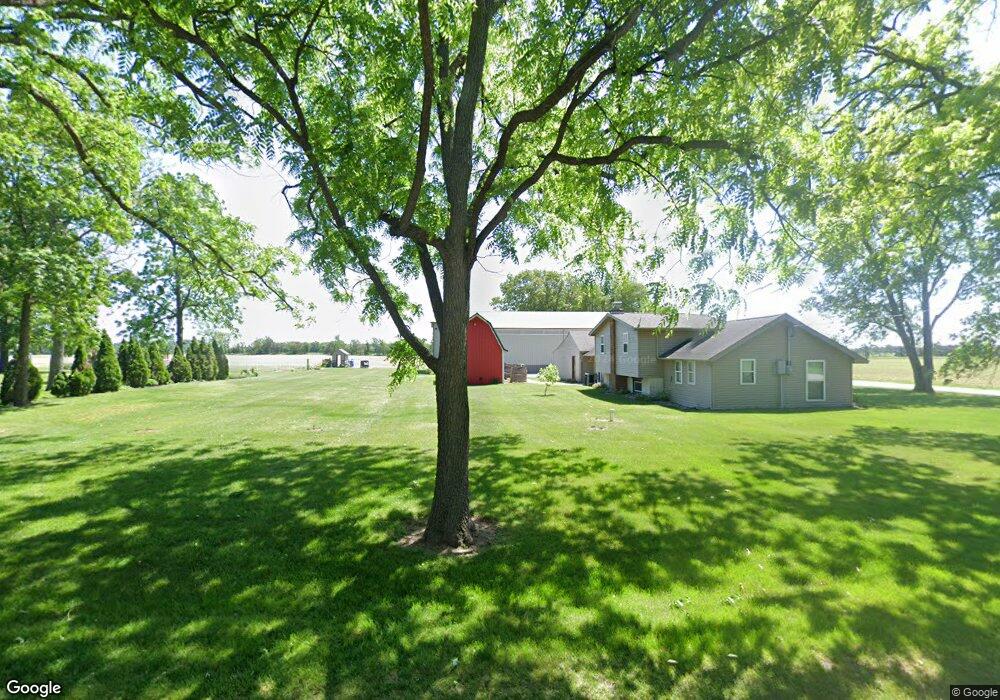
14411 S 700 W Wanatah, IN 46390
Estimated Value: $249,000 - $300,000
3
Beds
2
Baths
1,386
Sq Ft
$194/Sq Ft
Est. Value
About This Home
This home is located at 14411 S 700 W, Wanatah, IN 46390 and is currently estimated at $268,475, approximately $193 per square foot. 14411 S 700 W is a home.
Ownership History
Date
Name
Owned For
Owner Type
Purchase Details
Closed on
Apr 16, 2019
Sold by
Rocke Brad A and Rocke Julie K
Bought by
Rocke Trust
Current Estimated Value
Purchase Details
Closed on
Feb 25, 2011
Sold by
Brust Cory
Bought by
Rocke Brad A and Rocke Julie K
Purchase Details
Closed on
Jul 18, 2008
Sold by
Nelson Brian T
Bought by
Brust Cory
Home Financials for this Owner
Home Financials are based on the most recent Mortgage that was taken out on this home.
Original Mortgage
$125,970
Interest Rate
6.36%
Mortgage Type
FHA
Create a Home Valuation Report for This Property
The Home Valuation Report is an in-depth analysis detailing your home's value as well as a comparison with similar homes in the area
Home Values in the Area
Average Home Value in this Area
Purchase History
| Date | Buyer | Sale Price | Title Company |
|---|---|---|---|
| Rocke Trust | -- | None Available | |
| Rocke Brad A | $61,001 | None Available | |
| Brust Cory | -- | Chicago Title Insurance Co |
Source: Public Records
Mortgage History
| Date | Status | Borrower | Loan Amount |
|---|---|---|---|
| Previous Owner | Brust Cory | $125,970 |
Source: Public Records
Tax History Compared to Growth
Tax History
| Year | Tax Paid | Tax Assessment Tax Assessment Total Assessment is a certain percentage of the fair market value that is determined by local assessors to be the total taxable value of land and additions on the property. | Land | Improvement |
|---|---|---|---|---|
| 2024 | $2,275 | $161,600 | $40,000 | $121,600 |
| 2022 | $2,216 | $149,700 | $30,000 | $119,700 |
| 2021 | $2,325 | $148,000 | $30,000 | $118,000 |
| 2020 | $2,182 | $148,000 | $30,000 | $118,000 |
| 2019 | $1,576 | $106,500 | $27,500 | $79,000 |
| 2018 | $1,495 | $102,900 | $27,500 | $75,400 |
| 2017 | $536 | $100,600 | $27,500 | $73,100 |
| 2016 | $481 | $95,800 | $27,500 | $68,300 |
| 2014 | $398 | $90,700 | $27,500 | $63,200 |
Source: Public Records
Map
Nearby Homes
- 0 W Hwy 30 Unit GNR545374
- 6948 W 1700 S
- 114 E Jersey St
- 307 N Pennsylvania St
- 14501 S 400 W
- 6465 W 1100 S
- 305 N Ohio St
- 627 Fieldcrest Cir
- 106 N Illinois St Unit 266
- 104 W Cross St
- 116 Sprunger Dr
- 207 N Washington St
- 105 Earl St
- 9552 S Bigelow Mill Rd
- 627 E 300 S
- 17622 S State Road 39
- 11333 S State Road 39
- 9052 W Saint Road 8
- 601 E Main St
- 201 E Oneida St