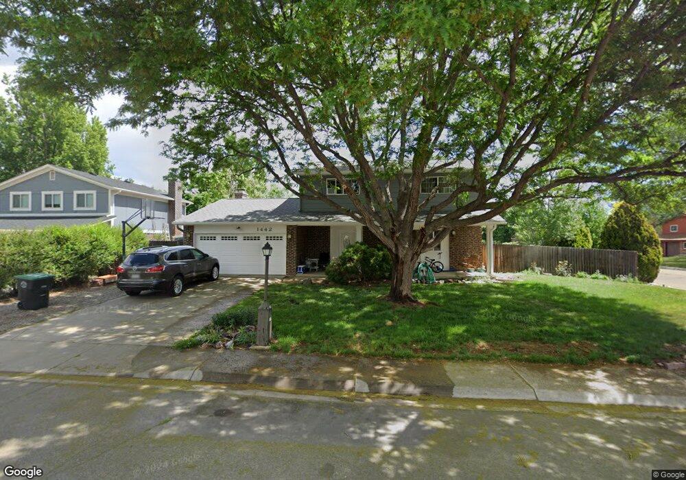
1442 Mayfield Cir Longmont, CO 80501
Southmoor NeighborhoodEstimated Value: $576,031 - $599,000
4
Beds
3
Baths
1,934
Sq Ft
$302/Sq Ft
Est. Value
About This Home
This home is located at 1442 Mayfield Cir, Longmont, CO 80501 and is currently estimated at $584,008, approximately $301 per square foot. 1442 Mayfield Cir is a home located in Boulder County with nearby schools including Indian Peaks Elementary School, Sunset Middle School, and Niwot High School.
Ownership History
Date
Name
Owned For
Owner Type
Purchase Details
Closed on
May 20, 1991
Bought by
Garrison Lynn Burnett and Garrison Robert L
Current Estimated Value
Purchase Details
Closed on
Dec 20, 1990
Bought by
Garrison Lynn Burnett and Garrison Robert L
Purchase Details
Closed on
May 20, 1988
Bought by
Garrison Lynn Burnett and Garrison Robert L
Purchase Details
Closed on
Oct 4, 1977
Bought by
Garrison Lynn Burnett and Garrison Robert L
Create a Home Valuation Report for This Property
The Home Valuation Report is an in-depth analysis detailing your home's value as well as a comparison with similar homes in the area
Home Values in the Area
Average Home Value in this Area
Purchase History
| Date | Buyer | Sale Price | Title Company |
|---|---|---|---|
| Garrison Lynn Burnett | -- | -- | |
| Garrison Lynn Burnett | $77,900 | -- | |
| Garrison Lynn Burnett | $97,000 | -- | |
| Garrison Lynn Burnett | $48,600 | -- |
Source: Public Records
Tax History Compared to Growth
Tax History
| Year | Tax Paid | Tax Assessment Tax Assessment Total Assessment is a certain percentage of the fair market value that is determined by local assessors to be the total taxable value of land and additions on the property. | Land | Improvement |
|---|---|---|---|---|
| 2025 | $2,393 | $36,788 | $13,525 | $23,263 |
| 2024 | $2,393 | $36,788 | $13,525 | $23,263 |
| 2023 | $2,993 | $31,718 | $16,884 | $18,519 |
| 2022 | $2,643 | $26,709 | $11,933 | $14,776 |
| 2021 | $2,677 | $27,478 | $12,277 | $15,201 |
| 2020 | $2,779 | $28,608 | $9,939 | $18,669 |
| 2019 | $2,735 | $28,608 | $9,939 | $18,669 |
| 2018 | $2,315 | $24,372 | $6,840 | $17,532 |
| 2017 | $2,284 | $26,945 | $7,562 | $19,383 |
| 2016 | $2,059 | $21,540 | $6,846 | $14,694 |
| 2015 | $1,962 | $18,125 | $5,413 | $12,712 |
| 2014 | $1,693 | $18,125 | $5,413 | $12,712 |
Source: Public Records
Map
Nearby Homes
- 1350 S Lincoln St
- 1435 Missouri Ave
- 1327 Brookfield Dr
- 1527 S Vivian St
- 1801 S Pratt Pkwy
- 1435 Ashcroft Dr
- 919 S Sherman St
- 1456 Sepia Ave
- 1028 Katy Ln
- 1518 Sepia Ave
- 2030 Emerald Dr
- 2050 Emerald Dr
- 1321 Onyx Cir
- 2119 Onyx Way
- 1072 Kane Dr
- 9 Seattle Ln
- 832 S Bowen St
- 1328 S Terry St
- 1343 S Coffman St
- 802 Neon Forest Cir
- 1444 Mayfield Cir
- 1447 S Sherman St
- 1443 S Sherman St
- 1446 Mayfield Cir
- 1441 Mayfield Cir
- 1415 Lefthand Dr
- 1421 Lefthand Dr
- 1443 Mayfield Cir
- 1437 S Sherman St
- 1409 Lefthand Dr
- 1427 Lefthand Dr
- 1445 Mayfield Cir
- 1448 Mayfield Cir
- 1403 Lefthand Dr
- 1433 Lefthand Dr
- 1442 S Sherman St
- 1431 S Sherman St
- 1436 S Sherman St
- 1491 Mayfield Cir
- 1447 Mayfield Cir