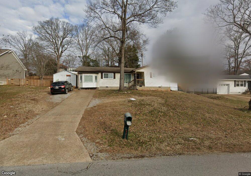
1443 Ely Rd Hixson, TN 37343
Dupont NeighborhoodEstimated Value: $228,000 - $268,000
4
Beds
2
Baths
1,700
Sq Ft
$149/Sq Ft
Est. Value
About This Home
This home is located at 1443 Ely Rd, Hixson, TN 37343 and is currently estimated at $253,179, approximately $148 per square foot. 1443 Ely Rd is a home located in Hamilton County with nearby schools including DuPont Elementary School, Hixson Middle School, and Hixson High School.
Ownership History
Date
Name
Owned For
Owner Type
Purchase Details
Closed on
Dec 26, 2012
Sold by
Rpj Properties Llc
Bought by
Rpj Properties Llc
Current Estimated Value
Purchase Details
Closed on
Dec 14, 2011
Sold by
Messier Cathy Smith and Messier Robert
Bought by
Jenkins Rodger Dale and Jenkins Peggy Kessel
Purchase Details
Closed on
Jun 5, 1996
Sold by
Eldredge James L and Dipillo Teena Lynn Eldredge
Bought by
Smith Cathy Eldredge
Home Financials for this Owner
Home Financials are based on the most recent Mortgage that was taken out on this home.
Original Mortgage
$42,950
Interest Rate
7.94%
Mortgage Type
FHA
Create a Home Valuation Report for This Property
The Home Valuation Report is an in-depth analysis detailing your home's value as well as a comparison with similar homes in the area
Home Values in the Area
Average Home Value in this Area
Purchase History
| Date | Buyer | Sale Price | Title Company |
|---|---|---|---|
| Rpj Properties Llc | -- | None Available | |
| Jenkins Rodger Dale | $60,000 | Northgate Title Escrow Inc | |
| Smith Cathy Eldredge | $43,950 | First Title |
Source: Public Records
Mortgage History
| Date | Status | Borrower | Loan Amount |
|---|---|---|---|
| Previous Owner | Smith Cathy Eldredge | $42,950 | |
| Closed | Smith Cathy Eldredge | $3,651 |
Source: Public Records
Tax History
| Year | Tax Paid | Tax Assessment Tax Assessment Total Assessment is a certain percentage of the fair market value that is determined by local assessors to be the total taxable value of land and additions on the property. | Land | Improvement |
|---|---|---|---|---|
| 2025 | $901 | $59,425 | $0 | $0 |
| 2024 | $606 | $27,075 | $0 | $0 |
| 2023 | $606 | $27,075 | $0 | $0 |
| 2022 | $606 | $27,075 | $0 | $0 |
| 2021 | $606 | $27,075 | $0 | $0 |
| 2020 | $611 | $22,100 | $0 | $0 |
| 2019 | $611 | $22,100 | $0 | $0 |
| 2018 | $630 | $22,100 | $0 | $0 |
| 2017 | $611 | $22,100 | $0 | $0 |
| 2016 | $496 | $0 | $0 | $0 |
| 2015 | $1,025 | $17,925 | $0 | $0 |
| 2014 | $1,025 | $0 | $0 | $0 |
Source: Public Records
Map
Nearby Homes
- 1218 Cranbrook Dr
- 1512 Ely Rd
- 1415 Highland Way
- 4703 Clover Ln
- 1416 Highland Way
- 1705 Bagwell Ave
- 4705 Clover Ln
- 1315 Northgate Cir
- 4326 Comet Trail
- 1636 Green Hill Dr
- 1313 Michael Ln
- 4607 Cloverdale Loop
- 961 Ashland Terrace
- 3914 Memphis Dr
- 4609 Plaza Hills Ln
- 3956 Fairfax Dr
- 3944 Azalean Dr
- 936 Sherry Cir
- 810 Forest Dale Ln
- 3609 Forest Highland Dr
Your Personal Tour Guide
Ask me questions while you tour the home.