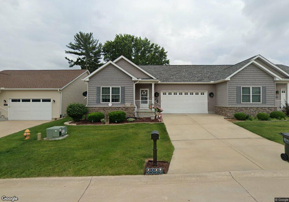
1443 W 39th St Davenport, IA 52806
North Side NeighborhoodEstimated Value: $321,088 - $369,000
3
Beds
3
Baths
1,631
Sq Ft
$216/Sq Ft
Est. Value
About This Home
This home is located at 1443 W 39th St, Davenport, IA 52806 and is currently estimated at $352,272, approximately $215 per square foot. 1443 W 39th St is a home located in Scott County with nearby schools including Cumberland Hall School, Harrison Elementary School, and Academy Of Continuing Education.
Ownership History
Date
Name
Owned For
Owner Type
Purchase Details
Closed on
Jul 31, 2014
Sold by
Blackhawk Bank & Trust
Bought by
Pearson Enterprises Of The Quad Cities I
Current Estimated Value
Purchase Details
Closed on
Jun 15, 2011
Sold by
Harmony Land Development Llc
Bought by
Harmony Land Development Llc
Create a Home Valuation Report for This Property
The Home Valuation Report is an in-depth analysis detailing your home's value as well as a comparison with similar homes in the area
Home Values in the Area
Average Home Value in this Area
Purchase History
| Date | Buyer | Sale Price | Title Company |
|---|---|---|---|
| Pearson Enterprises Of The Quad Cities I | $16,000 | None Available | |
| Harmony Land Development Llc | -- | None Available | |
| Harmony Land Development Llc | -- | None Available |
Source: Public Records
Tax History Compared to Growth
Tax History
| Year | Tax Paid | Tax Assessment Tax Assessment Total Assessment is a certain percentage of the fair market value that is determined by local assessors to be the total taxable value of land and additions on the property. | Land | Improvement |
|---|---|---|---|---|
| 2025 | $4,754 | $337,520 | $43,980 | $293,540 |
| 2024 | $4,752 | $289,920 | $29,320 | $260,600 |
| 2023 | $5,872 | $289,920 | $29,320 | $260,600 |
| 2022 | $5,898 | $283,820 | $29,320 | $254,500 |
| 2021 | $5,898 | $283,820 | $29,320 | $254,500 |
| 2020 | $5,472 | $260,680 | $29,320 | $231,360 |
| 2019 | $5,658 | $260,680 | $29,320 | $231,360 |
| 2018 | $5,534 | $260,680 | $29,320 | $231,360 |
| 2017 | $4,010 | $260,680 | $29,320 | $231,360 |
| 2016 | $642 | $29,320 | $0 | $0 |
| 2015 | $642 | $23,450 | $0 | $0 |
| 2014 | $520 | $23,450 | $0 | $0 |
| 2013 | $512 | $0 | $0 | $0 |
| 2012 | -- | $23,120 | $23,120 | $0 |
Source: Public Records
Map
Nearby Homes
- 1517 W Kimberly Rd
- 1453 W 41st St
- 3831 N Sturdevant St
- 1336 W 38th Place
- 1617 W 38th St
- 1344 W 37th St
- 3433 Washington St
- 4132 Rodeo Rd
- 3612 Wilkes Ave
- 4618 Fillmore Ln
- 4449 Royal Oaks Dr
- 4705 N Sturdevant St
- 4612 Warren St Unit 5
- 7 Vista Ct
- 4757 Willow Cir
- 4743 Willow Cir
- 4804 Northwest Blvd
- Lot 29 W 34th St
- 4406 Regency Place
- 2159 W 35th St
- 1443 W 39th St
- 1449 W 39th St
- 1437 W 39th St
- 1433 W 39th St
- 1433 W 39th St
- 1429 W 39th St
- 1446 W 39th St
- 1446 W 39th St Unit A
- 1434 W 39th St
- 1430 W Kimberly Rd
- 1440 W 39th St
- 1450 W 39th St
- 1434 W 39th St
- 1422 W Kimberly Rd
- 1459 W 39th St
- 1430 W 39th St
- 1423 W 39th St
- 1423 W 39th St
- 3916 Washington St
- 1424 W 39th St