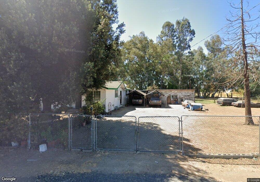
14433 Reverend Maurice Cotton Dr Lathrop, CA 95330
East Lathrop NeighborhoodEstimated Value: $206,000 - $519,922
3
Beds
1
Bath
1,367
Sq Ft
$308/Sq Ft
Est. Value
About This Home
This home is located at 14433 Reverend Maurice Cotton Dr, Lathrop, CA 95330 and is currently estimated at $421,231, approximately $308 per square foot. 14433 Reverend Maurice Cotton Dr is a home located in San Joaquin County with nearby schools including Joseph Widmer, Jr. Elementary School, Lathrop High School, and BE.TECH Charter High School.
Ownership History
Date
Name
Owned For
Owner Type
Purchase Details
Closed on
Jul 24, 2006
Sold by
Gansit Celso and Gansit Virgie
Bought by
Gansit Celso and Gansit Virgie
Current Estimated Value
Purchase Details
Closed on
Apr 13, 2000
Sold by
Baker James Z
Bought by
Gansit Celso and Gansit Virgie
Home Financials for this Owner
Home Financials are based on the most recent Mortgage that was taken out on this home.
Original Mortgage
$138,000
Interest Rate
8.53%
Purchase Details
Closed on
Dec 14, 1995
Sold by
Baker James Z
Bought by
Baker James Z and Baker Mary A
Create a Home Valuation Report for This Property
The Home Valuation Report is an in-depth analysis detailing your home's value as well as a comparison with similar homes in the area
Home Values in the Area
Average Home Value in this Area
Purchase History
| Date | Buyer | Sale Price | Title Company |
|---|---|---|---|
| Gansit Celso | -- | None Available | |
| Gansit Celso | $150,000 | Alliance Title Company | |
| Baker James Z | -- | -- |
Source: Public Records
Mortgage History
| Date | Status | Borrower | Loan Amount |
|---|---|---|---|
| Previous Owner | Gansit Celso | $138,000 |
Source: Public Records
Tax History Compared to Growth
Tax History
| Year | Tax Paid | Tax Assessment Tax Assessment Total Assessment is a certain percentage of the fair market value that is determined by local assessors to be the total taxable value of land and additions on the property. | Land | Improvement |
|---|---|---|---|---|
| 2025 | $3,416 | $236,680 | $61,473 | $175,207 |
| 2024 | $3,596 | $232,040 | $60,268 | $171,772 |
| 2023 | $3,458 | $227,491 | $59,087 | $168,404 |
| 2022 | $3,412 | $223,031 | $57,929 | $165,102 |
| 2021 | $3,383 | $218,659 | $56,794 | $161,865 |
| 2020 | $3,274 | $216,418 | $56,212 | $160,206 |
| 2019 | $3,246 | $212,175 | $55,110 | $157,065 |
| 2018 | $3,216 | $208,016 | $54,030 | $153,986 |
| 2017 | $3,172 | $203,938 | $52,971 | $150,967 |
| 2016 | $3,118 | $199,939 | $51,932 | $148,007 |
| 2014 | $2,369 | $138,600 | $41,800 | $96,800 |
Source: Public Records
Map
Nearby Homes
- 14224 S Harlan Rd
- 14129 Reverend Maurice Cotton Dr
- 14539 Cedar Valley Dr
- 813 Sugar Pine Dr
- 337 Gardner Place
- 15150 Hollyhock Ct
- 726 Milestone Dr
- 127 Argillite Ave
- 13377 Talc St
- 911 Englewood Way
- 13400 Forestwood Way
- 601 Olivine Ave
- 15820 S Harlan Rd Unit 51
- 15820 S Harlan Rd Unit 85
- 15820 S Harlan Rd Unit 158
- 15820 S Harlan Rd Unit 111
- 15364 Barbara Terry Blvd
- 334 Osage Place
- 323 Sacramento St
- 15871 7th St
- 14404 Stratford Ave
- 199 Shilling Ave
- 203 Shilling Ave
- 166 Shilling Ave
- 211 Shilling Ave
- 14554 Stratford Ave
- 14554 Reverend Maurice Cotton Dr
- 14388 Stratford Ave
- 14255 Stratford Ave
- 122 Shilling Ave
- 212 Shilling Ave
- 53 Shilling Ave
- 14255 Reverend Maurice Cotton Dr
- 51 Shilling Ave
- 14322 S Harlan Rd
- 228 Shilling Ave
- 245 Shilling Ave
- 14601 Stratford Ave
- 14233 Stratford Ave
- 23 Shilling Ave