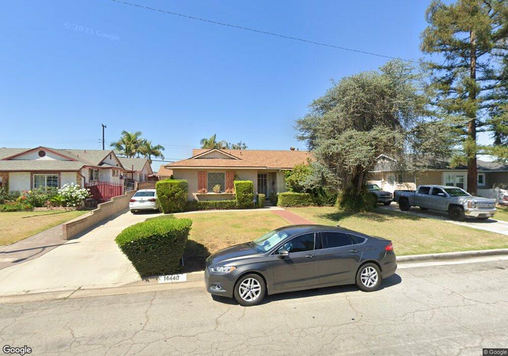
14440 Cornishcrest Rd Whittier, CA 90604
South Whittier NeighborhoodEstimated Value: $828,937 - $856,000
3
Beds
2
Baths
1,582
Sq Ft
$533/Sq Ft
Est. Value
About This Home
This home is located at 14440 Cornishcrest Rd, Whittier, CA 90604 and is currently estimated at $843,984, approximately $533 per square foot. 14440 Cornishcrest Rd is a home located in Los Angeles County with nearby schools including La Colima Elementary School, Granada Middle School, and California High School.
Ownership History
Date
Name
Owned For
Owner Type
Purchase Details
Closed on
May 17, 2002
Sold by
Contreras Roy
Bought by
Contreras Roy H
Current Estimated Value
Home Financials for this Owner
Home Financials are based on the most recent Mortgage that was taken out on this home.
Original Mortgage
$137,808
Interest Rate
6.94%
Purchase Details
Closed on
Mar 4, 1994
Sold by
Contreras Leonor
Bought by
Contreras Roy
Home Financials for this Owner
Home Financials are based on the most recent Mortgage that was taken out on this home.
Original Mortgage
$135,000
Interest Rate
7%
Create a Home Valuation Report for This Property
The Home Valuation Report is an in-depth analysis detailing your home's value as well as a comparison with similar homes in the area
Home Values in the Area
Average Home Value in this Area
Purchase History
| Date | Buyer | Sale Price | Title Company |
|---|---|---|---|
| Contreras Roy H | -- | -- | |
| Contreras Roy | -- | Southland Title Corporation |
Source: Public Records
Mortgage History
| Date | Status | Borrower | Loan Amount |
|---|---|---|---|
| Closed | Contreras Roy H | $137,808 | |
| Closed | Contreras Roy | $135,000 |
Source: Public Records
Tax History Compared to Growth
Tax History
| Year | Tax Paid | Tax Assessment Tax Assessment Total Assessment is a certain percentage of the fair market value that is determined by local assessors to be the total taxable value of land and additions on the property. | Land | Improvement |
|---|---|---|---|---|
| 2025 | $4,362 | $349,010 | $195,332 | $153,678 |
| 2024 | $4,362 | $342,167 | $191,502 | $150,665 |
| 2023 | $4,288 | $335,459 | $187,748 | $147,711 |
| 2022 | $4,195 | $328,882 | $184,067 | $144,815 |
| 2021 | $4,109 | $322,434 | $180,458 | $141,976 |
| 2019 | $4,026 | $312,872 | $175,106 | $137,766 |
| 2018 | $3,856 | $306,738 | $171,673 | $135,065 |
| 2016 | $3,643 | $294,828 | $165,007 | $129,821 |
| 2015 | $3,619 | $290,400 | $162,529 | $127,871 |
| 2014 | $3,571 | $284,713 | $159,346 | $125,367 |
Source: Public Records
Map
Nearby Homes
- 10955 Parise Dr
- 0 Telegraph Rd Unit DW24244539
- 11111 Colima Rd
- 11522 Double Eagle Dr
- 11502 Double Eagle Dr
- 11624 Starlight Ave
- 11813 Colima Rd
- 11531 Sunnybrook Ln
- 10855 Colima Rd
- 11118 Bunker Ln
- 11102 Eagle Ln
- 11134 Arroyo Dr
- 14076 Cornishcrest Rd
- 10822 Colima Rd
- 14520 Mulberry Dr
- 14034 Coteau Dr Unit 1103
- 10241 Ruoff Ave
- 10745 Victoria Ave Unit 4
- 10745 Victoria Ave Unit 6
- 10745 Victoria Ave
- 14434 Cornishcrest Rd
- 14446 Cornishcrest Rd
- 14443 Allegan St
- 14428 Cornishcrest Rd
- 14437 Allegan St
- 11027 Kane Ave
- 14450 Cornishcrest Rd
- 14451 Allegan St
- 14429 Allegan St
- 11044 Theis Ave
- 14420 Cornishcrest Rd
- 14457 Allegan St
- 14423 Allegan St
- 11021 Kane Ave
- 11032 Kane Ave
- 11038 Theis Ave
- 11028 Kane Ave
- 14414 Cornishcrest Rd
- 14463 Allegan St
- 14417 Allegan St