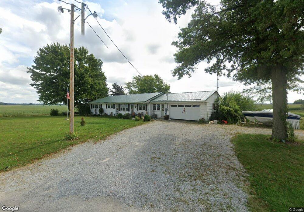
14441 State Highway 67 Upper Sandusky, OH 43351
Estimated Value: $263,000 - $288,971
4
Beds
2
Baths
2,916
Sq Ft
$95/Sq Ft
Est. Value
About This Home
This home is located at 14441 State Highway 67, Upper Sandusky, OH 43351 and is currently estimated at $275,986, approximately $94 per square foot. 14441 State Highway 67 is a home located in Wyandot County with nearby schools including Upper Sandusky High School and St. Peter Elementary School.
Ownership History
Date
Name
Owned For
Owner Type
Purchase Details
Closed on
Jun 6, 2013
Sold by
Esterline Linda A and Latham Linda A
Bought by
Oliver Kevin E
Current Estimated Value
Home Financials for this Owner
Home Financials are based on the most recent Mortgage that was taken out on this home.
Original Mortgage
$126,666
Outstanding Balance
$89,862
Interest Rate
3.43%
Estimated Equity
$186,124
Purchase Details
Closed on
Sep 8, 2008
Sold by
Mewhorter Linda A and Latham Linda A
Bought by
Latham Linda A and Latham Robert L
Purchase Details
Closed on
Oct 26, 2005
Sold by
Mewhorter Michael E and Mewhorter Linda A
Bought by
Mewhorter Linda A
Home Financials for this Owner
Home Financials are based on the most recent Mortgage that was taken out on this home.
Original Mortgage
$45,800
Interest Rate
5.98%
Purchase Details
Closed on
Mar 3, 2003
Bought by
Mewhorter Michael E and Mewhorter Li
Create a Home Valuation Report for This Property
The Home Valuation Report is an in-depth analysis detailing your home's value as well as a comparison with similar homes in the area
Home Values in the Area
Average Home Value in this Area
Purchase History
| Date | Buyer | Sale Price | Title Company |
|---|---|---|---|
| Oliver Kevin E | $124,000 | None Available | |
| Latham Linda A | -- | None Available | |
| Mewhorter Linda A | -- | None Available | |
| Mewhorter Michael E | $129,900 | -- |
Source: Public Records
Mortgage History
| Date | Status | Borrower | Loan Amount |
|---|---|---|---|
| Open | Oliver Kevin E | $126,666 | |
| Previous Owner | Mewhorter Linda A | $45,800 |
Source: Public Records
Tax History Compared to Growth
Tax History
| Year | Tax Paid | Tax Assessment Tax Assessment Total Assessment is a certain percentage of the fair market value that is determined by local assessors to be the total taxable value of land and additions on the property. | Land | Improvement |
|---|---|---|---|---|
| 2024 | $1,781 | $56,920 | $9,490 | $47,430 |
| 2023 | $1,781 | $56,920 | $9,490 | $47,430 |
| 2022 | $1,781 | $52,010 | $9,030 | $42,980 |
| 2021 | $1,703 | $52,010 | $9,030 | $42,980 |
| 2020 | $1,703 | $52,010 | $9,030 | $42,980 |
| 2019 | $1,700 | $52,010 | $9,030 | $42,980 |
| 2018 | $1,333 | $41,730 | $7,990 | $33,740 |
| 2017 | $1,355 | $41,730 | $7,990 | $33,740 |
| 2016 | $1,288 | $41,730 | $7,990 | $33,740 |
| 2015 | -- | $40,120 | $7,520 | $32,600 |
| 2014 | -- | $40,120 | $7,520 | $32,600 |
| 2013 | -- | $40,120 | $7,520 | $32,600 |
Source: Public Records
Map
Nearby Homes
- 379 Spring St
- 602 S 7th St
- 381 & 383 W Johnson St
- US 30 Sr 23
- 203 203 1/2 E Crawford St
- 221&221 1/2 S 7th St
- 0 State Highway 53 Unit 6132082
- 454 N Sandusky Ave
- 430 S Sandusky Ave
- 326 S 8th St
- 225 S Hazel St
- 346 W Hicks St
- 305 S 5th St
- 213 E Johnson St
- 137 N 8th St
- 386 W Finley St
- 326 N 5th St
- 417 N 8th St
- 334 N 4th St
- 222 E Bigelow St
- 14441 State Highway 67
- 14441 Ohio 67
- 15039 County Hwy
- 15039 C H 109
- 14177 State Highway 67
- 14913 County Highway 109
- 9876 County Highway 58
- 14862 State Highway 67
- 9429 County Highway 58
- 15039 County Highway 109
- 15035 State Highway 67
- 15034 State Highway 67
- 10196 County Highway 58
- 10658 County Highway 58
- 15095 County Highway 109
- 13803 State Highway 67
- 14799 County Highway 115
- 13961 County Highway 115
- 15099 State Highway 67
- 9152 County Highway 58