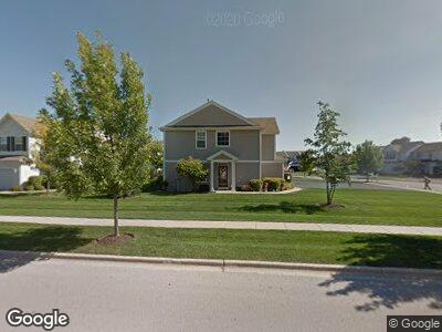
1445 Legacy Dr Dekalb, IL 60115
Estimated Value: $206,000 - $232,000
--
Bed
--
Bath
--
Sq Ft
1,045
Sq Ft Lot
About This Home
This home is located at 1445 Legacy Dr, Dekalb, IL 60115 and is currently estimated at $218,337. 1445 Legacy Dr is a home located in DeKalb County with nearby schools including Cortland Elementary School, Huntley Middle School, and De Kalb High School.
Ownership History
Date
Name
Owned For
Owner Type
Purchase Details
Closed on
Feb 18, 2021
Sold by
Krack Cassandra A and Wyruchowski Cassandra A
Bought by
Klumpp Macy
Current Estimated Value
Home Financials for this Owner
Home Financials are based on the most recent Mortgage that was taken out on this home.
Original Mortgage
$130,500
Outstanding Balance
$100,031
Interest Rate
2.7%
Mortgage Type
New Conventional
Estimated Equity
$122,930
Purchase Details
Closed on
Apr 14, 2006
Sold by
Enclave Land Llc
Bought by
Krack Cassandra A
Home Financials for this Owner
Home Financials are based on the most recent Mortgage that was taken out on this home.
Original Mortgage
$139,900
Interest Rate
6.42%
Mortgage Type
New Conventional
Create a Home Valuation Report for This Property
The Home Valuation Report is an in-depth analysis detailing your home's value as well as a comparison with similar homes in the area
Home Values in the Area
Average Home Value in this Area
Purchase History
| Date | Buyer | Sale Price | Title Company |
|---|---|---|---|
| Klumpp Macy | $145,000 | Attorneys Ttl Guaranty Fund | |
| Krack Cassandra A | $160,000 | -- |
Source: Public Records
Mortgage History
| Date | Status | Borrower | Loan Amount |
|---|---|---|---|
| Open | Klumpp Macy | $130,500 | |
| Previous Owner | Wyruchowski Cassandra A | $134,000 | |
| Previous Owner | Krack Cassandra A | $139,900 |
Source: Public Records
Tax History Compared to Growth
Tax History
| Year | Tax Paid | Tax Assessment Tax Assessment Total Assessment is a certain percentage of the fair market value that is determined by local assessors to be the total taxable value of land and additions on the property. | Land | Improvement |
|---|---|---|---|---|
| 2024 | $4,216 | $58,251 | $4,835 | $53,416 |
| 2023 | $4,216 | $50,790 | $4,216 | $46,574 |
| 2022 | $4,080 | $46,371 | $4,811 | $41,560 |
| 2021 | $4,813 | $43,492 | $4,512 | $38,980 |
| 2020 | $4,922 | $42,799 | $4,440 | $38,359 |
| 2019 | $4,825 | $41,118 | $4,266 | $36,852 |
| 2018 | $4,620 | $38,956 | $4,121 | $34,835 |
| 2017 | $3,917 | $37,447 | $3,961 | $33,486 |
| 2016 | $3,855 | $36,502 | $3,861 | $32,641 |
| 2015 | -- | $34,586 | $3,658 | $30,928 |
| 2014 | -- | $35,132 | $5,293 | $29,839 |
| 2013 | -- | $36,904 | $5,560 | $31,344 |
Source: Public Records
Map
Nearby Homes
- 1532 Legacy Dr Unit 3
- 1481 Cambria Dr Unit 1
- 1546 Reserve Ln Unit 1
- 1408 Hulmes Dr
- TBD Pleasant St
- 950 Sycamore Rd
- 1309 Pleasant St
- TBD Greenwood Acres Dr
- 2547 Pleasant St
- 638 N 10th St
- 127 Tilton Park Dr
- 827 Lewis St
- 110 Ilehamwood Dr
- 607 N 9th St
- 424 N 11th St
- 305 Knollwood Dr
- 1112 Market St
- 1015 Market St
- 705 N 6th St
- 7PARCELS N Peace Rd
- 1445 Legacy Dr
- 1445 Legacy Dr
- 1445 Legacy Dr
- 1445 Legacy Dr
- 1445 Legacy Dr Unit 4
- 1445 Legacy Dr Unit 3
- 1477 Legacy Dr
- 1477 Legacy Dr
- 1477 Legacy Dr
- 1477 Legacy Dr
- 1477 Legacy Dr Unit 4
- 1477 Legacy Dr Unit 3
- 1477 Legacy Dr Unit 2
- 1477 Legacy Dr Unit 1
- 1477 Legacy Dr Unit 321-2
- 1477 Legacy Dr Unit 321-3
- 1463 Reserve Ln
- 1461 Reserve Ln
- 1478 Reserve Ln
- 1478 Reserve Ln