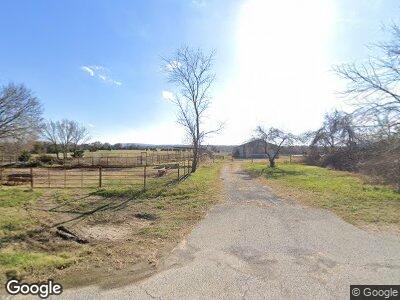
14451 Highway 62 E Alpena, AR 72611
Estimated Value: $90,000 - $284,000
--
Bed
1
Bath
725
Sq Ft
$226/Sq Ft
Est. Value
About This Home
This home is located at 14451 Highway 62 E, Alpena, AR 72611 and is currently estimated at $164,151, approximately $226 per square foot. 14451 Highway 62 E is a home located in Carroll County with nearby schools including Green Forest Elementary School, Green Forest Intermed School, and Green Forest High School.
Ownership History
Date
Name
Owned For
Owner Type
Purchase Details
Closed on
Dec 16, 2020
Sold by
Woods Denease and Woods Charmane Denease
Bought by
Richardson Alvin Blaine and Woods Charmane Denease
Current Estimated Value
Purchase Details
Closed on
Feb 28, 2011
Bought by
Richardson E B/Wimmie Trust and %Charmane D Woods Trustee
Purchase Details
Closed on
Jan 20, 2001
Sold by
Bailey
Bought by
Richardson
Purchase Details
Closed on
Jan 2, 2001
Sold by
Not Provided
Bought by
Not Provided
Purchase Details
Closed on
Mar 15, 1996
Sold by
Not Provided
Bought by
Not Provided
Purchase Details
Closed on
Mar 11, 1996
Sold by
Bailey
Bought by
Bailey
Create a Home Valuation Report for This Property
The Home Valuation Report is an in-depth analysis detailing your home's value as well as a comparison with similar homes in the area
Home Values in the Area
Average Home Value in this Area
Purchase History
| Date | Buyer | Sale Price | Title Company |
|---|---|---|---|
| Richardson Alvin Blaine | -- | None Available | |
| Richardson E B/Wimmie Trust | -- | -- | |
| Richardson | -- | -- | |
| Not Provided | -- | -- | |
| Not Provided | -- | -- | |
| Bailey | -- | -- |
Source: Public Records
Tax History Compared to Growth
Tax History
| Year | Tax Paid | Tax Assessment Tax Assessment Total Assessment is a certain percentage of the fair market value that is determined by local assessors to be the total taxable value of land and additions on the property. | Land | Improvement |
|---|---|---|---|---|
| 2024 | $275 | $5,670 | $3,190 | $2,480 |
| 2023 | $275 | $5,670 | $3,190 | $2,480 |
| 2022 | $275 | $5,670 | $3,190 | $2,480 |
| 2021 | $267 | $5,510 | $3,030 | $2,480 |
| 2020 | $267 | $5,510 | $3,030 | $2,480 |
| 2019 | $285 | $5,510 | $3,030 | $2,480 |
| 2018 | $285 | $5,510 | $3,030 | $2,480 |
| 2017 | $457 | $9,060 | $4,400 | $4,660 |
| 2016 | $468 | $9,650 | $3,950 | $5,700 |
| 2015 | $444 | $9,660 | $3,960 | $5,700 |
| 2014 | -- | $9,660 | $3,960 | $5,700 |
Source: Public Records
Map
Nearby Homes
- 13360 U S 62
- 13705 U S Highway 412
- 0 Highway 412 & Wpa Rd Unit 1306959
- 1885 County Road 912
- 166 Cr-966
- 0 Summit Rd
- TBD County Road 966
- 2691 Old Mountain Dr
- 0 Maple Hill Rd W
- 418 Green Hill Rd
- 704 Green Hill Rd S
- 68 County Road 8492
- 103 County Road 8491
- 000 Dunkard Rd
- 0000 Dunkard Rd
- 14319 Ayrs Rd N
- 0 Cr 9204 Unit 1288091
- 118 Lick Branch Rd
- 0 Dunkard Rd
- 751 County Road 978
- 14451 Highway 62 E
- 40 acres Carroll Co Rd 925
- 14240 Highway 62 E
- 14344 Highway 62 E
- 409 County Road 811
- 485 County Road 914
- 902 Highway 62 W
- 527 County Road 914
- 489 County Road 811
- 531 County Road 914 Rd
- 0 Co Rd Unit 127079
- 576 Co D 811 Rd
- 1576 Cr 811
- 56 Cr-922
- 250 Cr-986
- 6411 Co Rd 905
- 1637 County Road 935
- 516 Denver Rd (Cr 811)
- 493 County Road 811
- 493 Cr 811 (Denver Road)
