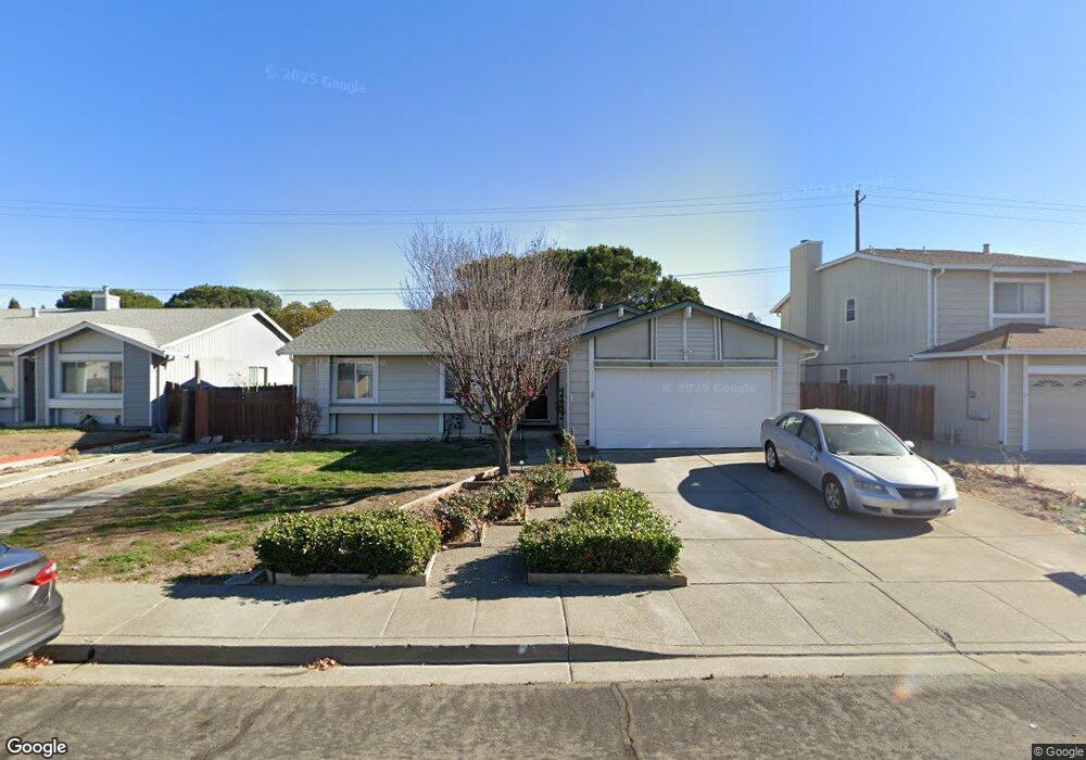
1447 Monitor Ave Suisun City, CA 94585
Estimated Value: $547,000 - $566,000
3
Beds
2
Baths
1,492
Sq Ft
$371/Sq Ft
Est. Value
About This Home
This home is located at 1447 Monitor Ave, Suisun City, CA 94585 and is currently estimated at $554,146, approximately $371 per square foot. 1447 Monitor Ave is a home located in Solano County with nearby schools including Dan O. Root Elementary School, Crystal Middle School, and Armijo High School.
Ownership History
Date
Name
Owned For
Owner Type
Purchase Details
Closed on
Sep 7, 2001
Sold by
Saunders Michael J and Saunders Julene G
Bought by
Dozier Edward D and Dozier Ada M
Current Estimated Value
Home Financials for this Owner
Home Financials are based on the most recent Mortgage that was taken out on this home.
Original Mortgage
$223,100
Outstanding Balance
$87,060
Interest Rate
7%
Estimated Equity
$467,086
Purchase Details
Closed on
Mar 29, 1996
Sold by
The United States Of America
Bought by
Saunders Michael J and Saunders Julene G
Home Financials for this Owner
Home Financials are based on the most recent Mortgage that was taken out on this home.
Original Mortgage
$119,700
Interest Rate
7.84%
Purchase Details
Closed on
Dec 14, 1995
Sold by
Jordan Nicholas C and Jordan Ofelia
Bought by
The United States Of America
Create a Home Valuation Report for This Property
The Home Valuation Report is an in-depth analysis detailing your home's value as well as a comparison with similar homes in the area
Home Values in the Area
Average Home Value in this Area
Purchase History
| Date | Buyer | Sale Price | Title Company |
|---|---|---|---|
| Dozier Edward D | $230,000 | Fidelity National Title Co | |
| Saunders Michael J | $126,000 | Fidelity National Title | |
| The United States Of America | -- | North American Title Co |
Source: Public Records
Mortgage History
| Date | Status | Borrower | Loan Amount |
|---|---|---|---|
| Open | Dozier Edward D | $223,100 | |
| Previous Owner | Saunders Michael J | $119,700 |
Source: Public Records
Tax History Compared to Growth
Tax History
| Year | Tax Paid | Tax Assessment Tax Assessment Total Assessment is a certain percentage of the fair market value that is determined by local assessors to be the total taxable value of land and additions on the property. | Land | Improvement |
|---|---|---|---|---|
| 2025 | $3,875 | $339,766 | $96,018 | $243,748 |
| 2024 | $3,875 | $333,105 | $94,136 | $238,969 |
| 2023 | $3,756 | $326,575 | $92,291 | $234,284 |
| 2022 | $3,709 | $320,173 | $90,482 | $229,691 |
| 2021 | $3,670 | $313,896 | $88,708 | $225,188 |
| 2020 | $3,585 | $310,678 | $87,799 | $222,879 |
| 2019 | $3,495 | $304,587 | $86,078 | $218,509 |
| 2018 | $3,634 | $298,616 | $84,391 | $214,225 |
| 2017 | $3,472 | $292,762 | $82,737 | $210,025 |
| 2016 | $3,443 | $287,022 | $81,115 | $205,907 |
| 2015 | $3,201 | $282,000 | $73,000 | $209,000 |
| 2014 | $2,868 | $250,000 | $65,000 | $185,000 |
Source: Public Records
Map
Nearby Homes
- 1201 Deanza Ct
- 1416 Prospect Way
- 1504 El Morro Ln
- 1411 Klamath Dr
- 1651 Little Rock Cir
- 610 Placer Ln
- 1415 Pelican Way
- 819 Bluejay Dr
- 1756 Keesler Cir
- 1109 Canary Dr
- 607 Crested Dr
- 2084 Parsons Dr
- 808 Pochard Way
- 1621 Savannah Ln
- 616 Emperor Dr
- 1016 Prairie Dr
- 1280 Mayfield Cir
- 1413 Spence Ct
- 51 Barcelona Cir
- 330 Engell Ct
- 1445 Monitor Ave
- 1451 Monitor Ave
- 1443 Monitor Ave
- 1446 Monitor Ave
- 1448 Monitor Ave
- 1444 Monitor Ave
- 1441 Monitor Ave
- 1450 Monitor Ave
- 1442 Monitor Ave
- 1452 Monitor Ave
- 736 Chula Vista Way
- 738 Chula Vista Way
- 1440 Monitor Ave
- 1455 Monitor Ave
- 734 Chula Vista Way
- 1439 Monitor Ave
- 740 Chula Vista Way
- 901 Whitney Ave