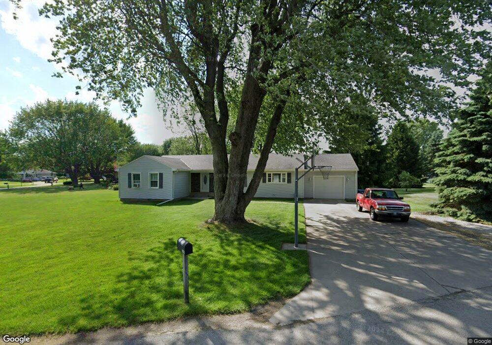
1448 Chieftain Cir Fremont, OH 43420
Estimated Value: $214,000 - $259,000
3
Beds
2
Baths
1,651
Sq Ft
$145/Sq Ft
Est. Value
About This Home
This home is located at 1448 Chieftain Cir, Fremont, OH 43420 and is currently estimated at $239,350, approximately $144 per square foot. 1448 Chieftain Cir is a home located in Sandusky County with nearby schools including Fremont Ross High School, Bishop Hoffman Catholic School - This is St Joe's School now, and St. Joseph School.
Ownership History
Date
Name
Owned For
Owner Type
Purchase Details
Closed on
Jan 15, 2005
Sold by
Wilson Robert S and Wilson Jeff D
Bought by
Reiter Anthony W and Reiter Sarah J
Current Estimated Value
Home Financials for this Owner
Home Financials are based on the most recent Mortgage that was taken out on this home.
Original Mortgage
$87,600
Outstanding Balance
$44,666
Interest Rate
5.9%
Mortgage Type
Purchase Money Mortgage
Estimated Equity
$194,684
Purchase Details
Closed on
Nov 10, 2003
Sold by
Estate Of Donna M Wilson
Bought by
Wilson Robert S
Create a Home Valuation Report for This Property
The Home Valuation Report is an in-depth analysis detailing your home's value as well as a comparison with similar homes in the area
Home Values in the Area
Average Home Value in this Area
Purchase History
| Date | Buyer | Sale Price | Title Company |
|---|---|---|---|
| Reiter Anthony W | -- | Midland Title | |
| Wilson Robert S | -- | -- |
Source: Public Records
Mortgage History
| Date | Status | Borrower | Loan Amount |
|---|---|---|---|
| Open | Reiter Anthony W | $87,600 |
Source: Public Records
Tax History Compared to Growth
Tax History
| Year | Tax Paid | Tax Assessment Tax Assessment Total Assessment is a certain percentage of the fair market value that is determined by local assessors to be the total taxable value of land and additions on the property. | Land | Improvement |
|---|---|---|---|---|
| 2024 | $2,362 | $60,730 | $11,660 | $49,070 |
| 2023 | $2,362 | $45,990 | $8,820 | $37,170 |
| 2022 | $1,911 | $45,990 | $8,820 | $37,170 |
| 2021 | $1,969 | $45,990 | $8,820 | $37,170 |
| 2020 | $1,689 | $38,680 | $8,820 | $29,860 |
| 2019 | $1,687 | $38,680 | $8,820 | $29,860 |
| 2018 | $1,642 | $38,680 | $8,820 | $29,860 |
| 2017 | $1,481 | $34,690 | $8,820 | $25,870 |
| 2016 | $1,298 | $34,690 | $8,820 | $25,870 |
| 2015 | $1,277 | $34,690 | $8,820 | $25,870 |
| 2014 | $1,210 | $31,470 | $8,820 | $22,650 |
| 2013 | $1,184 | $31,470 | $8,820 | $22,650 |
Source: Public Records
Map
Nearby Homes
- 10 Meadowbrook Dr
- 10 Meadowbrook Ln
- 1420 Center St
- 64 River Run Dr Unit J
- 350 Conner Dr
- 1818 Finley Dr
- 135 Briarwood Cir
- 1970 Morrison Rd
- 1832 Myrtle St
- 1485 Autumn Woods Dr
- 1719 Buckland Ave
- 1013 Whittlesey St
- 2484 Buckland Ave
- 905 Twinn St
- 933 E Cole Rd
- 18 Katlyn Dr
- 1028 June St
- 625 Bush Place
- 815 South St
- 616 S Wood St
- 1462 Chieftain Cir
- 1440 Chieftain Cir
- 1701 Arrowhead Dr
- 1470 Chieftain Cir
- 1451 Chieftain Cir
- 1457 Chieftain Cir
- 1445 Chieftain Cir
- 1435 Chieftain Cir
- 1727 Arrowhead Dr
- 1432 Chieftain Cir
- 1645 Arrowhead Dr
- 1637 Arrowhead Dr
- 1735 Arrowhead Dr
- 1704 Arrowhead Dr
- 1710 Arrowhead Dr
- 1700 Arrowhead Dr
- 1718 Arrowhead Dr
- 1440 W Cole Rd
- 1644 Arrowhead Dr
- 1428 W Cole Rd