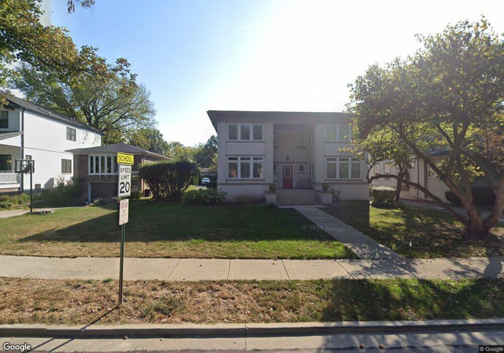
145 Barrypoint Rd Unit 1N Riverside, IL 60546
Estimated Value: $163,000 - $340,000
2
Beds
2
Baths
1,333
Sq Ft
$197/Sq Ft
Est. Value
About This Home
This home is located at 145 Barrypoint Rd Unit 1N, Riverside, IL 60546 and is currently estimated at $263,068, approximately $197 per square foot. 145 Barrypoint Rd Unit 1N is a home located in Cook County with nearby schools including Central Elementary School, L J Hauser Jr High School, and Riverside Brookfield High School.
Ownership History
Date
Name
Owned For
Owner Type
Purchase Details
Closed on
Sep 9, 2004
Sold by
Hawley Gregory M
Bought by
Clarke Mary Rob and Mary Rob Clarke Trust
Current Estimated Value
Purchase Details
Closed on
Jan 29, 2004
Sold by
Gentile Richard and Gentile Annette
Bought by
Hawley Gregory M
Home Financials for this Owner
Home Financials are based on the most recent Mortgage that was taken out on this home.
Original Mortgage
$252,000
Interest Rate
4.37%
Mortgage Type
Purchase Money Mortgage
Create a Home Valuation Report for This Property
The Home Valuation Report is an in-depth analysis detailing your home's value as well as a comparison with similar homes in the area
Home Values in the Area
Average Home Value in this Area
Purchase History
| Date | Buyer | Sale Price | Title Company |
|---|---|---|---|
| Clarke Mary Rob | $333,000 | -- | |
| Hawley Gregory M | $315,000 | Cti |
Source: Public Records
Mortgage History
| Date | Status | Borrower | Loan Amount |
|---|---|---|---|
| Previous Owner | Hawley Gregory M | $252,000 | |
| Closed | Hawley Gregory M | $31,450 |
Source: Public Records
Tax History Compared to Growth
Tax History
| Year | Tax Paid | Tax Assessment Tax Assessment Total Assessment is a certain percentage of the fair market value that is determined by local assessors to be the total taxable value of land and additions on the property. | Land | Improvement |
|---|---|---|---|---|
| 2024 | $5,904 | $21,770 | $3,750 | $18,020 |
| 2023 | $6,698 | $21,770 | $3,750 | $18,020 |
| 2022 | $6,698 | $20,908 | $2,727 | $18,181 |
| 2021 | $6,469 | $20,908 | $2,727 | $18,181 |
| 2020 | $6,339 | $20,908 | $2,727 | $18,181 |
| 2019 | $7,064 | $23,500 | $2,471 | $21,029 |
| 2018 | $6,855 | $23,500 | $2,471 | $21,029 |
| 2017 | $9,656 | $32,586 | $2,471 | $30,115 |
| 2016 | $7,072 | $22,579 | $2,045 | $20,534 |
| 2015 | $6,867 | $22,579 | $2,045 | $20,534 |
| 2014 | $6,768 | $22,579 | $2,045 | $20,534 |
| 2013 | $6,488 | $23,426 | $2,045 | $21,381 |
Source: Public Records
Map
Nearby Homes
- 78 Pine Ave
- 56 Forest Ave Unit 1N
- 68 Lawton Rd
- 207 W Quincy St Unit GARD
- 172 Olmsted Rd
- 198 W Burlington St
- 7825 41st Place
- 108 Lincoln Ave Unit 2B
- 3842 Woodside Ave
- 8034 42nd St
- 4222 Prescott Ave
- 4147 Gage Ave
- 4252 Prescott Ave
- 3845 Mccormick Ave
- 7807 43rd St
- 4343 Amelia Ave
- 4054 Fern Ave
- 4313 Elm Ave
- 4053 Rose Ave
- 7335 Oakwood Ave Unit P-10
- 145 Barrypoint Rd Unit 1S
- 145 Barrypoint Rd Unit 2N
- 145 Barrypoint Rd Unit 2S
- 141 Barrypoint Rd
- 137 Barrypoint Rd
- 151 Barrypoint Rd
- 151 Barrypoint Rd
- 151 Barrypoint Rd Unit A
- 151 Barrypoint Rd Unit B
- 153 Barrypoint Rd Unit 2
- 153 Barrypoint Rd Unit Barry1stfloor
- 153 Barrypoint Rd
- 133 Barrypoint Rd
- 157 Barrypoint Rd
- 160 Fairbank Rd
- 164 Fairbank Rd
- 161 Barrypoint Rd
- 150 Fairbank Rd
- 174 Fairbank Rd
- 150 Barrypoint Rd Unit 152