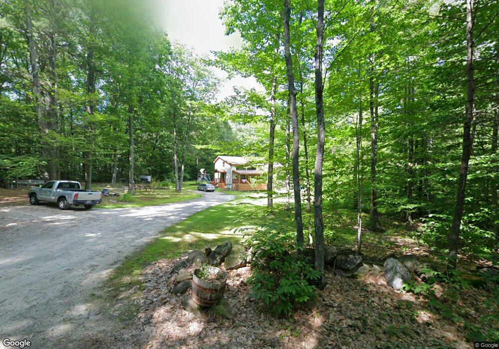
145 Brockway Rd Contoocook, NH 03229
Estimated Value: $598,000 - $693,000
4
Beds
2
Baths
2,406
Sq Ft
$264/Sq Ft
Est. Value
About This Home
This home is located at 145 Brockway Rd, Contoocook, NH 03229 and is currently estimated at $634,090, approximately $263 per square foot. 145 Brockway Rd is a home located in Merrimack County with nearby schools including Harold Martin School, Maple Street Elementary School, and Hopkinton Middle School.
Ownership History
Date
Name
Owned For
Owner Type
Purchase Details
Closed on
Sep 29, 2005
Sold by
Unknown
Bought by
Camp Russell C and Camp Patricia M
Current Estimated Value
Home Financials for this Owner
Home Financials are based on the most recent Mortgage that was taken out on this home.
Original Mortgage
$196,400
Outstanding Balance
$42,740
Interest Rate
5.84%
Mortgage Type
Purchase Money Mortgage
Estimated Equity
$591,350
Create a Home Valuation Report for This Property
The Home Valuation Report is an in-depth analysis detailing your home's value as well as a comparison with similar homes in the area
Home Values in the Area
Average Home Value in this Area
Purchase History
| Date | Buyer | Sale Price | Title Company |
|---|---|---|---|
| Camp Russell C | $245,500 | -- | |
| Camp Russell C | $245,500 | -- |
Source: Public Records
Mortgage History
| Date | Status | Borrower | Loan Amount |
|---|---|---|---|
| Open | Camp Russell C | $131,000 | |
| Open | Camp Russell C | $196,400 | |
| Closed | Camp Russell C | $196,400 |
Source: Public Records
Tax History Compared to Growth
Tax History
| Year | Tax Paid | Tax Assessment Tax Assessment Total Assessment is a certain percentage of the fair market value that is determined by local assessors to be the total taxable value of land and additions on the property. | Land | Improvement |
|---|---|---|---|---|
| 2024 | $11,867 | $542,100 | $185,000 | $357,100 |
| 2023 | $10,261 | $293,000 | $85,000 | $208,000 |
| 2022 | $9,411 | $291,800 | $85,000 | $206,800 |
| 2020 | $8,535 | $291,800 | $85,000 | $206,800 |
| 2019 | $8,497 | $291,800 | $85,000 | $206,800 |
| 2018 | $8,112 | $233,500 | $60,000 | $173,500 |
| 2017 | $8,007 | $233,500 | $60,000 | $173,500 |
| 2016 | $7,834 | $233,500 | $60,000 | $173,500 |
| 2015 | $7,850 | $233,500 | $60,000 | $173,500 |
| 2014 | $7,603 | $233,500 | $60,000 | $173,500 |
| 2013 | $7,507 | $261,200 | $87,800 | $173,400 |
Source: Public Records
Map
Nearby Homes
- 0 Jewett Rd
- 256-0-17 Jewett Rd
- 375 Farrington Corner Rd
- 0 Farrington Corner Rd Unit 14
- 63 Jewett Rd
- 0 George Rd Unit 30
- 5 Sullivan Dr
- 541 South Rd
- 186 Main St
- 102 Fieldstone Rd
- I3-03-05 Clinton St
- 325 Stark Hwy N
- 1 Appaloosa Run
- 256 Irish Hill Rd
- 36 Millstone Dr
- 16 Spillway Ln
- 6 Reserve Place
- 165 Concord Stage Rd
- 89 Old Henniker Rd
- 210 Hopkinton Rd
- 117 Brockway Rd
- 175 Brockway Rd
- 128 Brockway Rd
- 158 Brockway Rd
- 88 Brockway Rd
- 187 Brockway Rd
- 211 Brockway Rd
- 81 Brockway Rd
- 235 Brockway Rd
- 74 Buckingham Ln
- 274 Brockway Rd
- 174 Brockway Rd
- 62 Buckingham Ln
- 664 Jewett Rd
- 634 Jewett Rd
- 25 Brockway Rd
- 682 Jewett Rd
- 114 Brockway Rd
- 263 Brockway Rd
- 566 Jewett Rd