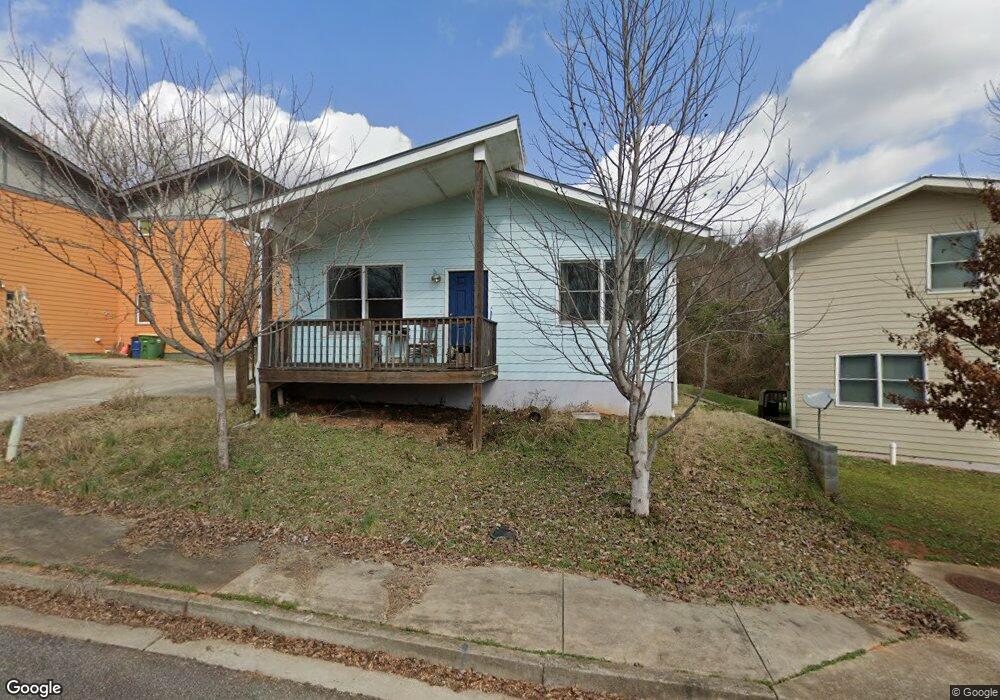
145 Cannon Dr Athens, GA 30601
North Avenue NeighborhoodEstimated Value: $85,000 - $1,690,000
Studio
2
Baths
1,176
Sq Ft
$557/Sq Ft
Est. Value
About This Home
This home is located at 145 Cannon Dr, Athens, GA 30601 and is currently estimated at $655,333, approximately $557 per square foot. 145 Cannon Dr is a home with nearby schools including Howard B. Stroud Elementary School, Coile Middle School, and Cedar Shoals High School.
Ownership History
Date
Name
Owned For
Owner Type
Purchase Details
Closed on
Jan 14, 2022
Sold by
Athens Land Trust Inc
Bought by
Blair Stephanie
Current Estimated Value
Home Financials for this Owner
Home Financials are based on the most recent Mortgage that was taken out on this home.
Original Mortgage
$94,963
Interest Rate
3.22%
Mortgage Type
New Conventional
Create a Home Valuation Report for This Property
The Home Valuation Report is an in-depth analysis detailing your home's value as well as a comparison with similar homes in the area
Home Values in the Area
Average Home Value in this Area
Purchase History
| Date | Buyer | Sale Price | Title Company |
|---|---|---|---|
| Blair Stephanie | $97,900 | -- |
Source: Public Records
Mortgage History
| Date | Status | Borrower | Loan Amount |
|---|---|---|---|
| Previous Owner | Blair Stephanie | $94,963 |
Source: Public Records
Tax History
| Year | Tax Paid | Tax Assessment Tax Assessment Total Assessment is a certain percentage of the fair market value that is determined by local assessors to be the total taxable value of land and additions on the property. | Land | Improvement |
|---|---|---|---|---|
| 2025 | $435 | $14,000 | $14,000 | $0 |
| 2024 | $435 | $14,000 | $14,000 | $0 |
| 2023 | $325 | $10,400 | $10,400 | $0 |
| 2022 | $1,378 | $43,200 | $10,400 | $32,800 |
| 2021 | $1,415 | $42,000 | $8,000 | $34,000 |
| 2020 | $1,415 | $42,000 | $8,000 | $34,000 |
| 2019 | $1,426 | $42,000 | $8,000 | $34,000 |
| 2018 | $274 | $8,064 | $8,064 | $0 |
| 2017 | $274 | $8,064 | $8,064 | $0 |
| 2016 | $274 | $8,064 | $8,064 | $0 |
| 2015 | $274 | $8,064 | $8,064 | $0 |
| 2014 | $275 | $8,064 | $8,064 | $0 |
Source: Public Records
Map
Nearby Homes
- 249 Fifth St
- 447 Rosa Nell Howard St
- 295 First St
- 211 North Ave Unit 1225
- 211 North Ave Unit 1334
- 211 North Ave
- 211 North Ave Unit 1227
- 464 Ruth St
- 200 John St
- 220 John St
- 225 Fourth St
- 185 First St
- 239 Madison Heights
- 455 Ruth St
- 118 Ruth Dr Unit 130
- 118 Ruth Dr Unit 140
- 178 First St
- 169 Vine St
- 495 Boley Dr
- 755 E Broad St Unit 803
Your Personal Tour Guide
Ask me questions while you tour the home.