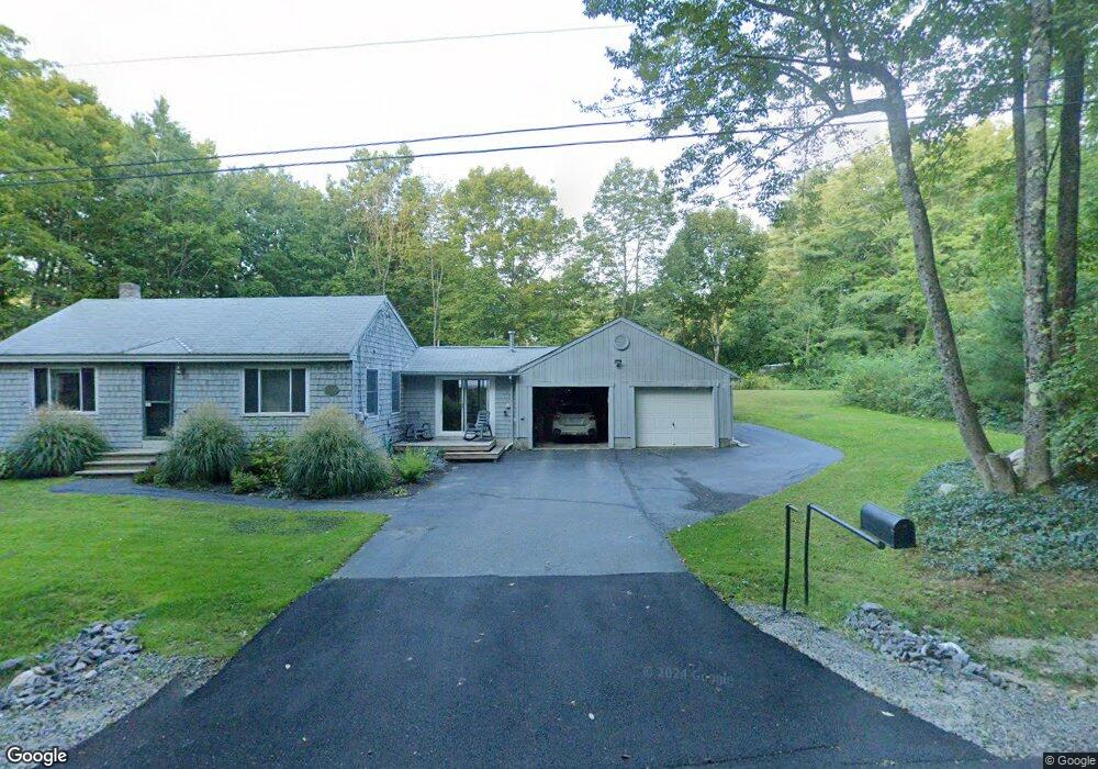
145 Cressey Rd Gorham, ME 04038
Estimated Value: $453,000 - $547,000
3
Beds
2
Baths
1,792
Sq Ft
$282/Sq Ft
Est. Value
About This Home
This home is located at 145 Cressey Rd, Gorham, ME 04038 and is currently estimated at $506,083, approximately $282 per square foot. 145 Cressey Rd is a home located in Cumberland County with nearby schools including Village Elementary School, Gorham Middle School, and Gorham High School.
Ownership History
Date
Name
Owned For
Owner Type
Purchase Details
Closed on
May 3, 2021
Sold by
Anita L Dugas Ret and Dugas
Bought by
Napolitano Jenna
Current Estimated Value
Home Financials for this Owner
Home Financials are based on the most recent Mortgage that was taken out on this home.
Original Mortgage
$235,246
Outstanding Balance
$210,548
Interest Rate
3%
Mortgage Type
FHA
Estimated Equity
$295,535
Purchase Details
Closed on
Nov 26, 2018
Sold by
Dugas Anita L
Bought by
Anita L Dugas Ret and Dugas
Purchase Details
Closed on
Sep 1, 2017
Sold by
Anita L Dugas Ret and Dugas
Bought by
Dugas Anita L
Purchase Details
Closed on
May 6, 2013
Sold by
Dugas Anita L
Bought by
Anita L Dugas Ret and Dugas
Purchase Details
Closed on
Jan 11, 2011
Sold by
Dugas Philip A and Dugas Anita L
Bought by
Dugas Peter J and Arnemann Joyce A
Create a Home Valuation Report for This Property
The Home Valuation Report is an in-depth analysis detailing your home's value as well as a comparison with similar homes in the area
Home Values in the Area
Average Home Value in this Area
Purchase History
| Date | Buyer | Sale Price | Title Company |
|---|---|---|---|
| Napolitano Jenna | -- | None Available | |
| Napolitano Jenna | -- | None Available | |
| Anita L Dugas Ret | -- | -- | |
| Anita L Dugas Ret | -- | -- | |
| Dugas Anita L | -- | -- | |
| Dugas Anita L | -- | -- | |
| Anita L Dugas Ret | -- | -- | |
| Anita L Dugas Ret | -- | -- | |
| Dugas Peter J | -- | -- | |
| Dugas Peter J | -- | -- |
Source: Public Records
Mortgage History
| Date | Status | Borrower | Loan Amount |
|---|---|---|---|
| Open | Napolitano Jenna | $235,246 | |
| Closed | Napolitano Jenna | $235,246 |
Source: Public Records
Tax History
| Year | Tax Paid | Tax Assessment Tax Assessment Total Assessment is a certain percentage of the fair market value that is determined by local assessors to be the total taxable value of land and additions on the property. | Land | Improvement |
|---|---|---|---|---|
| 2025 | $4,681 | $316,300 | $70,400 | $245,900 |
| 2024 | $4,650 | $316,300 | $70,400 | $245,900 |
| 2023 | $4,349 | $316,300 | $70,400 | $245,900 |
| 2022 | $4,064 | $316,300 | $70,400 | $245,900 |
| 2021 | $3,170 | $163,400 | $55,000 | $108,400 |
| 2020 | $3,105 | $163,400 | $55,000 | $108,400 |
| 2019 | $3,096 | $163,400 | $55,000 | $108,400 |
| 2018 | $2,510 | $163,400 | $55,000 | $108,400 |
| 2017 | $2,794 | $163,400 | $55,000 | $108,400 |
| 2016 | $2,778 | $163,400 | $55,000 | $108,400 |
| 2015 | $2,663 | $163,400 | $55,000 | $108,400 |
| 2014 | $2,671 | $153,500 | $50,600 | $102,900 |
| 2013 | $2,656 | $153,500 | $50,600 | $102,900 |
Source: Public Records
Map
Nearby Homes
- 127 Falcon Crest Dr Unit 4
- 12 Strouts Way
- 35 Rust Rd
- 15 Green St
- 182 Falcon Crest Dr Unit 56
- 187 Falcon Crest Dr Unit 30
- 189 Falcon Crest Dr Unit 31
- 191 Falcon Crest Dr Unit 32
- 193 Falcon Crest Dr Unit 33
- 192 Falcon Crest Dr Unit 59
- 195 Falcon Crest Dr Unit 34
- 194 Falcon Crest Dr Unit 60
- 52 Morrill Ave
- 91 South St
- 49 Lochwood Dr
- 16 Laurel Pines Dr
- 13 Lochwood Dr
- TBD Lochwood Dr
- 8 Martin Dr
- 17 Lochwood Dr
- 100 Lovers Ln
- 141 Cressey Rd
- 94 Lovers Ln
- 139 Cressey Rd
- 137 Cressey Rd
- 135 Cressey Rd
- 90 Lovers Ln
- 109 Lovers Ln
- 91 Lovers Ln
- 92 Lovers Ln
- 86 Lovers Ln
- 97 Lovers Ln
- 3 Sugar Maple Ln
- 77 Lovers Ln
- 121 Cressey Rd
- 38 Sugar Maple Ln
- 120 Cressey Rd
- 118 Cressey Rd
- 7 Ossipee Trail
- 0 Rt 25 Ossipee Trail Unit 919734
Your Personal Tour Guide
Ask me questions while you tour the home.