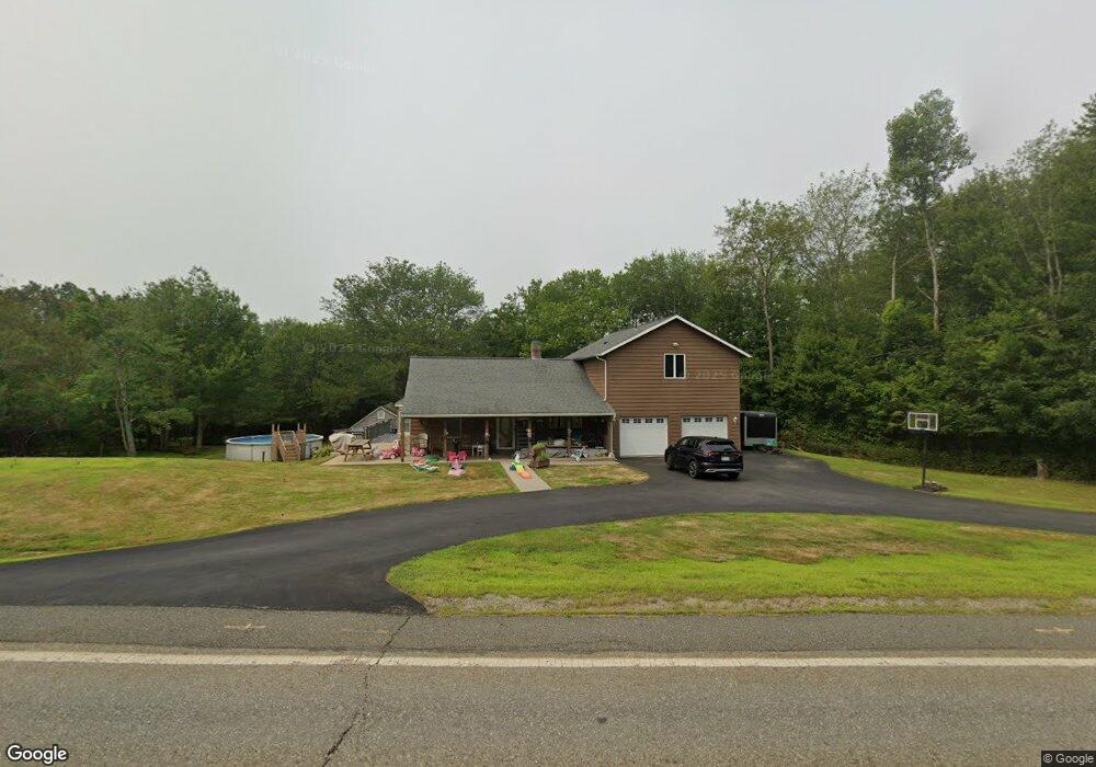
145 E Main St West Brookfield, MA 01585
Estimated Value: $466,000 - $535,000
3
Beds
2
Baths
2,290
Sq Ft
$215/Sq Ft
Est. Value
About This Home
This home is located at 145 E Main St, West Brookfield, MA 01585 and is currently estimated at $491,210, approximately $214 per square foot. 145 E Main St is a home located in Worcester County with nearby schools including Quaboag Regional High School.
Ownership History
Date
Name
Owned For
Owner Type
Purchase Details
Closed on
May 30, 2006
Sold by
Kmiecik Stanley
Bought by
Harris William
Current Estimated Value
Home Financials for this Owner
Home Financials are based on the most recent Mortgage that was taken out on this home.
Original Mortgage
$45,200
Outstanding Balance
$26,514
Interest Rate
6.53%
Mortgage Type
Purchase Money Mortgage
Estimated Equity
$464,696
Purchase Details
Closed on
Jan 20, 2000
Sold by
Mcdonald Diane
Bought by
Sullivan Brian M and Sullivan Heidi L
Purchase Details
Closed on
Feb 1, 1999
Sold by
Miller William S and Miller Elizabeth M
Bought by
Mcdonald Donald P and Mcdonald Diane
Create a Home Valuation Report for This Property
The Home Valuation Report is an in-depth analysis detailing your home's value as well as a comparison with similar homes in the area
Home Values in the Area
Average Home Value in this Area
Purchase History
| Date | Buyer | Sale Price | Title Company |
|---|---|---|---|
| Harris William | $226,000 | -- | |
| Sullivan Brian M | $88,000 | -- | |
| Mcdonald Donald P | $74,300 | -- |
Source: Public Records
Mortgage History
| Date | Status | Borrower | Loan Amount |
|---|---|---|---|
| Open | Harris William | $45,200 | |
| Previous Owner | Mcdonald Donald P | $129,972 | |
| Previous Owner | Mcdonald Donald P | $21,600 | |
| Previous Owner | Mcdonald Donald P | $20,100 |
Source: Public Records
Tax History
| Year | Tax Paid | Tax Assessment Tax Assessment Total Assessment is a certain percentage of the fair market value that is determined by local assessors to be the total taxable value of land and additions on the property. | Land | Improvement |
|---|---|---|---|---|
| 2025 | $4,350 | $403,500 | $54,900 | $348,600 |
| 2024 | $4,531 | $403,500 | $54,900 | $348,600 |
| 2023 | $4,391 | $366,200 | $49,600 | $316,600 |
| 2022 | $4,363 | $329,800 | $47,300 | $282,500 |
| 2021 | $4,203 | $299,600 | $47,300 | $252,300 |
| 2020 | $8,337 | $244,400 | $47,300 | $197,100 |
| 2019 | $3,830 | $244,400 | $47,300 | $197,100 |
| 2018 | $4,084 | $235,800 | $47,300 | $188,500 |
| 2017 | $3,642 | $226,800 | $47,600 | $179,200 |
| 2016 | $3,510 | $226,300 | $47,600 | $178,700 |
| 2015 | $3,305 | $220,600 | $47,600 | $173,000 |
Source: Public Records
Map
Nearby Homes
- 37 Central St
- 91 W Main St
- 3 Foster Rd
- 25 Highland Trail
- 21 Beach Dr
- 10 Green St
- 28 Long Hill Rd
- 29 Kimball St
- 940 Old West Brookfield Rd
- 18-20 Old w Brookfield Rd
- 8 Nanatomqua Dr Unit N55
- 291 Wigwam Rd
- 18 Tyler St
- 6 2nd St
- 18 Fox Run
- 21 Fox Run
- 10 Brookfield Rd
- 61 Bates St
- 6 Conestoga Trail
- 20 Conestoga Trail
Your Personal Tour Guide
Ask me questions while you tour the home.