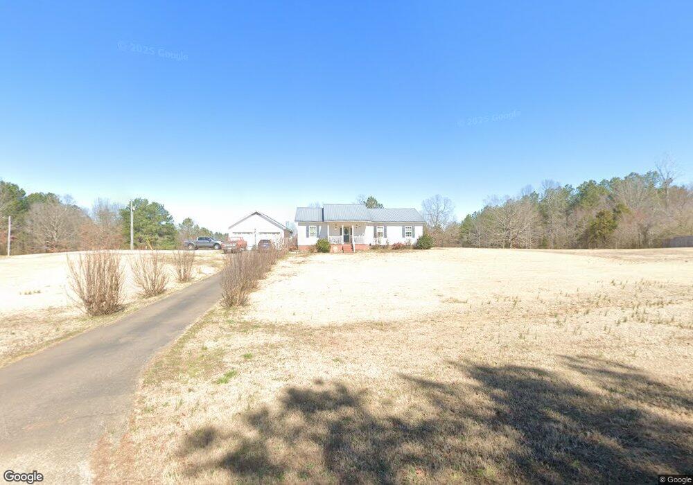
145 Embassy Cove Savannah, TN 38372
Estimated Value: $235,000 - $300,000
--
Bed
2
Baths
1,856
Sq Ft
$143/Sq Ft
Est. Value
About This Home
This home is located at 145 Embassy Cove, Savannah, TN 38372 and is currently estimated at $265,270, approximately $142 per square foot. 145 Embassy Cove is a home located in Hardin County with nearby schools including Hardin County High School.
Ownership History
Date
Name
Owned For
Owner Type
Purchase Details
Closed on
Oct 12, 2023
Sold by
Smith Christopher and Smith Angela
Bought by
Flatt Colton A and Flatt Kateline L
Current Estimated Value
Home Financials for this Owner
Home Financials are based on the most recent Mortgage that was taken out on this home.
Original Mortgage
$263,131
Outstanding Balance
$258,015
Interest Rate
7.18%
Mortgage Type
Credit Line Revolving
Estimated Equity
$7,255
Purchase Details
Closed on
Oct 24, 2003
Sold by
Smith Christopher P
Bought by
Hugh Stanfill
Purchase Details
Closed on
Jun 12, 2002
Bought by
Smith Christopher and Smith Angie
Purchase Details
Closed on
Jan 18, 1983
Bought by
Deford Mary Josephine
Purchase Details
Closed on
Oct 22, 1981
Purchase Details
Closed on
Aug 4, 1977
Create a Home Valuation Report for This Property
The Home Valuation Report is an in-depth analysis detailing your home's value as well as a comparison with similar homes in the area
Home Values in the Area
Average Home Value in this Area
Purchase History
| Date | Buyer | Sale Price | Title Company |
|---|---|---|---|
| Flatt Colton A | $260,500 | None Listed On Document | |
| Hugh Stanfill | $5,000 | -- | |
| Smith Christopher | $11,500 | -- | |
| Deford Mary Josephine | -- | -- | |
| -- | -- | -- | |
| -- | -- | -- |
Source: Public Records
Mortgage History
| Date | Status | Borrower | Loan Amount |
|---|---|---|---|
| Open | Flatt Colton A | $263,131 |
Source: Public Records
Tax History Compared to Growth
Tax History
| Year | Tax Paid | Tax Assessment Tax Assessment Total Assessment is a certain percentage of the fair market value that is determined by local assessors to be the total taxable value of land and additions on the property. | Land | Improvement |
|---|---|---|---|---|
| 2024 | $948 | $54,150 | $2,725 | $51,425 |
| 2023 | $948 | $53,700 | $2,275 | $51,425 |
| 2022 | $777 | $37,700 | $1,850 | $35,850 |
| 2021 | $745 | $37,700 | $1,850 | $35,850 |
| 2020 | $745 | $36,175 | $1,850 | $34,325 |
| 2019 | $745 | $36,175 | $1,850 | $34,325 |
| 2018 | $720 | $36,175 | $1,850 | $34,325 |
| 2017 | $663 | $31,875 | $1,850 | $30,025 |
| 2016 | $663 | $31,875 | $1,850 | $30,025 |
| 2015 | $580 | $31,875 | $1,850 | $30,025 |
| 2014 | $580 | $31,875 | $1,850 | $30,025 |
Source: Public Records
Map
Nearby Homes
- 61 Tulip Ln
- 865 Sylvan Dr
- 1031 Ridge Rd
- 175 Drake Loop
- 144 Deer Ln
- 160 Clement Dr
- 480 Dodd Dr
- 275 Dodd Dr
- 1910 Hamburg Loop
- 225 Nixon Loop
- LT 138 Bandit Way
- 470 Bandit Way
- 440 Pyburns Dr
- 725 One Stop Dr
- 2870 Highway 226
- 150 Cap Blount Ln
- 255 Easley Loop
- 230 Silver Water Ln
- 185 Branch Estate Ln
- 255 Gammill Ln
- 45 Galloway Cove
- 255 Embassy Cove
- 225 Darlington Dr
- 275 Embassy Cove
- 170 Galloway Cove
- 65 Darlington Dr
- 5930 Highway 128
- 410 Embassy Cove
- 450 Embassy Cove Unit 1
- 450 Embassy Cove
- 405 Embassy Cove
- 120 Darlington Dr
- 320 Darlington Dr
- 285 Darlington Dr
- 485 Embassy Cove
- 5680 Highway 128
- 5745 Highway 128
- 95 Sunset Dr
- 325 Bethel Ln
- 330 Bethel Ln