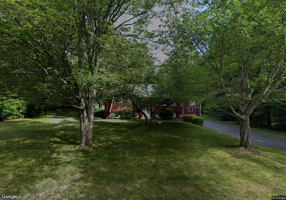
145 Grafton St Millbury, MA 01527
Estimated Value: $501,000 - $569,000
4
Beds
4
Baths
1,674
Sq Ft
$319/Sq Ft
Est. Value
About This Home
This home is located at 145 Grafton St, Millbury, MA 01527 and is currently estimated at $533,819, approximately $318 per square foot. 145 Grafton St is a home located in Worcester County with nearby schools including Elmwood Street Elementary School, Raymond E. Shaw Elementary School, and Millbury Junior/Senior High School.
Ownership History
Date
Name
Owned For
Owner Type
Purchase Details
Closed on
Sep 13, 2024
Sold by
Desantis John L
Bought by
Desantis John L and Sabonaitis Denise A
Current Estimated Value
Purchase Details
Closed on
Sep 3, 2009
Sold by
Desantis John L and Desantis Joan M
Bought by
Desantis John L
Create a Home Valuation Report for This Property
The Home Valuation Report is an in-depth analysis detailing your home's value as well as a comparison with similar homes in the area
Home Values in the Area
Average Home Value in this Area
Purchase History
| Date | Buyer | Sale Price | Title Company |
|---|---|---|---|
| Desantis John L | -- | None Available | |
| Desantis John L | -- | None Available | |
| Desantis John L | -- | None Available | |
| Desantis John L | -- | -- | |
| Desantis John L | -- | -- |
Source: Public Records
Mortgage History
| Date | Status | Borrower | Loan Amount |
|---|---|---|---|
| Previous Owner | Desantis John L | $81,000 | |
| Previous Owner | Desantis John L | $10,000 | |
| Previous Owner | Desantis John L | $250,000 | |
| Previous Owner | Desantis John L | $119,300 |
Source: Public Records
Tax History Compared to Growth
Tax History
| Year | Tax Paid | Tax Assessment Tax Assessment Total Assessment is a certain percentage of the fair market value that is determined by local assessors to be the total taxable value of land and additions on the property. | Land | Improvement |
|---|---|---|---|---|
| 2025 | $5,886 | $439,600 | $112,700 | $326,900 |
| 2024 | $4,683 | $354,000 | $104,400 | $249,600 |
| 2023 | $4,290 | $296,900 | $73,300 | $223,600 |
| 2022 | $4,019 | $267,900 | $73,300 | $194,600 |
| 2021 | $3,962 | $256,800 | $73,300 | $183,500 |
| 2020 | $4,058 | $264,700 | $73,300 | $191,400 |
| 2019 | $4,029 | $254,200 | $66,600 | $187,600 |
| 2018 | $3,982 | $243,700 | $66,600 | $177,100 |
| 2017 | $3,288 | $200,100 | $66,600 | $133,500 |
| 2016 | $3,094 | $188,000 | $66,600 | $121,400 |
| 2015 | $3,091 | $187,800 | $70,700 | $117,100 |
| 2014 | $2,984 | $174,500 | $70,700 | $103,800 |
Source: Public Records
Map
Nearby Homes
- 30 Lexington Rd
- 20 Woodridge Rd
- 8 Autumn Gate Cir
- Lot 1 Cooper Rd
- 19 Cortland Way
- 73 Potter Hill Rd
- 15 Rayburn Dr
- 81 Ariel Cir
- 75 Potter Hill Rd
- 43 Barbara Jean St
- 115 Ariel Cir
- 18 Barbara Jean St
- 81 Millbury St
- 123 Riverlin St
- 156 Brigham Hill Rd
- 19 Rice Rd
- 78 Pleasant St
- 4 Thomas Hill Rd
- 144 Pleasant St
- 28 Lincoln Ln
- 143 Grafton St
- 144 Grafton St
- 148 Grafton St
- 141 Grafton St
- 150 Grafton St
- 142 Grafton St
- 139 Grafton St
- 146 Grafton St
- 140 Grafton St
- 137 Grafton St
- 137 Grafton St
- 159 Millbury St
- 135 Grafton St
- 136 Grafton St
- 154 Millbury St
- 157 Millbury St
- 2 Lexington Rd
- 4 Lexington Rd
- 3 Lexington Rd
- 1 Lexington Rd