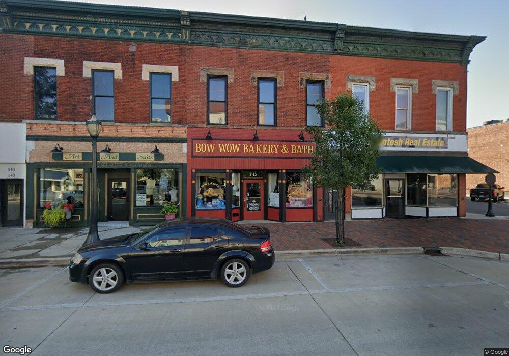
145 S Front St Dowagiac, MI 49047
Estimated Value: $104,308
--
Bed
1
Bath
6,678
Sq Ft
$16/Sq Ft
Est. Value
About This Home
This home is located at 145 S Front St, Dowagiac, MI 49047 and is currently estimated at $104,308, approximately $15 per square foot. 145 S Front St is a home located in Cass County with nearby schools including Justus Gage Elementary School, Dowagiac Middle School, and Union High School.
Ownership History
Date
Name
Owned For
Owner Type
Purchase Details
Closed on
Dec 11, 2023
Sold by
Rohdy Curt and Rohdy Debra
Bought by
Quail Angela and Dietrich Zachary R
Current Estimated Value
Purchase Details
Closed on
Jan 20, 2016
Sold by
Iowa State Bank
Bought by
Pugh Paul R
Purchase Details
Closed on
Jan 14, 2016
Sold by
Pugh Paul R and Paul R Pugh Trust
Bought by
Pugh Paul R
Purchase Details
Closed on
Jan 7, 2016
Sold by
Pugh Paul R
Bought by
Pugh Paul R and Paul R Pugh Trust
Purchase Details
Closed on
Nov 11, 2013
Sold by
Pugh Karen L and Karen L Pugh Trust
Bought by
Rohdy Curtis Alan and Rohdy Debra Kay
Create a Home Valuation Report for This Property
The Home Valuation Report is an in-depth analysis detailing your home's value as well as a comparison with similar homes in the area
Home Values in the Area
Average Home Value in this Area
Purchase History
| Date | Buyer | Sale Price | Title Company |
|---|---|---|---|
| Quail Angela | -- | None Listed On Document | |
| Pugh Paul R | -- | Attorney | |
| Pugh Paul R | -- | Attorney | |
| Pugh Paul R | -- | Attorney | |
| Rohdy Curtis Alan | -- | None Available |
Source: Public Records
Tax History Compared to Growth
Tax History
| Year | Tax Paid | Tax Assessment Tax Assessment Total Assessment is a certain percentage of the fair market value that is determined by local assessors to be the total taxable value of land and additions on the property. | Land | Improvement |
|---|---|---|---|---|
| 2025 | $3,047 | $56,000 | $7,400 | $48,600 |
| 2024 | $1,474 | $50,100 | $7,100 | $43,000 |
| 2023 | $1,248 | $66,600 | $0 | $0 |
| 2022 | $1,187 | $43,300 | $0 | $0 |
| 2021 | $2,450 | $41,600 | $0 | $0 |
| 2020 | $1,141 | $41,400 | $0 | $0 |
| 2019 | $2,382 | $44,600 | $0 | $0 |
| 2018 | $1,089 | $39,300 | $0 | $0 |
| 2017 | $1,067 | $37,500 | $0 | $0 |
| 2016 | $1,390 | $49,700 | $0 | $0 |
| 2015 | -- | $49,100 | $0 | $0 |
| 2011 | -- | $43,700 | $0 | $0 |
Source: Public Records
Map
Nearby Homes
- 307 New York Ave
- 106 Lagrange St
- 204 E High St
- 309 N Front St
- 102 S Mill St
- 409 Spruce St
- 210 McOmber St
- 402 Michigan Ave
- 105 Lester Ave
- 107 Lester Ave
- 403 Orchard St
- 310 W Telegraph St
- 425 Chestnut St
- 315 McOmber St
- 423 E Division St
- 307 E Telegraph St
- 512 Green St
- 530 S Front St
- 604 Orchard St
- 400 S Lowe St
- 147 S Front St
- 201 S Front St
- 141 S Front St
- 139 S Front St
- 137 S Front St
- 137 S Front St
- 113 Commercial St
- 148 S Front St
- 140 S Front St
- 132 S Front St
- 202 S Front St
- 0 Beeson St
- 210 S Front St Unit C
- 208 S Front St
- 124 S Front St
- 105 Beeson St Unit A, B, C
- 105 Beeson St
- 212 S Front St
- 107 Beeson St
- 221 S Front St