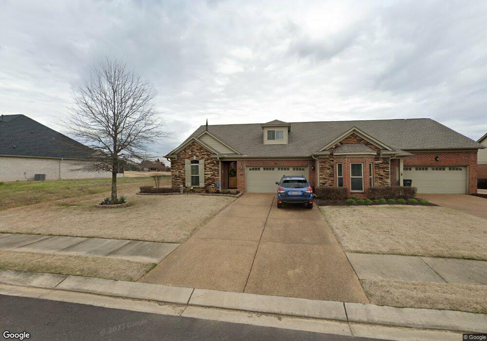
145 Saint Andrews Dr Oakland, TN 38060
Estimated Value: $315,000 - $362,000
--
Bed
3
Baths
2,030
Sq Ft
$166/Sq Ft
Est. Value
About This Home
This home is located at 145 Saint Andrews Dr, Oakland, TN 38060 and is currently estimated at $337,527, approximately $166 per square foot. 145 Saint Andrews Dr is a home located in Fayette County with nearby schools including Oakland Elementary School, West Junior High School, and Fayette Ware Comprehensive High School.
Ownership History
Date
Name
Owned For
Owner Type
Purchase Details
Closed on
Apr 11, 2025
Sold by
Shannon James I and Shannon Mary Lou
Bought by
Crowder Terrie Shannon
Current Estimated Value
Purchase Details
Closed on
Mar 21, 2012
Sold by
Swan Development Grp Llc
Bought by
Shannon James I and Shannon Mary Lou
Purchase Details
Closed on
Oct 15, 2008
Bought by
Worley Prince A and Worley Virginia M
Create a Home Valuation Report for This Property
The Home Valuation Report is an in-depth analysis detailing your home's value as well as a comparison with similar homes in the area
Home Values in the Area
Average Home Value in this Area
Purchase History
| Date | Buyer | Sale Price | Title Company |
|---|---|---|---|
| Crowder Terrie Shannon | -- | None Listed On Document | |
| Shannon James I | $215,725 | -- | |
| Worley Prince A | $224,400 | -- |
Source: Public Records
Tax History Compared to Growth
Tax History
| Year | Tax Paid | Tax Assessment Tax Assessment Total Assessment is a certain percentage of the fair market value that is determined by local assessors to be the total taxable value of land and additions on the property. | Land | Improvement |
|---|---|---|---|---|
| 2024 | $1,638 | $63,400 | $10,000 | $53,400 |
| 2023 | $1,638 | $63,400 | $0 | $0 |
| 2022 | $1,086 | $63,400 | $10,000 | $53,400 |
| 2021 | $1,086 | $63,400 | $10,000 | $53,400 |
| 2020 | $889 | $63,400 | $10,000 | $53,400 |
| 2019 | $1,197 | $59,000 | $7,500 | $51,500 |
| 2018 | $1,231 | $59,000 | $7,500 | $51,500 |
| 2017 | $1,049 | $59,000 | $7,500 | $51,500 |
| 2016 | $1,028 | $54,000 | $5,625 | $48,375 |
| 2015 | $1,028 | $54,000 | $5,625 | $48,375 |
| 2014 | $1,028 | $54,000 | $5,625 | $48,375 |
Source: Public Records
Map
Nearby Homes
- 175 Saint Andrews Dr
- 217 Saint Andrews Dr Unit 55-C
- 22 Doral Loop
- Callahan Plan at Fair Oaks - Villas at Fair Oaks
- Clark Plan at Fair Oaks - Villas at Fair Oaks
- Gibson Plan at Fair Oaks - Villas at Fair Oaks
- 205 Saint Andrews Dr
- 325 Saint Andrews Dr
- 290 Saint Andrews Dr
- 300 Saint Andrews Dr
- 360 Saint Andrews Dr
- 235 Fairoaks Dr
- 75 Fairoaks Dr
- 160 Aberdeen Dr
- 15 Hughetta St
- 65 Birkdale Dr
- 200 Hughetta St S
- 205 Hughetta St S
- 000 Hwy 64
- 195 Hughetta St S
- 145 St Andrews Way Unit 58-D
- 145 St Andrews Way
- 147 Saint Andrews Dr
- 147 Saint Andrews Dr Unit 58-E
- 177 Saint Andrews Dr
- 179 Saint Andrews Dr
- 175 St Andrews Way Unit 57-D
- 175 St Andrews Way
- 127 Saint Andrews Dr
- 20 Doral Loop
- 195 Saint Andrews Dr
- 110 Saint Andrews Dr
- 114 Saint Andrews Dr
- 95 St Andrews Dr Unit 95
- 95 Saint Andrews Dr
- 31 St Andrews Way
- 95 St Andrews Way Unit 60-A1
- 95 St Andrews Way
- 49 Saint Andrews Dr
- 49 St Andrews Dr