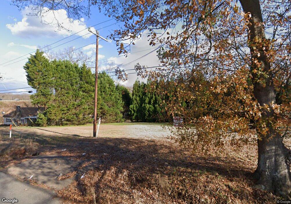
145 Simpson Dr Boiling Springs, SC 29316
Estimated Value: $146,558 - $222,000
3
Beds
1
Bath
1,055
Sq Ft
$179/Sq Ft
Est. Value
About This Home
This home is located at 145 Simpson Dr, Boiling Springs, SC 29316 and is currently estimated at $188,390, approximately $178 per square foot. 145 Simpson Dr is a home located in Spartanburg County with nearby schools including Shoally Creek Elementary School, Rainbow Lake Middle School, and Spartanburg Christian Academy.
Ownership History
Date
Name
Owned For
Owner Type
Purchase Details
Closed on
Jun 20, 2022
Sold by
Patricia Simpson
Bought by
Lovingood Kimberly and Green Frances Ann
Current Estimated Value
Purchase Details
Closed on
Mar 30, 2022
Sold by
Patricia Simpson
Bought by
Green Frances Ann and Hyatt Cheryl
Purchase Details
Closed on
Jan 8, 2008
Sold by
Simpson Hubert Edgar
Bought by
Simpson Patricia
Purchase Details
Closed on
Mar 5, 2006
Sold by
Simpson Patricia
Bought by
Simpson Patricia
Create a Home Valuation Report for This Property
The Home Valuation Report is an in-depth analysis detailing your home's value as well as a comparison with similar homes in the area
Home Values in the Area
Average Home Value in this Area
Purchase History
| Date | Buyer | Sale Price | Title Company |
|---|---|---|---|
| Lovingood Kimberly | -- | None Listed On Document | |
| Lovingood Kimberly | -- | None Listed On Document | |
| Green Frances Ann | -- | None Listed On Document | |
| Green Frances Ann | -- | None Listed On Document | |
| Simpson Patricia | $1,500 | Attorney | |
| Simpson Patricia | -- | None Available |
Source: Public Records
Tax History Compared to Growth
Tax History
| Year | Tax Paid | Tax Assessment Tax Assessment Total Assessment is a certain percentage of the fair market value that is determined by local assessors to be the total taxable value of land and additions on the property. | Land | Improvement |
|---|---|---|---|---|
| 2025 | $1,763 | $4,747 | $1,927 | $2,820 |
| 2024 | $1,763 | $4,747 | $1,927 | $2,820 |
| 2023 | $1,763 | $4,747 | $1,927 | $2,820 |
| 2022 | $1,603 | $4,128 | $1,500 | $2,628 |
| 2021 | $64 | $1,552 | $564 | $988 |
| 2020 | $57 | $1,552 | $564 | $988 |
| 2019 | $57 | $1,552 | $564 | $988 |
| 2018 | $57 | $1,552 | $564 | $988 |
| 2017 | $57 | $1,348 | $472 | $876 |
| 2016 | $57 | $1,348 | $472 | $876 |
| 2015 | $52 | $1,348 | $472 | $876 |
| 2014 | $47 | $1,348 | $472 | $876 |
Source: Public Records
Map
Nearby Homes
- 953 Mike Cir
- 202 Riverrun Dr
- 209 N Hill Dr
- 400 Woodson Ct
- 2331 Springview Ct
- 3019 Hunters Brook Dr
- 3018 Hunters Brook Dr
- 2238 Springview Ct
- 2335 Springview Ct
- 2231 Springview Ct
- 423 Shoally Rd
- 2227 Springview Ct
- SALEM Plan at Baxter Village
- CAMERON EXPRESS Plan at Baxter Village
- WILMINGTON Plan at Baxter Village
- CALI Plan at Baxter Village
- ARIA Plan at Baxter Village
- HAYDEN Plan at Baxter Village
- ELSTON Plan at Baxter Village
- AISLE Plan at Baxter Village
- 134 Parris Bridge Rd
- 943 Mike Cir
- 144 Parris Bridge Rd
- 939 Mike Cir
- 942 Mike Cir
- 938 Mike Cir
- 126 Parris Bridge Rd
- 126, 128 Parris Bridge Rd
- 122 Parris Bridge Rd
- 960 Mike Cir
- 930 Mike Cir
- 935 Mike Cir
- 121 Parris Bridge Rd
- 928 Mike Cir
- 118 Parris Bridge Rd
- 984 Mike Cir
- 920 Mike Cir
- 177 Riverrun Dr
- 169 Riverrun Dr
- 110 Parris Bridge Rd
